Property Record
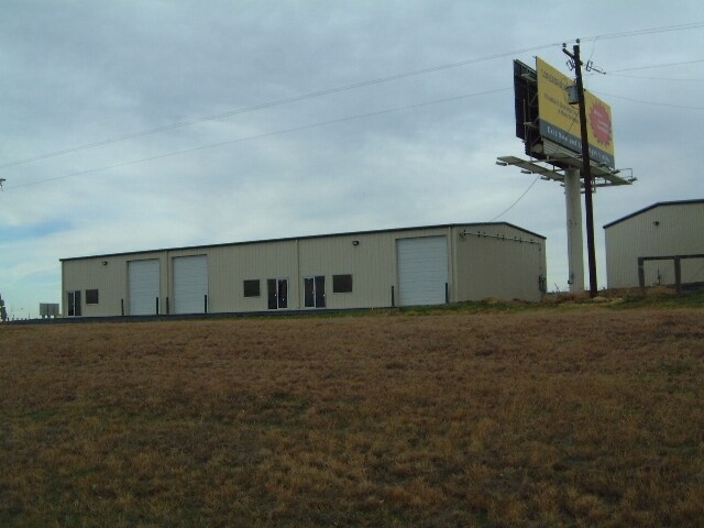
850 Blue Mound Rd W, Haslet, TX 76052

Property Detail
850 Blue Mound Rd W
40035549
RIGHLY, JAMES SURVEY ABSTRACT 1268 TRACT 8A01A3
Commercialnec
Tarrant
B and X Area of moderate flood hazard, usually the area between the limits of the 100-year and 500-year floods.
Texas
2025
10.05 AC
2025
NE Tarrant/Alliance
114111
Dallas/Ft Worth
58,950 SF
Dallas-Fort Worth-Arlington, TX
NEARBY LISTINGS FOR SALE OR LEASE
DEMOGRAPHICS near 850 Blue Mound Rd W
1 mile
3 mile
5 mile
2025 Total Population
6,212
39,763
131,038
2030 Population
6,914
43,746
142,375
Pop Growth 2025-2030
+ 11.30%
+ 10.02%
+ 8.65%
Average Age
36
35
35
2025 Total Households
1,920
12,334
42,240
HH Growth 2025-2030
+ 11.56%
+ 10.25%
+ 8.80%
Median Household Inc
$132,787
$134,810
$120,781
Avg Household Size
3.20
3.20
3.10
2025 Avg HH Vehicles
3.00
2.00
2.00
Median Home Value
$475,559
$440,782
$385,191
Median Year Built
2011
2010
2010
Nearby Places
Map Layers
Map Styles
 Street
 Aerial
Layers
 Traffic
 Biking
Places
Listings with unknown addresses are not visible on the map
- Restaurants
- Banks
- Shops
- Fitness
- Groceries
PUBLIC TRANSPORTATION
AIRPORT
Dallas-Fort Worth International
Drive
Walk
Distance
Dallas-Fort Worth International
39 min
26.5 mi
Freight Ports
Port of Shreveport
Drive
Walk
Distance
Port of Shreveport
261 min
238.9 mi
SALE & LEASE HISTORY
LISTING DATE
SALE/LEASE

Sep 06, 2019
For Lease
Nearby Properties
Address
Land Use
TOTAL SIZE
Lot Size
Zoning
Address
Land Use
TOTAL SIZE
Lot Size
Zoning
348,270 SF
39.34 AC
Address
Land Use
TOTAL SIZE
Lot Size
Zoning
553,605 SF
81.10 AC
Address
Land Use
TOTAL SIZE
Lot Size
Zoning
681,942 SF
29.37 AC
Address
Land Use
TOTAL SIZE
Lot Size
Zoning
391,529 SF
17.23 AC
Address
Land Use
TOTAL SIZE
Lot Size
Zoning
422,682 SF
22.66 AC
Address
Land Use
TOTAL SIZE
Lot Size
Zoning
504,000 SF
26.39 AC
Address
Land Use
TOTAL SIZE
Lot Size
Zoning
882,565 SF
56.65 AC
Address
Land Use
TOTAL SIZE
Lot Size
Zoning
436,875 SF
11.14 AC
Address
Land Use
TOTAL SIZE
Lot Size
Zoning
175,000 SF
14.48 AC
Address
Land Use
TOTAL SIZE
Lot Size
Zoning
222,672 SF
8.73 AC
Address
Land Use
TOTAL SIZE
Lot Size
Zoning
634,042 SF
35.88 AC
Address
Land Use
TOTAL SIZE
Lot Size
Zoning
731,548 SF
56.18 AC
Address
Land Use
TOTAL SIZE
Lot Size
Zoning
436,589 SF
32.43 AC
Address
Land Use
TOTAL SIZE
Lot Size
Zoning
457,283 SF
33.17 AC
Address
Land Use
TOTAL SIZE
Lot Size
Zoning
56,701 SF
57.56 AC
Address
Land Use
TOTAL SIZE
Lot Size
Zoning
46,464 SF
15.24 AC
Address
Land Use
TOTAL SIZE
Lot Size
Zoning
72,713 SF
10.88 AC
Address
Land Use
TOTAL SIZE
Lot Size
Zoning
218,400 SF
12.40 AC
Address
Land Use
TOTAL SIZE
Lot Size
Zoning
107,819 SF
14.11 AC
Address
Land Use
TOTAL SIZE
Lot Size
Zoning
315,432 SF
3.87 AC
Address
Land Use
TOTAL SIZE
Lot Size
Zoning
181,074 SF
14 AC
Address
Land Use
TOTAL SIZE
Lot Size
Zoning
240,144 SF
6.92 AC
Address
Land Use
TOTAL SIZE
Lot Size
Zoning
76,000 SF
10.43 AC
Address
Land Use
TOTAL SIZE
Lot Size
Zoning
104,490 SF
15.64 AC
Address
Land Use
TOTAL SIZE
Lot Size
Zoning
80,980 SF
11.39 AC
Address
Land Use
TOTAL SIZE
Lot Size
Zoning
53,619 SF
14.34 AC
Address
Land Use
TOTAL SIZE
Lot Size
Zoning
154,434 SF
17.47 AC
Address
Land Use
TOTAL SIZE
Lot Size
Zoning
114,139 SF
15.95 AC
Address
Land Use
TOTAL SIZE
Lot Size
Zoning
47,875 SF
19.14 AC
Address
Land Use
TOTAL SIZE
Lot Size
Zoning
147,806 SF
21.60 AC
The World's #1 Commercial Real Estate Marketplace
Connect with us
© 2026 CoStar Group
The information above has been obtained from sources believed reliable. While we do not doubt its accuracy we have not verified it and make no guarantee, warranty or representation about it. It is your responsibility to independently confirm its accuracy and completeness. Any projections, opinions, assumptions, or estimates used are for example only and do not represent the current or future performance of the property. The value of this transaction to you depends on tax and other factors which should be evaluated by your tax, financial, and legal advisors. You and your advisors should conduct a careful, independent investigation of the property to determine to your satisfaction the suitability of the property for your needs.