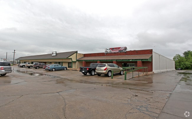
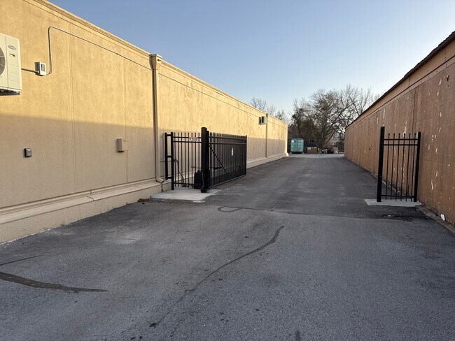
Property Record
8532 E 41St St, Tulsa, OK 74145

Current Lease Availabilities
NEARBY LISTINGS FOR SALE OR LEASE
Property Detail
8532 E 41St St
99325-93-25-20570
Unplatted
Lightindustrial
BEG 333.85E & 66.96S NWC W/2 NE NW TH S279.67 E326.15 TO EL W/2 NE NW TH N TO S R/W B A EXPRESSWAY NWLY16.55 TO PT 95.87S & 16.23W NEC W/2 NE NW TH NWLY CRV LF317.11 POB LESS E25 FOR ST SEC 25 19 13 1.83ACS
AE
Tulsa
40143C0357L
Oklahoma
2025
1.83 AC
2025
South Central Tulsa
006906
Tulsa
34,806 SF
Tulsa, OK
DEMOGRAPHICS near 8532 E 41St St
1 mile
3 mile
5 mile
2024 Total Population
7,554
96,496
243,117
2029 Population
7,766
99,677
250,923
Pop Growth 2024-2029
+ 2.81%
+ 3.30%
+ 3.21%
Average Age
36
37
38
2024 Total Households
2,932
40,028
101,272
HH Growth 2024-2029
+ 2.90%
+ 3.39%
+ 3.30%
Median Household Inc
$48,418
$48,509
$55,879
Avg Household Size
2.50
2.30
2.30
2024 Avg HH Vehicles
2.00
2.00
2.00
Median Home Value
$136,878
$155,733
$179,209
Median Year Built
1968
1972
1973
Nearby Places
Map Layers
Map Styles
 Street
 Aerial
Transit
 Traffic
 Biking
Places
Listings with unknown addresses are not visible on the map
- Restaurants
- Banks
- Shops
- Fitness
- Groceries
PUBLIC TRANSPORTATION
AIRPORT
Tulsa International
Drive
Walk
Distance
Tulsa International
19 min
9.7 mi
Nearby Properties
Address
Land Use
TOTAL SIZE
Lot Size
Zoning
Address
Land Use
TOTAL SIZE
Lot Size
Zoning
431,569 SF
39.02 AC
RM2
Address
Land Use
TOTAL SIZE
Lot Size
Zoning
80,431 SF
9.51 AC
IL
Address
Land Use
TOTAL SIZE
Lot Size
Zoning
184,679 SF
33.97 AC
AG
Address
Land Use
TOTAL SIZE
Lot Size
Zoning
304,789 SF
40.82 AC
CO
Address
Land Use
TOTAL SIZE
Lot Size
Zoning
350,741 SF
28.01 AC
CS
Address
Land Use
TOTAL SIZE
Lot Size
Zoning
78,119 SF
11.11 AC
CO
Address
Land Use
TOTAL SIZE
Lot Size
Zoning
216,280 SF
41.17 AC
RS2
Address
Land Use
TOTAL SIZE
Lot Size
Zoning
25,173 SF
155.93 AC
RS3
Address
Land Use
TOTAL SIZE
Lot Size
Zoning
46,859 SF
5.80 AC
CH
Address
Land Use
TOTAL SIZE
Lot Size
Zoning
592,682 SF
30.42 AC
CO
Address
Land Use
TOTAL SIZE
Lot Size
Zoning
66,541 SF
6.05 AC
CN
Address
Land Use
TOTAL SIZE
Lot Size
Zoning
146,538 SF
2.56 AC
CS
Address
Land Use
TOTAL SIZE
Lot Size
Zoning
108,416 SF
4.26 AC
OM
Address
Land Use
TOTAL SIZE
Lot Size
Zoning
45,191 SF
6.30 AC
CS
Address
Land Use
TOTAL SIZE
Lot Size
Zoning
180,642 SF
5.14 AC
CS
Address
Land Use
TOTAL SIZE
Lot Size
Zoning
55,283 SF
39.50 AC
SR
Address
Land Use
TOTAL SIZE
Lot Size
Zoning
77,346 SF
8.59 AC
RS3
Address
Land Use
TOTAL SIZE
Lot Size
Zoning
56,611 SF
26.92 AC
RS2
Address
Land Use
TOTAL SIZE
Lot Size
Zoning
96,983 SF
5.42 AC
RM2
Address
Land Use
TOTAL SIZE
Lot Size
Zoning
66,276 SF
3.97 AC
IL
Address
Land Use
TOTAL SIZE
Lot Size
Zoning
625 SF
78.96 AC
RS3
Address
Land Use
TOTAL SIZE
Lot Size
Zoning
106,898 SF
5.25 AC
RM2
Address
Land Use
TOTAL SIZE
Lot Size
Zoning
117,537 SF
14.99 AC
CO
Address
Land Use
TOTAL SIZE
Lot Size
Zoning
73,294 SF
10.08 AC
RS3
Address
Land Use
TOTAL SIZE
Lot Size
Zoning
74,600 SF
3.65 AC
RM2
Address
Land Use
TOTAL SIZE
Lot Size
Zoning
25,604 SF
25.15 AC
IL
Address
Land Use
TOTAL SIZE
Lot Size
Zoning
92,121 SF
9.34 AC
CS
Address
Land Use
TOTAL SIZE
Lot Size
Zoning
57,630 SF
35.09 AC
IL
Address
Land Use
TOTAL SIZE
Lot Size
Zoning
33,332 SF
2.92 AC
CO
Address
Land Use
TOTAL SIZE
Lot Size
Zoning
22,938 SF
2.95 AC
OM
The World's #1 Commercial Real Estate Marketplace
Connect with us
© 2026 CoStar Group
The information above has been obtained from sources believed reliable. While we do not doubt its accuracy we have not verified it and make no guarantee, warranty or representation about it. It is your responsibility to independently confirm its accuracy and completeness. Any projections, opinions, assumptions, or estimates used are for example only and do not represent the current or future performance of the property. The value of this transaction to you depends on tax and other factors which should be evaluated by your tax, financial, and legal advisors. You and your advisors should conduct a careful, independent investigation of the property to determine to your satisfaction the suitability of the property for your needs.