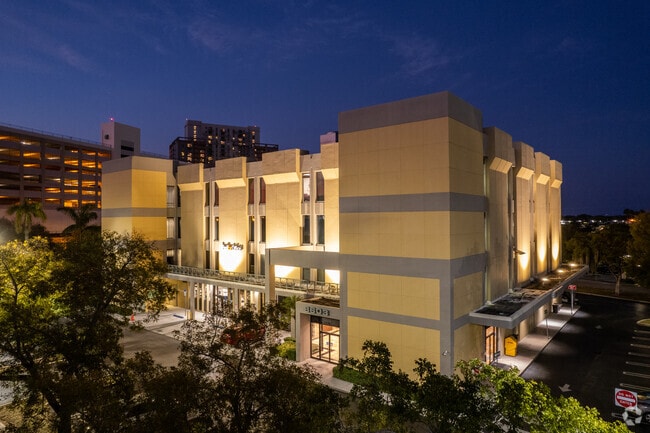
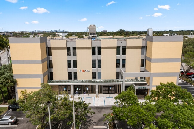
Property Record
8601 S Dixie Hwy, Pinecrest, FL 33156


Current Lease Availabilities
Property Detail
8601 S Dixie Hwy
20-4035-000-1203
35 54 40 5.67 AC M/L BEG 168.5FTW OF NE COR OF SE1/4 OF SW1/4 OF SE1/4 CONT W94.05FT TO SELY R/W/L OF SR 5 SWLY481.33FT SELY334.40FT E323.79FT N170FT E18.5FT N453.17FT TO POB & BEG 168.5FTW & 255FTN OF SE COR OF SE1/4 OF SW1/4 OF SE1/4 TH N165FT E264
Officebuilding
MIAMI/DADE
6200
Florida
B and X Area of moderate flood hazard, usually the area between the limits of the 100-year and 500-year floods.
5.67 AC
2024
Kendall
2025
South Florida
007609
Miami-Miami Beach-Kendall, FL
128,871 SF
NEARBY LISTINGS FOR SALE OR LEASE
DEMOGRAPHICS near 8601 S Dixie Hwy
1 mile
3 mile
5 mile
2025 Total Population
25,741
103,482
299,534
2030 Population
27,950
111,171
320,193
Pop Growth 2025-2030
+ 8.58%
+ 7.43%
+ 6.90%
Average Age
41
42
43
2025 Total Households
12,569
40,070
111,453
HH Growth 2025-2030
+ 8.64%
+ 7.71%
+ 7.07%
Median Household Inc
$71,411
$105,253
$102,355
Avg Household Size
2.00
2.50
2.60
2025 Avg HH Vehicles
1.00
2.00
2.00
Median Home Value
$573,550
$887,556
$752,432
Median Year Built
1983
1974
1971
Nearby Places
Map Layers
Map Styles
 Street
 Aerial
Layers
 Traffic
 Biking
Places
Listings with unknown addresses are not visible on the map
- Restaurants
- Banks
- Shops
- Fitness
- Groceries
PUBLIC TRANSPORTATION
COMMUTER RAIL
Dadeland North (Metrorail Green Line - Miami-Dade Transit (Metrorail/Metromover))
Drive
Walk
Distance
Dadeland North (Metrorail Green Line - Miami-Dade Transit (Metrorail/Metromover))
1 min
10 min
0.5 mi
Dadeland South (Metrorail Green Line - Miami-Dade Transit (Metrorail/Metromover))
Drive
Walk
Distance
Dadeland South (Metrorail Green Line - Miami-Dade Transit (Metrorail/Metromover))
2 min
13 min
0.7 mi
AIRPORT
Miami International
Drive
Walk
Distance
Miami International
20 min
10.6 mi
Fort Lauderdale/Hollywood International
Drive
Walk
Distance
Fort Lauderdale/Hollywood International
48 min
32.4 mi
Freight Ports
Port of Miami
Drive
Walk
Distance
Port of Miami
24 min
12.1 mi
Nearby Properties
Address
Land Use
TOTAL SIZE
Lot Size
Zoning
Address
Land Use
TOTAL SIZE
Lot Size
Zoning
2,238,641 SF
39 AC
6114
Address
Land Use
TOTAL SIZE
Lot Size
Zoning
1,018,683 SF
11.46 AC
5000
Address
Land Use
TOTAL SIZE
Lot Size
Zoning
883,561 SF
5.63 AC
8200
Address
Land Use
TOTAL SIZE
Lot Size
Zoning
1,527,515 SF
55.17 AC
5000
Address
Land Use
TOTAL SIZE
Lot Size
Zoning
877,136 SF
2.96 AC
6112
Address
Land Use
TOTAL SIZE
Lot Size
Zoning
715,755 SF
2.66 AC
5005
Address
Land Use
TOTAL SIZE
Lot Size
Zoning
973,728 SF
76.18 AC
8200
Address
Land Use
TOTAL SIZE
Lot Size
Zoning
766,093 SF
8.91 AC
5000
Address
Land Use
TOTAL SIZE
Lot Size
Zoning
764,501 SF
1.81 AC
6114
Address
Land Use
TOTAL SIZE
Lot Size
Zoning
644,929 SF
1.10 AC
6114
Address
Land Use
TOTAL SIZE
Lot Size
Zoning
759,863 SF
7.02 AC
6506
Address
Land Use
TOTAL SIZE
Lot Size
Zoning
634,144 SF
3.12 AC
6114
Address
Land Use
TOTAL SIZE
Lot Size
Zoning
500,332 SF
3.46 AC
6000
Address
Land Use
TOTAL SIZE
Lot Size
Zoning
521,667 SF
1.08 AC
6112
Address
Land Use
TOTAL SIZE
Lot Size
Zoning
532,779 SF
0000
Address
Land Use
TOTAL SIZE
Lot Size
Zoning
365,003 SF
15.05 AC
8200
Address
Land Use
TOTAL SIZE
Lot Size
Zoning
535,679 SF
2.73 AC
6000
Address
Land Use
TOTAL SIZE
Lot Size
Zoning
14.30 AC
0700
Address
Land Use
TOTAL SIZE
Lot Size
Zoning
859,337 SF
0.13 AC
7100
Address
Land Use
TOTAL SIZE
Lot Size
Zoning
516,656 SF
9.65 AC
6300
Address
Land Use
TOTAL SIZE
Lot Size
Zoning
364,114 SF
20 AC
3100
Address
Land Use
TOTAL SIZE
Lot Size
Zoning
432,416 SF
1.67 AC
5004
Address
Land Use
TOTAL SIZE
Lot Size
Zoning
452,547 SF
0.90 AC
6114
Address
Land Use
TOTAL SIZE
Lot Size
Zoning
705,929 SF
7.05 AC
9600
Address
Land Use
TOTAL SIZE
Lot Size
Zoning
553,491 SF
10.64 AC
3900
Address
Land Use
TOTAL SIZE
Lot Size
Zoning
370,938 SF
1.58 AC
6112
Address
Land Use
TOTAL SIZE
Lot Size
Zoning
277,025 SF
0.01 AC
6114
Address
Land Use
TOTAL SIZE
Lot Size
Zoning
129,079 SF
4 AC
6114
Address
Land Use
TOTAL SIZE
Lot Size
Zoning
327,378 SF
0.14 AC
7600
Address
Land Use
TOTAL SIZE
Lot Size
Zoning
309,432 SF
272.32 AC
8900
The World's #1 Commercial Real Estate Marketplace
Connect with us
© 2026 CoStar Group
The information above has been obtained from sources believed reliable. While we do not doubt its accuracy we have not verified it and make no guarantee, warranty or representation about it. It is your responsibility to independently confirm its accuracy and completeness. Any projections, opinions, assumptions, or estimates used are for example only and do not represent the current or future performance of the property. The value of this transaction to you depends on tax and other factors which should be evaluated by your tax, financial, and legal advisors. You and your advisors should conduct a careful, independent investigation of the property to determine to your satisfaction the suitability of the property for your needs.