Property Record
869 Mclean Ave, Yonkers, NY 10704


Save to a Folder
{{folder.Name}}
{{folder.ListingIds.length}} Properties
{{folder.ListingIds.length}} Property
Create a New Folder
Property Detail
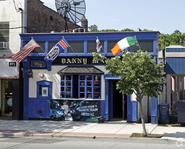
869 Mclean Ave
1800-006-000-06233-000-0003
Westchester
Bartavern
New York
B
3.000
B and X Area of moderate flood hazard, usually the area between the limits of the 100-year and 500-year floods.
0.05 AC
2025
Southwest
2025
Westchester/So Connecticut
001503
New York-Jersey City-White Plains, NY-NJ
2,304 SF
NEARBY LISTINGS FOR SALE OR LEASE
DEMOGRAPHICS near 869 Mclean Ave
1 mile
3 mile
5 mile
2025 Total Population
33,072
580,526
1,331,957
2030 Population
31,970
568,305
1,315,674
Pop Growth 2025-2030
(3.33%)
(2.11%)
(1.22%)
Average Age
41
40
40
2025 Total Households
13,040
214,221
485,825
HH Growth 2025-2030
(3.57%)
(2.28%)
(1.36%)
Median Household Inc
$82,189
$62,733
$61,039
Avg Household Size
2.40
2.60
2.60
2025 Avg HH Vehicles
1.00
1.00
1.00
Median Home Value
$519,497
$481,294
$539,805
Median Year Built
1948
1951
1951
Nearby Places
Map Layers
Map Styles
 Street
 Aerial
Layers
 Traffic
 Biking
Places
Listings with unknown addresses are not visible on the map
- Restaurants
- Banks
- Shops
- Fitness
- Groceries
PUBLIC TRANSPORTATION
COMMUTER RAIL
Woodlawn Station (Harlem Line - Metro-North Commuter Railroad Company (Metro-North))
Drive
Walk
Distance
Woodlawn Station (Harlem Line - Metro-North Commuter Railroad Company (Metro-North))
3 min
19 min
0.9 mi
Wakefield Station (Harlem Line - Metro-North Commuter Railroad Company (Metro-North))
Drive
Walk
Distance
Wakefield Station (Harlem Line - Metro-North Commuter Railroad Company (Metro-North))
5 min
18 min
0.9 mi
AIRPORT
LaGuardia
Drive
Walk
Distance
LaGuardia
26 min
14.5 mi
Westchester County
Drive
Walk
Distance
Westchester County
30 min
19.8 mi
John F Kennedy International
Drive
Walk
Distance
John F Kennedy International
37 min
22.4 mi
Freight Ports
NY - Red Hook Container Terminal
Drive
Walk
Distance
NY - Red Hook Container Terminal
39 min
22.7 mi
Nearby Properties
Address
Land Use
TOTAL SIZE
Lot Size
Zoning
Address
Land Use
TOTAL SIZE
Lot Size
Zoning
481,172 SF
205.58 AC
PARK
Address
Land Use
TOTAL SIZE
Lot Size
Zoning
1,132,500 SF
62.44 AC
R6
Address
Land Use
TOTAL SIZE
Lot Size
Zoning
895,256 SF
8.32 AC
R7-1
Address
Land Use
TOTAL SIZE
Lot Size
Zoning
1,237,424 SF
21.25 AC
R6
Address
Land Use
TOTAL SIZE
Lot Size
Zoning
204,200 SF
1.68 AC
R7-1
Address
Land Use
TOTAL SIZE
Lot Size
Zoning
4,000 SF
19.83 AC
BUS
Address
Land Use
TOTAL SIZE
Lot Size
Zoning
617,567 SF
3.19 AC
R7-1
Address
Land Use
TOTAL SIZE
Lot Size
Zoning
707,353 SF
29.34 AC
R6
Address
Land Use
TOTAL SIZE
Lot Size
Zoning
269,100 SF
1.63 AC
R4
Address
Land Use
TOTAL SIZE
Lot Size
Zoning
87,000 SF
455.70 AC
PARK
Address
Land Use
TOTAL SIZE
Lot Size
Zoning
251,884 SF
21.53 AC
R6
Address
Land Use
TOTAL SIZE
Lot Size
Zoning
18,445 SF
510.83 AC
PARK
Address
Land Use
TOTAL SIZE
Lot Size
Zoning
450,784 SF
42.36 AC
R4
Address
Land Use
TOTAL SIZE
Lot Size
Zoning
64,165 SF
3.24 AC
B
Address
Land Use
TOTAL SIZE
Lot Size
Zoning
1,028,976 SF
23.03 AC
R5
Address
Land Use
TOTAL SIZE
Lot Size
Zoning
1,038,034 SF
23.41 AC
R5
Address
Land Use
TOTAL SIZE
Lot Size
Zoning
614,887 SF
14.77 AC
R4
Address
Land Use
TOTAL SIZE
Lot Size
Zoning
244,650 SF
2 AC
R7-1
Address
Land Use
TOTAL SIZE
Lot Size
Zoning
280,539 SF
3.11 AC
R6
Address
Land Use
TOTAL SIZE
Lot Size
Zoning
61,055 SF
343.42 AC
R6
Address
Land Use
TOTAL SIZE
Lot Size
Zoning
285,373 SF
2.66 AC
R4
Address
Land Use
TOTAL SIZE
Lot Size
Zoning
493,000 SF
3.02 AC
R5
Address
Land Use
TOTAL SIZE
Lot Size
Zoning
240,000 SF
6.49 AC
C4-3
Address
Land Use
TOTAL SIZE
Lot Size
Zoning
203,837 SF
1.92 AC
R6
Address
Land Use
TOTAL SIZE
Lot Size
Zoning
104,129 SF
137.74 AC
PARK
Address
Land Use
TOTAL SIZE
Lot Size
Zoning
633,000 SF
9.16 AC
R6
Address
Land Use
TOTAL SIZE
Lot Size
Zoning
336,240 SF
8.45 AC
R5
Address
Land Use
TOTAL SIZE
Lot Size
Zoning
193,520 SF
4.32 AC
R4
Address
Land Use
TOTAL SIZE
Lot Size
Zoning
Address
Land Use
TOTAL SIZE
Lot Size
Zoning
405,908 SF
7.12 AC
R6
The World's #1 Commercial Real Estate Marketplace
Connect with us
© 2026 CoStar Group
The information above has been obtained from sources believed reliable. While we do not doubt its accuracy we have not verified it and make no guarantee, warranty or representation about it. It is your responsibility to independently confirm its accuracy and completeness. Any projections, opinions, assumptions, or estimates used are for example only and do not represent the current or future performance of the property. The value of this transaction to you depends on tax and other factors which should be evaluated by your tax, financial, and legal advisors. You and your advisors should conduct a careful, independent investigation of the property to determine to your satisfaction the suitability of the property for your needs.