Property Record
875 S Tracy Blvd, Tracy, CA 95376


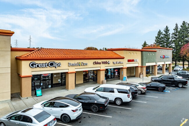
Property Detail
875 S Tracy Blvd
242-020-22
97-FM PT OF 19/PT TO 23 THRU 27/PM 20-164
Supermarket
SAN JOAQUIN
NS
California
B and X Area of moderate flood hazard, usually the area between the limits of the 100-year and 500-year floods.
5.82 AC
2025
Tracy/Manteca
2025
Stockton/Modesto
005208
Stockton-Lodi, CA
62,246 SF
NEARBY LISTINGS FOR SALE OR LEASE
DEMOGRAPHICS near 875 S Tracy Blvd
1 mile
3 mile
5 mile
2025 Total Population
22,317
99,542
107,609
2030 Population
23,152
103,965
112,927
Pop Growth 2025-2030
+ 3.74%
+ 4.44%
+ 4.94%
Average Age
38
38
38
2025 Total Households
6,815
29,492
32,175
HH Growth 2025-2030
+ 3.80%
+ 4.50%
+ 4.99%
Median Household Inc
$118,217
$121,012
$122,439
Avg Household Size
3.20
3.30
3.30
2025 Avg HH Vehicles
3.00
3.00
3.00
Median Home Value
$711,355
$728,151
$738,540
Median Year Built
1991
1994
1995
Nearby Places
Map Layers
Map Styles
 Street
 Aerial
Transit
 Traffic
 Biking
Places
Listings with unknown addresses are not visible on the map
- Restaurants
- Banks
- Shops
- Fitness
- Groceries
PUBLIC TRANSPORTATION
COMMUTER RAIL
Tracy Station (ACE Train - Altamont Corridor Express)
Drive
Walk
Distance
Tracy Station (ACE Train - Altamont Corridor Express)
5 min
2.3 mi
AIRPORT
Stockton Metro
Drive
Walk
Distance
Stockton Metro
28 min
20.3 mi
Freight Ports
Port of Stockton
Drive
Walk
Distance
Port of Stockton
31 min
23.6 mi
SALE & LEASE HISTORY
LISTING DATE
SALE/LEASE

May 10, 2022
For Lease
Nearby Properties
Address
Land Use
TOTAL SIZE
Lot Size
Zoning
Address
Land Use
TOTAL SIZE
Lot Size
Zoning
3,485,402 SF
86.48 AC
Address
Land Use
TOTAL SIZE
Lot Size
Zoning
610,914 SF
28.11 AC
M1
Address
Land Use
TOTAL SIZE
Lot Size
Zoning
8.90 AC
Address
Land Use
TOTAL SIZE
Lot Size
Zoning
1,601 SF
17.08 AC
PUD1
Address
Land Use
TOTAL SIZE
Lot Size
Zoning
3.77 AC
Address
Land Use
TOTAL SIZE
Lot Size
Zoning
1,124,201 SF
53.72 AC
Address
Land Use
TOTAL SIZE
Lot Size
Zoning
22,926 SF
11.63 AC
Address
Land Use
TOTAL SIZE
Lot Size
Zoning
749,840 SF
37.96 AC
Address
Land Use
TOTAL SIZE
Lot Size
Zoning
115.53 AC
IG
Address
Land Use
TOTAL SIZE
Lot Size
Zoning
567,870 SF
36.41 AC
M1
Address
Land Use
TOTAL SIZE
Lot Size
Zoning
29,442 SF
6.52 AC
Address
Land Use
TOTAL SIZE
Lot Size
Zoning
827,280 SF
36.18 AC
Address
Land Use
TOTAL SIZE
Lot Size
Zoning
9,327 SF
12.06 AC
Address
Land Use
TOTAL SIZE
Lot Size
Zoning
442,350 SF
27.01 AC
CN
Address
Land Use
TOTAL SIZE
Lot Size
Zoning
143,280 SF
20 AC
Address
Land Use
TOTAL SIZE
Lot Size
Zoning
575,167 SF
46.44 AC
Address
Land Use
TOTAL SIZE
Lot Size
Zoning
382,260 SF
18.70 AC
Address
Land Use
TOTAL SIZE
Lot Size
Zoning
265,868 SF
11.99 AC
Address
Land Use
TOTAL SIZE
Lot Size
Zoning
265,000 SF
10.83 AC
Address
Land Use
TOTAL SIZE
Lot Size
Zoning
49,264 SF
9 AC
Address
Land Use
TOTAL SIZE
Lot Size
Zoning
148,663 SF
16.37 AC
Address
Land Use
TOTAL SIZE
Lot Size
Zoning
225,000 SF
11.13 AC
M
Address
Land Use
TOTAL SIZE
Lot Size
Zoning
258,520 SF
16.74 AC
Address
Land Use
TOTAL SIZE
Lot Size
Zoning
6,000 SF
22.88 AC
IL
Address
Land Use
TOTAL SIZE
Lot Size
Zoning
32.90 AC
Address
Land Use
TOTAL SIZE
Lot Size
Zoning
155,942 SF
11.90 AC
Address
Land Use
TOTAL SIZE
Lot Size
Zoning
65.83 AC
The World's #1 Commercial Real Estate Marketplace
Connect with us
© 2026 CoStar Group
The information above has been obtained from sources believed reliable. While we do not doubt its accuracy we have not verified it and make no guarantee, warranty or representation about it. It is your responsibility to independently confirm its accuracy and completeness. Any projections, opinions, assumptions, or estimates used are for example only and do not represent the current or future performance of the property. The value of this transaction to you depends on tax and other factors which should be evaluated by your tax, financial, and legal advisors. You and your advisors should conduct a careful, independent investigation of the property to determine to your satisfaction the suitability of the property for your needs.