Property Record
S Woodlawn Ave, Ofallon, MO 63366

Current Lease Availabilities
NEARBY LISTINGS FOR SALE OR LEASE
Property Detail
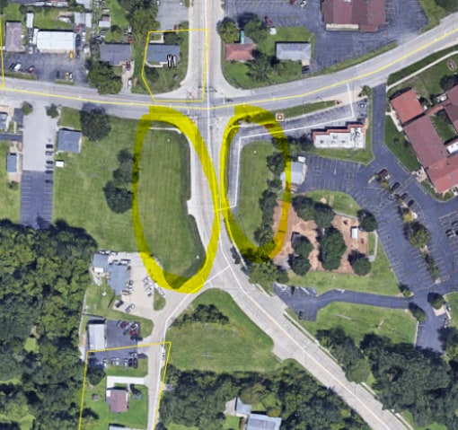
S Woodlawn Ave
St. Louis, MO-IL
Fort Zumwalt Hgts
2-0141-4274-00-0002.1000000
FORT ZUMWALT HGTS PT TRT 2 & PT VACATED PLACKEMEIER RD
Vacantlandnec
St. Charles
X
Missouri
29183C0237G
2
2024
0.46 AC
2025
St Charles County
311802
St. Louis
DEMOGRAPHICS near S Woodlawn Ave
1 Mile
3 Mile
5 Mile
2024 Total Population
9,925
81,847
153,745
2029 Population
10,552
86,299
162,824
Pop Growth 2024-2029
+ 6.32%
+ 5.44%
+ 5.91%
Average Age
41
40
40
2024 Total Households
4,142
30,567
57,247
HH Growth 2024-2029
+ 6.30%
+ 5.50%
+ 5.96%
Median Household Inc
$71,555
$93,170
$98,643
Avg Household Size
2.40
2.60
2.60
2024 Avg HH Vehicles
2.00
2.00
2.00
Median Home Value
$263,882
$265,962
$283,073
Median Year Built
1995
1995
1997
Nearby Places
Map Layers
Map Styles
 Street
 Aerial
- Restaurants
- Banks
- Shops
- Fitness
- Groceries
PUBLIC TRANSPORTATION
AIRPORT
St Louis Lambert International
DRIVE
WALK
Distance
St Louis Lambert International
31 min
22.1 mi
Freight Ports
Tulsa Port of Inola
DRIVE
WALK
Distance
Tulsa Port of Inola
429 min
379.2 mi
Nearby Properties
Address
Land Use
TOTAL SIZE
Lot Size
Zoning
Address
Land Use
TOTAL SIZE
Lot Size
Zoning
163,438 SF
5.76 AC
Address
Land Use
TOTAL SIZE
Lot Size
Zoning
189,054 SF
24.92 AC
AA1
Address
Land Use
TOTAL SIZE
Lot Size
Zoning
71,908 SF
8.72 AC
Address
Land Use
TOTAL SIZE
Lot Size
Zoning
254,435 SF
16.57 AC
Address
Land Use
TOTAL SIZE
Lot Size
Zoning
342,840 SF
58.93 AC
AB6
Address
Land Use
TOTAL SIZE
Lot Size
Zoning
235,876 SF
11.35 AC
Address
Land Use
TOTAL SIZE
Lot Size
Zoning
261,357 SF
7.90 AC
Address
Land Use
TOTAL SIZE
Lot Size
Zoning
46,388 SF
10.76 AC
Address
Land Use
TOTAL SIZE
Lot Size
Zoning
75.10 AC
AC7
Address
Land Use
TOTAL SIZE
Lot Size
Zoning
399,520 SF
16.98 AC
AB3
Address
Land Use
TOTAL SIZE
Lot Size
Zoning
591,516 SF
28.79 AC
AB2
Address
Land Use
TOTAL SIZE
Lot Size
Zoning
32.19 AC
AA1
Address
Land Use
TOTAL SIZE
Lot Size
Zoning
36,438 SF
2.08 AC
AC4
Address
Land Use
TOTAL SIZE
Lot Size
Zoning
429,473 SF
82.18 AC
Address
Land Use
TOTAL SIZE
Lot Size
Zoning
167,090 SF
19.85 AC
Address
Land Use
TOTAL SIZE
Lot Size
Zoning
251,169 SF
20.19 AC
Address
Land Use
TOTAL SIZE
Lot Size
Zoning
562,434 SF
40.73 AC
AB3
Address
Land Use
TOTAL SIZE
Lot Size
Zoning
210,095 SF
12.29 AC
AE9
Address
Land Use
TOTAL SIZE
Lot Size
Zoning
53,636 SF
Address
Land Use
TOTAL SIZE
Lot Size
Zoning
201,531 SF
22.28 AC
Address
Land Use
TOTAL SIZE
Lot Size
Zoning
48.76 AC
AF0
Address
Land Use
TOTAL SIZE
Lot Size
Zoning
109,400 SF
19.94 AC
Address
Land Use
TOTAL SIZE
Lot Size
Zoning
197,791 SF
18.58 AC
Address
Land Use
TOTAL SIZE
Lot Size
Zoning
261,016 SF
15.27 AC
Address
Land Use
TOTAL SIZE
Lot Size
Zoning
47.95 AC
AF0
Address
Land Use
TOTAL SIZE
Lot Size
Zoning
129,472 SF
22 AC
AC2
Address
Land Use
TOTAL SIZE
Lot Size
Zoning
113,099 SF
12.12 AC
Address
Land Use
TOTAL SIZE
Lot Size
Zoning
147,526 SF
7.51 AC
AE8
Address
Land Use
TOTAL SIZE
Lot Size
Zoning
155,630 SF
10.83 AC
Address
Land Use
TOTAL SIZE
Lot Size
Zoning
40,804 SF
7.98 AC
The World's #1 Commercial Real Estate Marketplace
Connect with us
© 2026 CoStar Group
The information above has been obtained from sources believed reliable. While we do not doubt its accuracy we have not verified it and make no guarantee, warranty or representation about it. It is your responsibility to independently confirm its accuracy and completeness. Any projections, opinions, assumptions, or estimates used are for example only and do not represent the current or future performance of the property. The value of this transaction to you depends on tax and other factors which should be evaluated by your tax, financial, and legal advisors. You and your advisors should conduct a careful, independent investigation of the property to determine to your satisfaction the suitability of the property for your needs.