Property Record
8914 Delrose Ave, Spring Valley, CA 91977
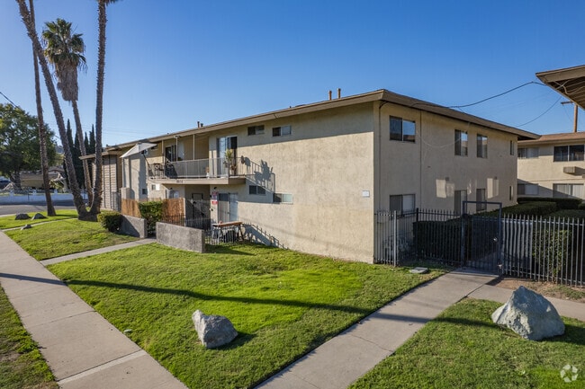

Property Detail
8914 Delrose Ave
583-501-08
LOTS 488 THRU 492 TR 004158
Multifamilydwelling
San Diego
RU
California
B and X Area of moderate flood hazard, usually the area between the limits of the 100-year and 500-year floods.
488-4
2024
1.15 AC
2025
La Presa
003108
San Diego
32,944 SF
San Diego-Chula Vista-Carlsbad, CA
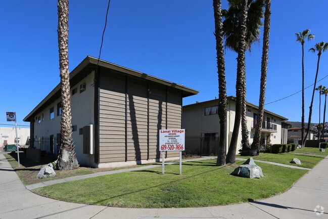
NEARBY LISTINGS FOR SALE OR LEASE
DEMOGRAPHICS near 8914 Delrose Ave
1 mile
3 mile
5 mile
2025 Total Population
25,414
158,053
418,823
2030 Population
25,312
157,597
418,209
Pop Growth 2025-2030
(0.40%)
(0.29%)
(0.15%)
Average Age
38
39
39
2025 Total Households
7,214
47,313
133,152
HH Growth 2025-2030
(0.57%)
(0.44%)
(0.28%)
Median Household Inc
$91,929
$95,690
$91,658
Avg Household Size
3.40
3.20
3.00
2025 Avg HH Vehicles
2.00
2.00
2.00
Median Home Value
$694,011
$714,285
$738,281
Median Year Built
1968
1973
1973
Nearby Places
Map Layers
Map Styles
 Street
 Aerial
Layers
 Traffic
 Biking
Places
Listings with unknown addresses are not visible on the map
- Restaurants
- Banks
- Shops
- Fitness
- Groceries
PUBLIC TRANSPORTATION
AIRPORT
San Diego International
Drive
Walk
Distance
San Diego International
21 min
15.1 mi
Freight Ports
Port of San Diego
Drive
Walk
Distance
Port of San Diego
19 min
12.4 mi
SALE & LEASE HISTORY
LISTING DATE
SALE/LEASE

Jun 22, 2020
For Sale
Aug 10, 2022
For Sale
Nearby Properties
Address
Land Use
TOTAL SIZE
Lot Size
Zoning
Address
Land Use
TOTAL SIZE
Lot Size
Zoning
10.92 AC
RM-2-5
Address
Land Use
TOTAL SIZE
Lot Size
Zoning
89,332 SF
1.14 AC
C
Address
Land Use
TOTAL SIZE
Lot Size
Zoning
Address
Land Use
TOTAL SIZE
Lot Size
Zoning
83,324 SF
5.17 AC
RU
Address
Land Use
TOTAL SIZE
Lot Size
Zoning
11.28 AC
RM-2-5
Address
Land Use
TOTAL SIZE
Lot Size
Zoning
78,360 SF
5.69 AC
RU
Address
Land Use
TOTAL SIZE
Lot Size
Zoning
7.09 AC
RV
Address
Land Use
TOTAL SIZE
Lot Size
Zoning
10.45 AC
RM-2-5
Address
Land Use
TOTAL SIZE
Lot Size
Zoning
95,506 SF
4.65 AC
RU
Address
Land Use
TOTAL SIZE
Lot Size
Zoning
1.25 AC
C
Address
Land Use
TOTAL SIZE
Lot Size
Zoning
5.27 AC
RU
Address
Land Use
TOTAL SIZE
Lot Size
Zoning
15.88 AC
RU
Address
Land Use
TOTAL SIZE
Lot Size
Zoning
78,723 SF
3.09 AC
R3
Address
Land Use
TOTAL SIZE
Lot Size
Zoning
10.05 AC
C
Address
Land Use
TOTAL SIZE
Lot Size
Zoning
62,394 SF
2 AC
C36
Address
Land Use
TOTAL SIZE
Lot Size
Zoning
Address
Land Use
TOTAL SIZE
Lot Size
Zoning
13.27 AC
CR-1-1
Address
Land Use
TOTAL SIZE
Lot Size
Zoning
12.33 AC
CR-1-1
Address
Land Use
TOTAL SIZE
Lot Size
Zoning
8.36 AC
CR-1-1
Address
Land Use
TOTAL SIZE
Lot Size
Zoning
76,068 SF
3.86 AC
RU
Address
Land Use
TOTAL SIZE
Lot Size
Zoning
1.81 AC
R1
Address
Land Use
TOTAL SIZE
Lot Size
Zoning
3,180 SF
10.82 AC
RMH9
Address
Land Use
TOTAL SIZE
Lot Size
Zoning
59,116 SF
2.77 AC
R3
Address
Land Use
TOTAL SIZE
Lot Size
Zoning
9.36 AC
RM-2-5
Address
Land Use
TOTAL SIZE
Lot Size
Zoning
6.17 AC
R2
Address
Land Use
TOTAL SIZE
Lot Size
Zoning
2.94 AC
CR-1-1
Address
Land Use
TOTAL SIZE
Lot Size
Zoning
56,015 SF
5.31 AC
C
Address
Land Use
TOTAL SIZE
Lot Size
Zoning
50,799 SF
2.02 AC
RU
Address
Land Use
TOTAL SIZE
Lot Size
Zoning
78,870 SF
3.37 AC
R4
Address
Land Use
TOTAL SIZE
Lot Size
Zoning
10.16 AC
CC-2-3
The World's #1 Commercial Real Estate Marketplace
Connect with us
© 2026 CoStar Group
The information above has been obtained from sources believed reliable. While we do not doubt its accuracy we have not verified it and make no guarantee, warranty or representation about it. It is your responsibility to independently confirm its accuracy and completeness. Any projections, opinions, assumptions, or estimates used are for example only and do not represent the current or future performance of the property. The value of this transaction to you depends on tax and other factors which should be evaluated by your tax, financial, and legal advisors. You and your advisors should conduct a careful, independent investigation of the property to determine to your satisfaction the suitability of the property for your needs.