Property Record
8930 Watsonville Rd, Gilroy, CA 95020
Property Detail
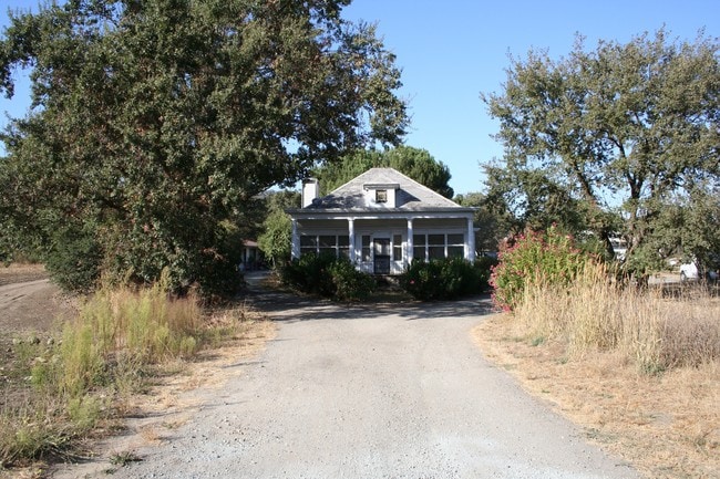
8930 Watsonville Rd
San Jose-Sunnyvale-Santa Clara, CA
LOT 2
783-08-059
SANTA CLARA
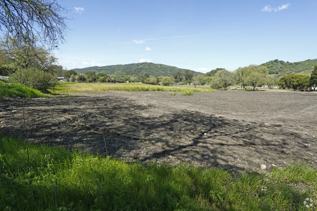
Agriculturalland
California
A-20A
2
AE The base floodplain where base flood elevations are provided. AE Zones are now used on new format FIRMs instead of A1-A30 Zones.
113.23 AC
2024
Outlying Santa Clara Cnty
2025
South Bay/San Jose
512200
NEARBY LISTINGS FOR SALE OR LEASE
-
-
View all Gilroy listings for sale on LoopNet.com
DEMOGRAPHICS near 8930 Watsonville Rd
1 mile
3 mile
5 mile
2025 Total Population
579
12,185
57,536
2030 Population
581
12,408
58,530
Pop Growth 2025-2030
+ 0.35%
+ 1.83%
+ 1.73%
Average Age
48
42
40
2025 Total Households
207
3,765
17,455
HH Growth 2025-2030
+ 0.48%
+ 1.81%
+ 1.72%
Median Household Inc
$226,050
$178,112
$134,174
Avg Household Size
2.80
3.20
3.20
2025 Avg HH Vehicles
3.00
3.00
2.00
Median Home Value
$1,089,474
$1,100,841
$1,007,667
Median Year Built
1990
1999
1987
Nearby Places
Map Layers
Map Styles
 Street
 Aerial
Layers
 Traffic
 Biking
Places
Listings with unknown addresses are not visible on the map
- Restaurants
- Banks
- Shops
- Fitness
- Groceries
PUBLIC TRANSPORTATION
COMMUTER RAIL
Gilroy Caltrain Station Southbound (South Santa Clara County Connector - Caltrain (Caltrain))
Drive
Walk
Distance
Gilroy Caltrain Station Southbound (South Santa Clara County Connector - Caltrain (Caltrain))
11 min
6.1 mi
San Martin Caltrain Station Northbound (South Santa Clara County Connector - Caltrain (Caltrain))
Drive
Walk
Distance
San Martin Caltrain Station Northbound (South Santa Clara County Connector - Caltrain (Caltrain))
14 min
8.2 mi
AIRPORT
Norman Y Mineta San Jose International
Drive
Walk
Distance
Norman Y Mineta San Jose International
47 min
34.5 mi
Freight Ports
Port of Redwood City
Drive
Walk
Distance
Port of Redwood City
68 min
52.6 mi
SALE & LEASE HISTORY
LISTING DATE
SALE/LEASE

Apr 20, 2017
For Sale
Nearby Properties
Address
Land Use
TOTAL SIZE
Lot Size
Zoning
Address
Land Use
TOTAL SIZE
Lot Size
Zoning
102,915 SF
3.81 AC
R3
Address
Land Use
TOTAL SIZE
Lot Size
Zoning
43,973 SF
3.38 AC
R3
Address
Land Use
TOTAL SIZE
Lot Size
Zoning
2.94 AC
A140
Address
Land Use
TOTAL SIZE
Lot Size
Zoning
49,724 SF
2.79 AC
C3
Address
Land Use
TOTAL SIZE
Lot Size
Zoning
20,742 SF
1.40 AC
R-3
Address
Land Use
TOTAL SIZE
Lot Size
Zoning
50.84 AC
A-20A
Address
Land Use
TOTAL SIZE
Lot Size
Zoning
2,510 SF
1.47 AC
C3
Address
Land Use
TOTAL SIZE
Lot Size
Zoning
19,209 SF
2.14 AC
C3
Address
Land Use
TOTAL SIZE
Lot Size
Zoning
60.15 AC
AW
Address
Land Use
TOTAL SIZE
Lot Size
Zoning
14.25 AC
HS-SR
Address
Land Use
TOTAL SIZE
Lot Size
Zoning
48.27 AC
AW
Address
Land Use
TOTAL SIZE
Lot Size
Zoning
525.15 AC
HS
Address
Land Use
TOTAL SIZE
Lot Size
Zoning
9.57 AC
A-20A
Address
Land Use
TOTAL SIZE
Lot Size
Zoning
22.70 AC
A-20A
Address
Land Use
TOTAL SIZE
Lot Size
Zoning
10.21 AC
AW
Address
Land Use
TOTAL SIZE
Lot Size
Zoning
15.29 AC
AW
Address
Land Use
TOTAL SIZE
Lot Size
Zoning
1,983 SF
75.52 AC
HS-SR
Address
Land Use
TOTAL SIZE
Lot Size
Zoning
24,133 SF
40.76 AC
A-20A
Address
Land Use
TOTAL SIZE
Lot Size
Zoning
6.70 AC
A-20A
Address
Land Use
TOTAL SIZE
Lot Size
Zoning
1.60 AC
R3
Address
Land Use
TOTAL SIZE
Lot Size
Zoning
31.72 AC
HS
Address
Land Use
TOTAL SIZE
Lot Size
Zoning
60.72 AC
HS-SR
Address
Land Use
TOTAL SIZE
Lot Size
Zoning
378.45 AC
AW
Address
Land Use
TOTAL SIZE
Lot Size
Zoning
1.40 AC
C-3
Address
Land Use
TOTAL SIZE
Lot Size
Zoning
54.59 AC
A
Address
Land Use
TOTAL SIZE
Lot Size
Zoning
118.04 AC
HS
Address
Land Use
TOTAL SIZE
Lot Size
Zoning
1.25 AC
C-3
Address
Land Use
TOTAL SIZE
Lot Size
Zoning
49.11 AC
HS
Address
Land Use
TOTAL SIZE
Lot Size
Zoning
41.55 AC
HS
The World's #1 Commercial Real Estate Marketplace
Connect with us
© 2026 CoStar Group
The information above has been obtained from sources believed reliable. While we do not doubt its accuracy we have not verified it and make no guarantee, warranty or representation about it. It is your responsibility to independently confirm its accuracy and completeness. Any projections, opinions, assumptions, or estimates used are for example only and do not represent the current or future performance of the property. The value of this transaction to you depends on tax and other factors which should be evaluated by your tax, financial, and legal advisors. You and your advisors should conduct a careful, independent investigation of the property to determine to your satisfaction the suitability of the property for your needs.