Property Record
900 Highway 70 W, Alamogordo, NM 88310

Save to a Folder
{{folder.Name}}
{{folder.ListingIds.length}} Properties
{{folder.ListingIds.length}} Property
Create a New Folder
Property Detail
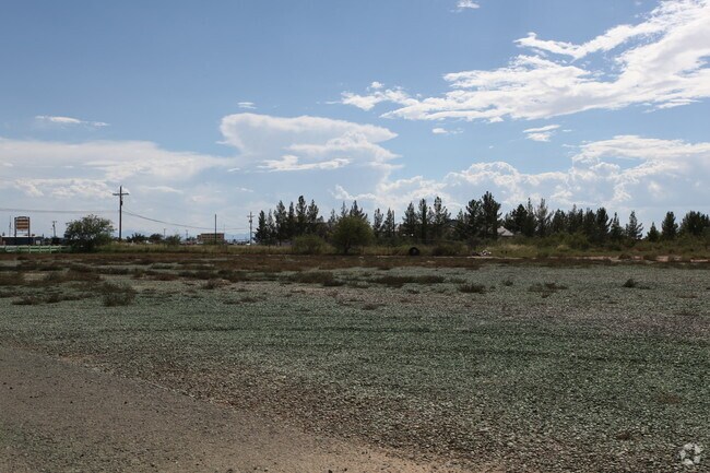
900 Highway 70 W
R010065
S: 2 T: 17 R: 9 TRACT IN S1/2NE1/4
Wholesaleoutletdiscountstore
Otero
C-3
New Mexico
AH Areas with a 1% annual chance of shallow flooding, usually in the form of a pond, withan average depth ranging from 1 to 3 feet. These areas have a 26% chance of flooding over the life of a 30-year mortgage.
1.32 AC
2025
Las Cruces/Alamogordo
2025
Other Market Areas
000502
Alamogordo, NM
9,058 SF
NEARBY LISTINGS FOR SALE OR LEASE
DEMOGRAPHICS near 900 Highway 70 W
1 mile
3 mile
5 mile
2025 Total Population
3,051
13,070
31,271
2030 Population
3,157
13,300
31,479
Pop Growth 2025-2030
+ 3.47%
+ 1.76%
+ 0.67%
Average Age
39
39
40
2025 Total Households
1,314
5,496
13,490
HH Growth 2025-2030
+ 3.42%
+ 1.60%
+ 0.50%
Median Household Inc
$37,218
$55,783
$50,590
Avg Household Size
2.20
2.30
2.20
2025 Avg HH Vehicles
2.00
2.00
2.00
Median Home Value
$72,120
$199,028
$170,691
Median Year Built
1986
1990
1978
Nearby Places
Map Layers
Map Styles
 Street
 Aerial
Layers
 Traffic
 Biking
Places
Listings with unknown addresses are not visible on the map
- Restaurants
- Banks
- Shops
- Fitness
- Groceries
Nearby Properties
Address
Land Use
TOTAL SIZE
Lot Size
Zoning
Address
Land Use
TOTAL SIZE
Lot Size
Zoning
7,534 SF
66.27 AC
R-1
Address
Land Use
TOTAL SIZE
Lot Size
Zoning
33.74 AC
R-1
Address
Land Use
TOTAL SIZE
Lot Size
Zoning
211,757 SF
4.86 AC
Address
Land Use
TOTAL SIZE
Lot Size
Zoning
22,893 SF
2.18 AC
C-3
Address
Land Use
TOTAL SIZE
Lot Size
Zoning
56,121 SF
1.81 AC
C-3
Address
Land Use
TOTAL SIZE
Lot Size
Zoning
52,763 SF
20 AC
M-2
Address
Land Use
TOTAL SIZE
Lot Size
Zoning
6,928 SF
30.66 AC
R-1
Address
Land Use
TOTAL SIZE
Lot Size
Zoning
32,430 SF
1.81 AC
C-3
Address
Land Use
TOTAL SIZE
Lot Size
Zoning
39,856 SF
1.97 AC
C-3
Address
Land Use
TOTAL SIZE
Lot Size
Zoning
2,440 SF
22.25 AC
M-2
Address
Land Use
TOTAL SIZE
Lot Size
Zoning
40,607 SF
3.06 AC
M-2
Address
Land Use
TOTAL SIZE
Lot Size
Zoning
45,123 SF
2.03 AC
C-3
Address
Land Use
TOTAL SIZE
Lot Size
Zoning
54,880 SF
5.17 AC
C-3
Address
Land Use
TOTAL SIZE
Lot Size
Zoning
2,304 SF
4.19 AC
C-3
Address
Land Use
TOTAL SIZE
Lot Size
Zoning
46,761 SF
2.42 AC
C-3
Address
Land Use
TOTAL SIZE
Lot Size
Zoning
26,215 SF
5.04 AC
C-3
Address
Land Use
TOTAL SIZE
Lot Size
Zoning
1,400 SF
2.92 AC
C-3
Address
Land Use
TOTAL SIZE
Lot Size
Zoning
36,300 SF
1.28 AC
C-3
Address
Land Use
TOTAL SIZE
Lot Size
Zoning
29,050 SF
3 AC
C-1
Address
Land Use
TOTAL SIZE
Lot Size
Zoning
5,814 SF
2.86 AC
C-3
Address
Land Use
TOTAL SIZE
Lot Size
Zoning
25,464 SF
3.89 AC
C-3
Address
Land Use
TOTAL SIZE
Lot Size
Zoning
14,354 SF
0.78 AC
C-3
Address
Land Use
TOTAL SIZE
Lot Size
Zoning
6,067 SF
3.82 AC
C-3
Address
Land Use
TOTAL SIZE
Lot Size
Zoning
42,196 SF
4.05 AC
C-3
Address
Land Use
TOTAL SIZE
Lot Size
Zoning
21,223 SF
0.34 AC
C-1
Address
Land Use
TOTAL SIZE
Lot Size
Zoning
16,851 SF
1.81 AC
M-2
Address
Land Use
TOTAL SIZE
Lot Size
Zoning
15,724 SF
3.06 AC
MH-2
Address
Land Use
TOTAL SIZE
Lot Size
Zoning
8,556 SF
2.63 AC
Address
Land Use
TOTAL SIZE
Lot Size
Zoning
6,153 SF
1.58 AC
C-3
Address
Land Use
TOTAL SIZE
Lot Size
Zoning
15,100 SF
1.05 AC
C-3
The World's #1 Commercial Real Estate Marketplace
Connect with us
© 2026 CoStar Group
The information above has been obtained from sources believed reliable. While we do not doubt its accuracy we have not verified it and make no guarantee, warranty or representation about it. It is your responsibility to independently confirm its accuracy and completeness. Any projections, opinions, assumptions, or estimates used are for example only and do not represent the current or future performance of the property. The value of this transaction to you depends on tax and other factors which should be evaluated by your tax, financial, and legal advisors. You and your advisors should conduct a careful, independent investigation of the property to determine to your satisfaction the suitability of the property for your needs.