Property Record
9000 Cameron Pkwy, Oklahoma City, OK 73114

NEARBY LISTINGS FOR SALE OR LEASE
Property Detail
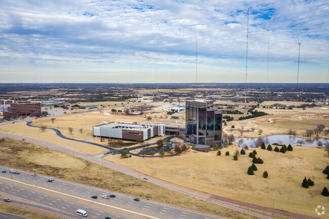
9000 Cameron Pkwy
Oklahoma City, OK
Unpltd Pt Sec 34 13N 3W
134604510
UNPLTD PT SEC 34 13N 3W BLK 000 LOT 000 PT NW4 SEC 34 13N 3W BEG 1258.66FT E & 834.4FT S OF NW/C NW4 TH S821.6FT W1180FT TO E LINE BROADWAY EXTENSION TH N APPROX 75.7FT E20FT N36.63FT NELY ON A CURVE 397.26FT NELY ON A CURVE 207.38FT TH NLY ALONG A C
Parkingstructure
Oklahoma
X
Oklahoma
40109C0160H
000
2023
54.25 AC
2024
North
108301
Oklahoma City
777,727 SF
DEMOGRAPHICS near 9000 Cameron Pkwy
1 Mile
3 Mile
5 Mile
2024 Total Population
5,386
43,617
146,690
2029 Population
5,531
44,744
150,732
Pop Growth 2024-2029
+ 2.69%
+ 2.58%
+ 2.76%
Average Age
34
38
39
2024 Total Households
1,973
19,600
67,475
HH Growth 2024-2029
+ 2.89%
+ 2.61%
+ 2.91%
Median Household Inc
$29,247
$54,337
$54,431
Avg Household Size
2.60
2.10
2.10
2024 Avg HH Vehicles
1.00
2.00
2.00
Median Home Value
$106,650
$182,178
$199,727
Median Year Built
1969
1972
1973
Nearby Places
Map Layers
Map Styles
 Street
 Aerial
- Restaurants
- Banks
- Shops
- Fitness
- Groceries
PUBLIC TRANSPORTATION
COMMUTER RAIL
Oklahoma City (Heartland Flyer - Amtrak)
DRIVE
WALK
Distance
Oklahoma City (Heartland Flyer - Amtrak)
12 min
7.7 mi
AIRPORT
Will Rogers World
DRIVE
WALK
Distance
Will Rogers World
29 min
16.6 mi
Freight Ports
Tulsa Port Of Catoosa
DRIVE
WALK
Distance
Tulsa Port Of Catoosa
129 min
118.8 mi
Nearby Properties
Address
Land Use
TOTAL SIZE
Lot Size
Zoning
Address
Land Use
TOTAL SIZE
Lot Size
Zoning
233,053 SF
18.93 AC
O-2
Address
Land Use
TOTAL SIZE
Lot Size
Zoning
442,553 SF
58.86 AC
PUD
Address
Land Use
TOTAL SIZE
Lot Size
Zoning
469,063 SF
71.44 AC
I-2
Address
Land Use
TOTAL SIZE
Lot Size
Zoning
58,071 SF
4.15 AC
PUD
Address
Land Use
TOTAL SIZE
Lot Size
Zoning
327,248 SF
14.22 AC
R-4
Address
Land Use
TOTAL SIZE
Lot Size
Zoning
294,583 SF
20.14 AC
PUD
Address
Land Use
TOTAL SIZE
Lot Size
Zoning
93,244 SF
7.54 AC
PUD
Address
Land Use
TOTAL SIZE
Lot Size
Zoning
399,688 SF
80.57 AC
PUD
Address
Land Use
TOTAL SIZE
Lot Size
Zoning
202,147 SF
44.36 AC
PUD
Address
Land Use
TOTAL SIZE
Lot Size
Zoning
241,874 SF
36.89 AC
PUD
Address
Land Use
TOTAL SIZE
Lot Size
Zoning
258,381 SF
2.54 AC
PUD
Address
Land Use
TOTAL SIZE
Lot Size
Zoning
254,126 SF
2.11 AC
SPUD
Address
Land Use
TOTAL SIZE
Lot Size
Zoning
105,426 SF
15.58 AC
O-2
Address
Land Use
TOTAL SIZE
Lot Size
Zoning
200,836 SF
10.79 AC
R-4
Address
Land Use
TOTAL SIZE
Lot Size
Zoning
43,489 SF
14.86 AC
PUD
Address
Land Use
TOTAL SIZE
Lot Size
Zoning
21,000 SF
2.64 AC
I-1
Address
Land Use
TOTAL SIZE
Lot Size
Zoning
280,970 SF
24.32 AC
Address
Land Use
TOTAL SIZE
Lot Size
Zoning
242,907 SF
I-2
Address
Land Use
TOTAL SIZE
Lot Size
Zoning
574,062 SF
57.69 AC
I-2
Address
Land Use
TOTAL SIZE
Lot Size
Zoning
203,712 SF
10.01 AC
R-4
Address
Land Use
TOTAL SIZE
Lot Size
Zoning
160,389 SF
16.48 AC
PUD
Address
Land Use
TOTAL SIZE
Lot Size
Zoning
436,316 SF
5.23 AC
I-1
Address
Land Use
TOTAL SIZE
Lot Size
Zoning
113,781 SF
14.06 AC
Address
Land Use
TOTAL SIZE
Lot Size
Zoning
285,771 SF
8.64 AC
PUD
Address
Land Use
TOTAL SIZE
Lot Size
Zoning
1 SF
3.72 AC
C-3
Address
Land Use
TOTAL SIZE
Lot Size
Zoning
59,307 SF
3.75 AC
PUD
Address
Land Use
TOTAL SIZE
Lot Size
Zoning
198,422 SF
4.17 AC
O-2
Address
Land Use
TOTAL SIZE
Lot Size
Zoning
167,057 SF
2.62 AC
PUD
The World's #1 Commercial Real Estate Marketplace
Connect with us
© 2026 CoStar Group
The information above has been obtained from sources believed reliable. While we do not doubt its accuracy we have not verified it and make no guarantee, warranty or representation about it. It is your responsibility to independently confirm its accuracy and completeness. Any projections, opinions, assumptions, or estimates used are for example only and do not represent the current or future performance of the property. The value of this transaction to you depends on tax and other factors which should be evaluated by your tax, financial, and legal advisors. You and your advisors should conduct a careful, independent investigation of the property to determine to your satisfaction the suitability of the property for your needs.