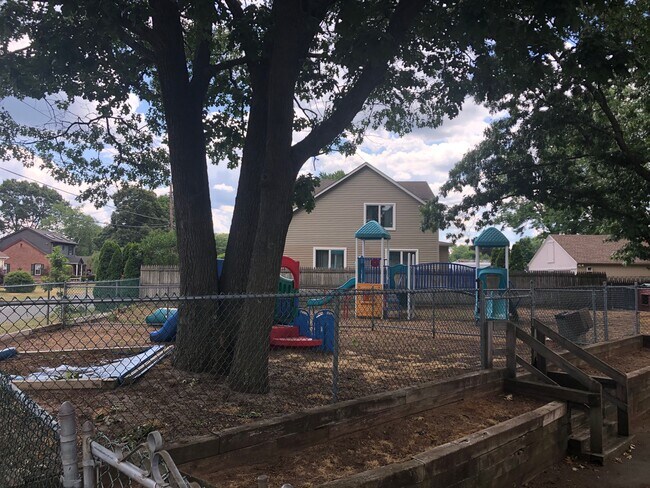
Property Record
901 Springfield St, Feeding Hills, MA 01030


NEARBY LISTINGS FOR SALE OR LEASE
Property Detail
901 Springfield St
AGAW-000011G-000001-000005
Hampden
Officebuilding
Massachusetts
X
5
25013C0383E
0.40 AC
2025
Hampden County
2025
Hartford
813206
Springfield, MA
2,428 SF
DEMOGRAPHICS near 901 Springfield St
1 Mile
3 Mile
5 Mile
2024 Total Population
4,944
37,947
110,502
2029 Population
4,867
37,210
108,442
Pop Growth 2024-2029
(1.56%)
(1.94%)
(1.86%)
Average Age
43
43
40
2024 Total Households
2,038
15,636
44,860
HH Growth 2024-2029
(1.67%)
(2.04%)
(1.92%)
Median Household Inc
$81,335
$76,900
$60,157
Avg Household Size
2.40
2.40
2.40
2024 Avg HH Vehicles
2.00
2.00
2.00
Median Home Value
$263,223
$271,560
$285,891
Median Year Built
1959
1964
1958
Nearby Places
Map Layers
Map Styles
 Street
 Aerial
- Restaurants
- Banks
- Shops
- Fitness
- Groceries
PUBLIC TRANSPORTATION
COMMUTER RAIL
Springfield (Amtrak Hartford Line - Amtrak, Hartford Line - Amtrak, Lake Shore Limited - Amtrak, Northeast Regional - Amtrak, Valley Flyer - Amtrak, Vermonter - Amtrak)
DRIVE
WALK
Distance
Springfield (Amtrak Hartford Line - Amtrak, Hartford Line - Amtrak, Lake Shore Limited - Amtrak, Northeast Regional - Amtrak, Valley Flyer - Amtrak, Vermonter - Amtrak)
7 min
4.8 mi
AIRPORT
Bradley International
DRIVE
WALK
Distance
Bradley International
29 min
12.6 mi
Freight Ports
Port of New Haven
DRIVE
WALK
Distance
Port of New Haven
88 min
68.4 mi
SALE & LEASE HISTORY
LISTING DATE
SALE/LEASE

Jun 26, 2020
For Sale
Jun 02, 2017
For Sale
Jul 18, 2019
For Sale
Nearby Properties
Address
Land Use
TOTAL SIZE
Lot Size
Zoning
Address
Land Use
TOTAL SIZE
Lot Size
Zoning
36.53 AC
IB
Address
Land Use
TOTAL SIZE
Lot Size
Zoning
236,032 SF
41.65 AC
RA2
Address
Land Use
TOTAL SIZE
Lot Size
Zoning
137,450 SF
16 AC
Address
Land Use
TOTAL SIZE
Lot Size
Zoning
133,822 SF
40.51 AC
RA2
Address
Land Use
TOTAL SIZE
Lot Size
Zoning
2,022 SF
33.70 AC
AG
Address
Land Use
TOTAL SIZE
Lot Size
Zoning
32,084 SF
0.48 AC
Address
Land Use
TOTAL SIZE
Lot Size
Zoning
18.51 AC
BA
Address
Land Use
TOTAL SIZE
Lot Size
Zoning
15,696 SF
0.47 AC
Address
Land Use
TOTAL SIZE
Lot Size
Zoning
91,224 SF
4.54 AC
Address
Land Use
TOTAL SIZE
Lot Size
Zoning
811.20 AC
RA2
Address
Land Use
TOTAL SIZE
Lot Size
Zoning
241,663 SF
13.59 AC
IA
Address
Land Use
TOTAL SIZE
Lot Size
Zoning
63,891 SF
3.50 AC
RA2
Address
Land Use
TOTAL SIZE
Lot Size
Zoning
36,890 SF
158.16 AC
Address
Land Use
TOTAL SIZE
Lot Size
Zoning
63,580 SF
4.90 AC
Address
Land Use
TOTAL SIZE
Lot Size
Zoning
78,732 SF
16.72 AC
BA
Address
Land Use
TOTAL SIZE
Lot Size
Zoning
73,356 SF
18.20 AC
RA2
Address
Land Use
TOTAL SIZE
Lot Size
Zoning
77,453 SF
1.86 AC
Address
Land Use
TOTAL SIZE
Lot Size
Zoning
205,380 SF
15.41 AC
IA
Address
Land Use
TOTAL SIZE
Lot Size
Zoning
186,125 SF
14.69 AC
IA
Address
Land Use
TOTAL SIZE
Lot Size
Zoning
6.73 AC
BA
Address
Land Use
TOTAL SIZE
Lot Size
Zoning
16.74 AC
IA
Address
Land Use
TOTAL SIZE
Lot Size
Zoning
125,000 SF
15.35 AC
IA
Address
Land Use
TOTAL SIZE
Lot Size
Zoning
67,046 SF
11.63 AC
BA
Address
Land Use
TOTAL SIZE
Lot Size
Zoning
12.26 AC
IB
Address
Land Use
TOTAL SIZE
Lot Size
Zoning
553,495 SF
19.94 AC
Address
Land Use
TOTAL SIZE
Lot Size
Zoning
68,644 SF
5.20 AC
RA2
Address
Land Use
TOTAL SIZE
Lot Size
Zoning
43,582 SF
4.39 AC
BA
Address
Land Use
TOTAL SIZE
Lot Size
Zoning
38.59 AC
RA2
Address
Land Use
TOTAL SIZE
Lot Size
Zoning
62,471 SF
28.11 AC
RA2
Address
Land Use
TOTAL SIZE
Lot Size
Zoning
190,582 SF
13.81 AC
The World's #1 Commercial Real Estate Marketplace
Connect with us
© 2025 CoStar Group
The information above has been obtained from sources believed reliable. While we do not doubt its accuracy we have not verified it and make no guarantee, warranty or representation about it. It is your responsibility to independently confirm its accuracy and completeness. Any projections, opinions, assumptions, or estimates used are for example only and do not represent the current or future performance of the property. The value of this transaction to you depends on tax and other factors which should be evaluated by your tax, financial, and legal advisors. You and your advisors should conduct a careful, independent investigation of the property to determine to your satisfaction the suitability of the property for your needs.