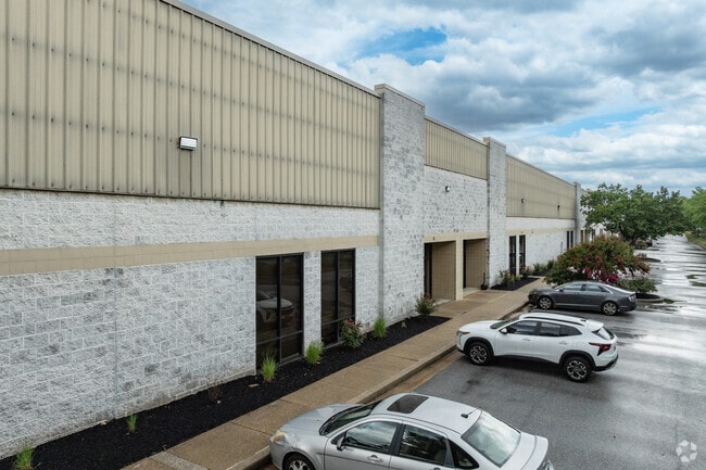
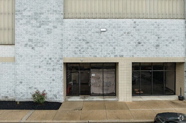
Property Record
9015 Junction Dr, Annapolis Junction, MD 20701

Property Detail
9015 Junction Dr
06-490107
PAR G-1 6.2672 A 9015 JUNCTION DR JCT INDUST PK S 1 AR 1
Distributionwarehouseregional
Howard
M2
Maryland
B and X Area of moderate flood hazard, usually the area between the limits of the 100-year and 500-year floods.
g 1
2024
6.26 AC
2025
Route 1 Corridor
606905
Baltimore
124,634 SF
Baltimore-Columbia-Towson, MD
NEARBY LISTINGS FOR SALE OR LEASE
DEMOGRAPHICS near 9015 Junction Dr
1 mile
3 mile
5 mile
2024 Total Population
2,407
64,187
191,931
2029 Population
2,403
65,468
195,096
Pop Growth 2024-2029
(0.17%)
+ 2.00%
+ 1.65%
Average Age
39
37
37
2024 Total Households
935
22,899
70,181
HH Growth 2024-2029
(0.11%)
+ 1.78%
+ 1.57%
Median Household Inc
$123,724
$108,231
$110,875
Avg Household Size
2.50
2.70
2.60
2024 Avg HH Vehicles
2.00
2.00
2.00
Median Home Value
$454,975
$425,443
$445,155
Median Year Built
1993
1992
1989
Nearby Places
Map Layers
Map Styles
 Street
 Aerial
Transit
 Traffic
 Biking
Places
Listings with unknown addresses are not visible on the map
- Restaurants
- Banks
- Shops
- Fitness
- Groceries
PUBLIC TRANSPORTATION
TRANSIT/SUBWAY
Savage (Camden Line - Maryland Area Regional Commuter Trains (The MARC))
Drive
Walk
Distance
Savage (Camden Line - Maryland Area Regional Commuter Trains (The MARC))
4 min
13 min
0.7 mi
COMMUTER RAIL
Savage (Camden Line - Maryland Area Regional Commuter Trains (The MARC))
Drive
Walk
Distance
Savage (Camden Line - Maryland Area Regional Commuter Trains (The MARC))
4 min
13 min
0.7 mi
Drive
Walk
Distance
11 min
3.5 mi
AIRPORT
Baltimore/Washington International Thurgood Marshall
Drive
Walk
Distance
Baltimore/Washington International Thurgood Marshall
21 min
12.2 mi
Ronald Reagan Washington Ntl
Drive
Walk
Distance
Ronald Reagan Washington Ntl
47 min
28.9 mi
Washington Dulles International
Drive
Walk
Distance
Washington Dulles International
73 min
48.8 mi
Freight Ports
Port of Baltimore
Drive
Walk
Distance
Port of Baltimore
29 min
18.9 mi
SALE & LEASE HISTORY
LISTING DATE
SALE/LEASE

Sep 24, 2016
For Lease
Nov 05, 2020
For Lease
Mar 23, 2022
For Lease
Mar 06, 2025
For Lease
Jan 30, 2019
For Lease
Feb 26, 2020
For Lease
Nearby Properties
Address
Land Use
TOTAL SIZE
Lot Size
Zoning
Address
Land Use
TOTAL SIZE
Lot Size
Zoning
8,192 SF
13,053.34 AC
R1
Address
Land Use
TOTAL SIZE
Lot Size
Zoning
594.68 AC
R1
Address
Land Use
TOTAL SIZE
Lot Size
Zoning
238,700 SF
7.43 AC
TOD
Address
Land Use
TOTAL SIZE
Lot Size
Zoning
853,520 SF
47.33 AC
M2
Address
Land Use
TOTAL SIZE
Lot Size
Zoning
500,970 SF
18.88 AC
MXD-E
Address
Land Use
TOTAL SIZE
Lot Size
Zoning
796,368 SF
11.80 AC
R5
Address
Land Use
TOTAL SIZE
Lot Size
Zoning
279,320 SF
15.25 AC
R15
Address
Land Use
TOTAL SIZE
Lot Size
Zoning
376,918 SF
8.55 AC
W1
Address
Land Use
TOTAL SIZE
Lot Size
Zoning
261,969 SF
12.13 AC
R5R10
Address
Land Use
TOTAL SIZE
Lot Size
Zoning
295,684 SF
33.25 AC
RSCMX
Address
Land Use
TOTAL SIZE
Lot Size
Zoning
14.84 AC
R-15
Address
Land Use
TOTAL SIZE
Lot Size
Zoning
234,264 SF
5.03 AC
W1
Address
Land Use
TOTAL SIZE
Lot Size
Zoning
192,703 SF
6.67 AC
W-1
Address
Land Use
TOTAL SIZE
Lot Size
Zoning
551,529 SF
9.52 AC
W1
Address
Land Use
TOTAL SIZE
Lot Size
Zoning
539,758 SF
48.32 AC
M1
Address
Land Use
TOTAL SIZE
Lot Size
Zoning
161,528 SF
10.86 AC
W1
Address
Land Use
TOTAL SIZE
Lot Size
Zoning
16,016 SF
19.95 AC
RA15
Address
Land Use
TOTAL SIZE
Lot Size
Zoning
12,936 SF
19.50 AC
RA15
Address
Land Use
TOTAL SIZE
Lot Size
Zoning
164,448 SF
3.87 AC
W1
Address
Land Use
TOTAL SIZE
Lot Size
Zoning
364,609 SF
8.57 AC
R22
Address
Land Use
TOTAL SIZE
Lot Size
Zoning
126,960 SF
13.72 AC
MXDR
Address
Land Use
TOTAL SIZE
Lot Size
Zoning
418,818 SF
48.07 AC
C3
Address
Land Use
TOTAL SIZE
Lot Size
Zoning
291,250 SF
30.09 AC
CECLI
Address
Land Use
TOTAL SIZE
Lot Size
Zoning
149,990 SF
10.41 AC
PEC
Address
Land Use
TOTAL SIZE
Lot Size
Zoning
149,990 SF
9.70 AC
PEC
Address
Land Use
TOTAL SIZE
Lot Size
Zoning
6,201 SF
71.87 AC
M 2
Address
Land Use
TOTAL SIZE
Lot Size
Zoning
304,575 SF
33.71 AC
TOD
Address
Land Use
TOTAL SIZE
Lot Size
Zoning
162,729 SF
10.18 AC
W1
Address
Land Use
TOTAL SIZE
Lot Size
Zoning
125,480 SF
11.30 AC
W1
Address
Land Use
TOTAL SIZE
Lot Size
Zoning
135,000 SF
11.69 AC
W1
The World's #1 Commercial Real Estate Marketplace
Connect with us
© 2026 CoStar Group
The information above has been obtained from sources believed reliable. While we do not doubt its accuracy we have not verified it and make no guarantee, warranty or representation about it. It is your responsibility to independently confirm its accuracy and completeness. Any projections, opinions, assumptions, or estimates used are for example only and do not represent the current or future performance of the property. The value of this transaction to you depends on tax and other factors which should be evaluated by your tax, financial, and legal advisors. You and your advisors should conduct a careful, independent investigation of the property to determine to your satisfaction the suitability of the property for your needs.