Property Record
9040 Independence Pkwy, Plano, TX 75025
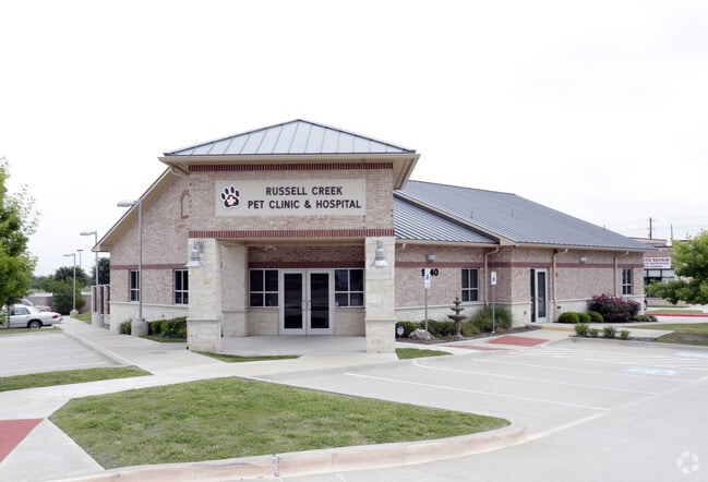


Property Detail
9040 Independence Pkwy
Dallas-Fort Worth-Arlington, TX
MCDERMOTT SQUARE, BLK A, LOT 7
R-8683-00A-0070-1
COLLIN
Officebuilding
Texas
B and X Area of moderate flood hazard, usually the area between the limits of the 100-year and 500-year floods.
7
2025
0.65 AC
2025
Central Plano
031666
Dallas/Ft Worth
4,500 SF
NEARBY LISTINGS FOR SALE OR LEASE
DEMOGRAPHICS near 9040 Independence Pkwy
1 mile
3 mile
5 mile
2025 Total Population
20,291
148,970
380,101
2030 Population
22,856
168,668
433,141
Pop Growth 2025-2030
+ 12.64%
+ 13.22%
+ 13.95%
Average Age
38
39
38
2025 Total Households
6,757
51,177
143,437
HH Growth 2025-2030
+ 12.83%
+ 13.44%
+ 14.25%
Median Household Inc
$145,113
$152,541
$124,293
Avg Household Size
2.90
2.90
2.60
2025 Avg HH Vehicles
2.00
2.00
2.00
Median Home Value
$504,198
$596,344
$576,591
Median Year Built
1997
1998
2001
Nearby Places
Map Layers
Map Styles
 Street
 Aerial
Transit
 Traffic
 Biking
Places
Listings with unknown addresses are not visible on the map
- Restaurants
- Banks
- Shops
- Fitness
- Groceries
PUBLIC TRANSPORTATION
AIRPORT
Dallas Love Field
Drive
Walk
Distance
Dallas Love Field
36 min
26.5 mi
Dallas-Fort Worth International
Drive
Walk
Distance
Dallas-Fort Worth International
33 min
27.3 mi
Nearby Properties
Address
Land Use
TOTAL SIZE
Lot Size
Zoning
Address
Land Use
TOTAL SIZE
Lot Size
Zoning
766,124 SF
62.04 AC
Address
Land Use
TOTAL SIZE
Lot Size
Zoning
649,703 SF
31.92 AC
MF
Address
Land Use
TOTAL SIZE
Lot Size
Zoning
535,339 SF
54.76 AC
Address
Land Use
TOTAL SIZE
Lot Size
Zoning
511,762 SF
28.81 AC
Address
Land Use
TOTAL SIZE
Lot Size
Zoning
419,994 SF
19.83 AC
MF-M
Address
Land Use
TOTAL SIZE
Lot Size
Zoning
442,484 SF
APTS
Address
Land Use
TOTAL SIZE
Lot Size
Zoning
584,548 SF
33.76 AC
MF
Address
Land Use
TOTAL SIZE
Lot Size
Zoning
529,149 SF
9.21 AC
MF-E
Address
Land Use
TOTAL SIZE
Lot Size
Zoning
537,872 SF
36.28 AC
MF
Address
Land Use
TOTAL SIZE
Lot Size
Zoning
442,184 SF
11.65 AC
MF-E
Address
Land Use
TOTAL SIZE
Lot Size
Zoning
393,074 SF
24.03 AC
MFM
Address
Land Use
TOTAL SIZE
Lot Size
Zoning
294,229 SF
32.11 AC
Address
Land Use
TOTAL SIZE
Lot Size
Zoning
495,663 SF
8.68 AC
COMM
Address
Land Use
TOTAL SIZE
Lot Size
Zoning
467,134 SF
24.13 AC
MF-M
Address
Land Use
TOTAL SIZE
Lot Size
Zoning
471,114 SF
26.05 AC
MF-M
Address
Land Use
TOTAL SIZE
Lot Size
Zoning
375,944 SF
5.88 AC
MF-E
Address
Land Use
TOTAL SIZE
Lot Size
Zoning
508,028 SF
14.61 AC
Address
Land Use
TOTAL SIZE
Lot Size
Zoning
373,261 SF
5.55 AC
Address
Land Use
TOTAL SIZE
Lot Size
Zoning
390,948 SF
21.95 AC
MF-M
Address
Land Use
TOTAL SIZE
Lot Size
Zoning
443,704 SF
18.87 AC
MFM
Address
Land Use
TOTAL SIZE
Lot Size
Zoning
424,266 SF
13.72 AC
MF-M
Address
Land Use
TOTAL SIZE
Lot Size
Zoning
408,042 SF
18.47 AC
MF-M
Address
Land Use
TOTAL SIZE
Lot Size
Zoning
365,341 SF
15.26 AC
MF-M
Address
Land Use
TOTAL SIZE
Lot Size
Zoning
389,334 SF
4.72 AC
MF-E
Address
Land Use
TOTAL SIZE
Lot Size
Zoning
337,052 SF
5.33 AC
PD
Address
Land Use
TOTAL SIZE
Lot Size
Zoning
334,313 SF
22.10 AC
Address
Land Use
TOTAL SIZE
Lot Size
Zoning
173,823 SF
19.77 AC
Address
Land Use
TOTAL SIZE
Lot Size
Zoning
283,040 SF
16 AC
MF-M
Address
Land Use
TOTAL SIZE
Lot Size
Zoning
332,500 SF
22.99 AC
MF-M
Address
Land Use
TOTAL SIZE
Lot Size
Zoning
260,679 SF
18.05 AC
MF-L
The World's #1 Commercial Real Estate Marketplace
Connect with us
© 2026 CoStar Group
The information above has been obtained from sources believed reliable. While we do not doubt its accuracy we have not verified it and make no guarantee, warranty or representation about it. It is your responsibility to independently confirm its accuracy and completeness. Any projections, opinions, assumptions, or estimates used are for example only and do not represent the current or future performance of the property. The value of this transaction to you depends on tax and other factors which should be evaluated by your tax, financial, and legal advisors. You and your advisors should conduct a careful, independent investigation of the property to determine to your satisfaction the suitability of the property for your needs.