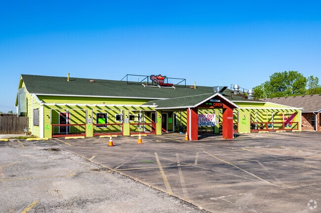
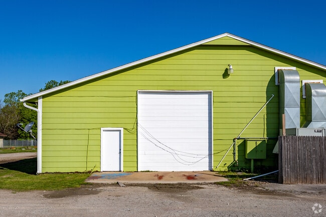
Property Record
9050 E E 93 Ct S Ba Ct S, Broken Arrow, OK 74014

Property Detail
9050 E E 93 Ct S Ba Ct S
Tulsa, OK
DUKE'S COUNTRY SUB PT L-1 BLK 1 DESC AS:BEG AT MOST ERLY COR L-1 S 67 DEG 10'43" W:ALNG SERLY LN SD L-1 A DIS OF 318.41'-N 42
730007284
WAGONER
Commercialacreage
Oklahoma
B and X Area of moderate flood hazard, usually the area between the limits of the 100-year and 500-year floods.
1
2025
1.29 AC
2025
Wagoner County
030508
Tulsa
6,000 SF
NEARBY LISTINGS FOR SALE OR LEASE
DEMOGRAPHICS near 9050 E E 93 Ct S Ba Ct S
1 mile
3 mile
5 mile
2025 Total Population
790
28,485
102,471
2030 Population
863
30,768
108,307
Pop Growth 2025-2030
+ 9.24%
+ 8.01%
+ 5.70%
Average Age
40
40
39
2025 Total Households
290
10,430
38,842
HH Growth 2025-2030
+ 8.62%
+ 7.68%
+ 5.53%
Median Household Inc
$76,961
$91,263
$83,570
Avg Household Size
2.70
2.70
2.60
2025 Avg HH Vehicles
2.00
2.00
2.00
Median Home Value
$218,095
$274,462
$251,609
Median Year Built
1982
1991
1992
Nearby Places
Map Layers
Map Styles
 Street
 Aerial
Layers
 Traffic
 Biking
Places
Listings with unknown addresses are not visible on the map
- Restaurants
- Banks
- Shops
- Fitness
- Groceries
PUBLIC TRANSPORTATION
AIRPORT
Tulsa International
Drive
Walk
Distance
Tulsa International
27 min
19.5 mi
Freight Ports
Drive
Walk
Distance
27 min
15.4 mi
SALE & LEASE HISTORY
LISTING DATE
SALE/LEASE

Dec 13, 2017
For Sale
Nearby Properties
Address
Land Use
TOTAL SIZE
Lot Size
Zoning
Address
Land Use
TOTAL SIZE
Lot Size
Zoning
75,444 SF
23.92 AC
R1
Address
Land Use
TOTAL SIZE
Lot Size
Zoning
39,733 SF
9.36 AC
A1
Address
Land Use
TOTAL SIZE
Lot Size
Zoning
11,601 SF
38.18 AC
RS1
Address
Land Use
TOTAL SIZE
Lot Size
Zoning
13,691 SF
2.04 AC
CH
Address
Land Use
TOTAL SIZE
Lot Size
Zoning
10,140 SF
18.57 AC
R1
Address
Land Use
TOTAL SIZE
Lot Size
Zoning
23,283 SF
3.94 AC
A1
Address
Land Use
TOTAL SIZE
Lot Size
Zoning
11,800 SF
2.45 AC
A1
Address
Land Use
TOTAL SIZE
Lot Size
Zoning
12,497 SF
3.31 AC
R1
Address
Land Use
TOTAL SIZE
Lot Size
Zoning
27,477 SF
5.79 AC
R1
Address
Land Use
TOTAL SIZE
Lot Size
Zoning
255,328 SF
27.50 AC
IL
Address
Land Use
TOTAL SIZE
Lot Size
Zoning
11,100 SF
5.30 AC
R1
Address
Land Use
TOTAL SIZE
Lot Size
Zoning
Address
Land Use
TOTAL SIZE
Lot Size
Zoning
16,623 SF
4.28 AC
R2
Address
Land Use
TOTAL SIZE
Lot Size
Zoning
145,261 SF
14.09 AC
CH
Address
Land Use
TOTAL SIZE
Lot Size
Zoning
5,920 SF
10.77 AC
Address
Land Use
TOTAL SIZE
Lot Size
Zoning
99,288 SF
6.43 AC
RM
Address
Land Use
TOTAL SIZE
Lot Size
Zoning
18,820 SF
13.42 AC
Address
Land Use
TOTAL SIZE
Lot Size
Zoning
7,200 SF
24.37 AC
Address
Land Use
TOTAL SIZE
Lot Size
Zoning
8,274 SF
4.66 AC
R3
Address
Land Use
TOTAL SIZE
Lot Size
Zoning
20,224 SF
4.93 AC
CN
Address
Land Use
TOTAL SIZE
Lot Size
Zoning
183,055 SF
35.44 AC
IL
Address
Land Use
TOTAL SIZE
Lot Size
Zoning
40,560 SF
14.96 AC
Address
Land Use
TOTAL SIZE
Lot Size
Zoning
14,625 SF
42.36 AC
Address
Land Use
TOTAL SIZE
Lot Size
Zoning
14,090 SF
4.98 AC
NCU
Address
Land Use
TOTAL SIZE
Lot Size
Zoning
9,561 SF
2.83 AC
R1
Address
Land Use
TOTAL SIZE
Lot Size
Zoning
11.34 AC
A1
Address
Land Use
TOTAL SIZE
Lot Size
Zoning
38,658 SF
7.62 AC
CH
Address
Land Use
TOTAL SIZE
Lot Size
Zoning
5,738 SF
1.72 AC
CH
Address
Land Use
TOTAL SIZE
Lot Size
Zoning
50,325 SF
4.46 AC
CH
The World's #1 Commercial Real Estate Marketplace
Connect with us
© 2026 CoStar Group
The information above has been obtained from sources believed reliable. While we do not doubt its accuracy we have not verified it and make no guarantee, warranty or representation about it. It is your responsibility to independently confirm its accuracy and completeness. Any projections, opinions, assumptions, or estimates used are for example only and do not represent the current or future performance of the property. The value of this transaction to you depends on tax and other factors which should be evaluated by your tax, financial, and legal advisors. You and your advisors should conduct a careful, independent investigation of the property to determine to your satisfaction the suitability of the property for your needs.