Property Record
9100 Rothbury Dr, Montgomery Village, MD 20886


NEARBY LISTINGS FOR SALE OR LEASE
Property Detail
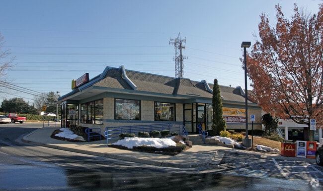
9100 Rothbury Dr
09-03779446
Partridge Place Montg Vill
Storebuilding
PAR C-2 PARTRIDGE P OWNERSHIP PAR
X
Montgomery
24031C0187D
Maryland
2024
0.58 AC
2025
Gaithersburg
700811
Washington, DC
3,125 SF
Washington-Arlington-Alexandria, DC-VA-MD-WV
DEMOGRAPHICS near 9100 Rothbury Dr
1 Mile
3 Mile
5 Mile
2024 Total Population
18,292
101,721
233,313
2029 Population
18,047
100,302
230,360
Pop Growth 2024-2029
(1.34%)
(1.39%)
(1.27%)
Average Age
39
39
38
2024 Total Households
5,829
34,096
81,144
HH Growth 2024-2029
(1.58%)
(1.45%)
(1.37%)
Median Household Inc
$97,488
$93,634
$99,311
Avg Household Size
3.00
2.90
2.80
2024 Avg HH Vehicles
2.00
2.00
2.00
Median Home Value
$365,938
$384,243
$422,209
Median Year Built
1982
1984
1985
Nearby Places
Map Layers
Map Styles
 Street
 Aerial
- Restaurants
- Banks
- Shops
- Fitness
- Groceries
PUBLIC TRANSPORTATION
COMMUTER RAIL
DRIVE
WALK
Distance
8 min
3.3 mi
DRIVE
WALK
Distance
8 min
3.3 mi
AIRPORT
Ronald Reagan Washington Ntl
DRIVE
WALK
Distance
Ronald Reagan Washington Ntl
52 min
29.8 mi
Washington Dulles International
DRIVE
WALK
Distance
Washington Dulles International
57 min
36.1 mi
Baltimore/Washington International Thurgood Marshall
DRIVE
WALK
Distance
Baltimore/Washington International Thurgood Marshall
58 min
42.6 mi
Freight Ports
Port of Baltimore
DRIVE
WALK
Distance
Port of Baltimore
62 min
45.2 mi
Nearby Properties
Address
Land Use
TOTAL SIZE
Lot Size
Zoning
Address
Land Use
TOTAL SIZE
Lot Size
Zoning
317,233 SF
18.26 AC
LSC2.
Address
Land Use
TOTAL SIZE
Lot Size
Zoning
298,220 SF
38.37 AC
I3
Address
Land Use
TOTAL SIZE
Lot Size
Zoning
912,992 SF
6.11 AC
CBD
Address
Land Use
TOTAL SIZE
Lot Size
Zoning
754,379 SF
28.29 AC
R90
Address
Land Use
TOTAL SIZE
Lot Size
Zoning
185,040 SF
49.79 AC
IL1.0
Address
Land Use
TOTAL SIZE
Lot Size
Zoning
323,940 SF
17.92 AC
R30
Address
Land Use
TOTAL SIZE
Lot Size
Zoning
565,209 SF
6.53 AC
MXD
Address
Land Use
TOTAL SIZE
Lot Size
Zoning
207,587 SF
16.41 AC
CD
Address
Land Use
TOTAL SIZE
Lot Size
Zoning
407,972 SF
44.95 AC
IL1.0
Address
Land Use
TOTAL SIZE
Lot Size
Zoning
3.03 AC
MXD
Address
Land Use
TOTAL SIZE
Lot Size
Zoning
55,943 SF
31.86 AC
I1
Address
Land Use
TOTAL SIZE
Lot Size
Zoning
128,884 SF
5.20 AC
CBD
Address
Land Use
TOTAL SIZE
Lot Size
Zoning
467,896 SF
14.08 AC
R90
Address
Land Use
TOTAL SIZE
Lot Size
Zoning
17 AC
R18
Address
Land Use
TOTAL SIZE
Lot Size
Zoning
265,447 SF
13.43 AC
CRT1.
Address
Land Use
TOTAL SIZE
Lot Size
Zoning
265,447 SF
12.33 AC
CRN0.
Address
Land Use
TOTAL SIZE
Lot Size
Zoning
273,491 SF
16.47 AC
CRN0.
Address
Land Use
TOTAL SIZE
Lot Size
Zoning
119,858 SF
43.30 AC
RE1
Address
Land Use
TOTAL SIZE
Lot Size
Zoning
195,196 SF
8.72 AC
R20
Address
Land Use
TOTAL SIZE
Lot Size
Zoning
158,000 SF
6.22 AC
R10
Address
Land Use
TOTAL SIZE
Lot Size
Zoning
87,060 SF
23.44 AC
R200
Address
Land Use
TOTAL SIZE
Lot Size
Zoning
1,343 SF
8.11 AC
R30
Address
Land Use
TOTAL SIZE
Lot Size
Zoning
195,380 SF
10.95 AC
R18
Address
Land Use
TOTAL SIZE
Lot Size
Zoning
141,615 SF
15.13 AC
R200
Address
Land Use
TOTAL SIZE
Lot Size
Zoning
132,259 SF
41.20 AC
RA
Address
Land Use
TOTAL SIZE
Lot Size
Zoning
200,000 SF
0.79 AC
I3
Address
Land Use
TOTAL SIZE
Lot Size
Zoning
203,214 SF
17.63 AC
R30
Address
Land Use
TOTAL SIZE
Lot Size
Zoning
318,065 SF
10.83 AC
CBD
Address
Land Use
TOTAL SIZE
Lot Size
Zoning
122,557 SF
9.46 AC
CRT1.
Address
Land Use
TOTAL SIZE
Lot Size
Zoning
197,400 SF
9.73 AC
MXD
The World's #1 Commercial Real Estate Marketplace
Connect with us
© 2026 CoStar Group
The information above has been obtained from sources believed reliable. While we do not doubt its accuracy we have not verified it and make no guarantee, warranty or representation about it. It is your responsibility to independently confirm its accuracy and completeness. Any projections, opinions, assumptions, or estimates used are for example only and do not represent the current or future performance of the property. The value of this transaction to you depends on tax and other factors which should be evaluated by your tax, financial, and legal advisors. You and your advisors should conduct a careful, independent investigation of the property to determine to your satisfaction the suitability of the property for your needs.