Property Record
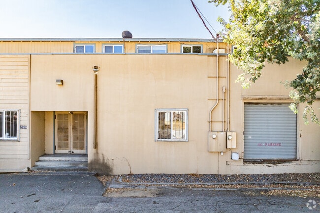
9101 Graton Rd, Graton, CA 95444


Property Detail
9101 Graton Rd
130-154-005
91 FM 130-154-03 & PT TO RD 90022291
Lightindustrial
SONOMA
M1
California
B and X Area of moderate flood hazard, usually the area between the limits of the 100-year and 500-year floods.
1.14 AC
2024
Sebastopol/Bodega
2025
North Bay/Santa Rosa
153601
Santa Rosa-Petaluma, CA
39,288 SF
NEARBY LISTINGS FOR SALE OR LEASE
DEMOGRAPHICS near 9101 Graton Rd
1 mile
3 mile
5 mile
2024 Total Population
1,817
9,651
24,439
2029 Population
1,733
9,154
23,254
Pop Growth 2024-2029
(4.62%)
(5.15%)
(4.85%)
Average Age
48
48
48
2024 Total Households
721
3,907
10,159
HH Growth 2024-2029
(4.72%)
(5.20%)
(4.82%)
Median Household Inc
$131,807
$113,668
$111,837
Avg Household Size
2.40
2.40
2.30
2024 Avg HH Vehicles
2.00
2.00
2.00
Median Home Value
$953,828
$960,330
$927,753
Median Year Built
1966
1971
1971
Nearby Places
Map Layers
Map Styles
 Street
 Aerial
Transit
 Traffic
 Biking
Places
Listings with unknown addresses are not visible on the map
- Restaurants
- Banks
- Shops
- Fitness
- Groceries
PUBLIC TRANSPORTATION
COMMUTER RAIL
Smart Santa Rosa North (Main Line - Sonoma Marin Area Rail Transit)
Drive
Walk
Distance
Smart Santa Rosa North (Main Line - Sonoma Marin Area Rail Transit)
16 min
8.3 mi
AIRPORT
Charles M Schulz - Sonoma County
Drive
Walk
Distance
Charles M Schulz - Sonoma County
24 min
12.4 mi
Freight Ports
Port of Richmond
Drive
Walk
Distance
Port of Richmond
72 min
53.0 mi
Nearby Properties
Address
Land Use
TOTAL SIZE
Lot Size
Zoning
Address
Land Use
TOTAL SIZE
Lot Size
Zoning
90,449 SF
12.51 AC
DA20
Address
Land Use
TOTAL SIZE
Lot Size
Zoning
11,827 SF
19.16 AC
DA20
Address
Land Use
TOTAL SIZE
Lot Size
Zoning
89,970 SF
7.32 AC
Address
Land Use
TOTAL SIZE
Lot Size
Zoning
14,962 SF
20.02 AC
Address
Land Use
TOTAL SIZE
Lot Size
Zoning
26,734 SF
9.55 AC
Address
Land Use
TOTAL SIZE
Lot Size
Zoning
9.97 AC
Address
Land Use
TOTAL SIZE
Lot Size
Zoning
9,127 SF
262.94 AC
LEAB7FRZN
Address
Land Use
TOTAL SIZE
Lot Size
Zoning
276,623 SF
76.04 AC
Address
Land Use
TOTAL SIZE
Lot Size
Zoning
5,988 SF
20.11 AC
Address
Land Use
TOTAL SIZE
Lot Size
Zoning
29,861 SF
4 AC
Address
Land Use
TOTAL SIZE
Lot Size
Zoning
43.67 AC
Address
Land Use
TOTAL SIZE
Lot Size
Zoning
18.05 AC
DA40
Address
Land Use
TOTAL SIZE
Lot Size
Zoning
70,673 SF
3.50 AC
Address
Land Use
TOTAL SIZE
Lot Size
Zoning
84,504 SF
8.55 AC
LCF2
Address
Land Use
TOTAL SIZE
Lot Size
Zoning
7,720 SF
56.30 AC
DA20
Address
Land Use
TOTAL SIZE
Lot Size
Zoning
43,968 SF
9.67 AC
Address
Land Use
TOTAL SIZE
Lot Size
Zoning
11,337 SF
55.57 AC
DA20
Address
Land Use
TOTAL SIZE
Lot Size
Zoning
10,082 SF
17.42 AC
DA10
Address
Land Use
TOTAL SIZE
Lot Size
Zoning
6,356 SF
10.61 AC
Address
Land Use
TOTAL SIZE
Lot Size
Zoning
68,313 SF
20.47 AC
DA10
Address
Land Use
TOTAL SIZE
Lot Size
Zoning
26,764 SF
20.31 AC
DA10
Address
Land Use
TOTAL SIZE
Lot Size
Zoning
33,446 SF
0.86 AC
Address
Land Use
TOTAL SIZE
Lot Size
Zoning
45.26 AC
Address
Land Use
TOTAL SIZE
Lot Size
Zoning
7,515 SF
11.70 AC
Address
Land Use
TOTAL SIZE
Lot Size
Zoning
22,281 SF
167.10 AC
DA20
Address
Land Use
TOTAL SIZE
Lot Size
Zoning
80.14 AC
LEA60
Address
Land Use
TOTAL SIZE
Lot Size
Zoning
251.91 AC
Address
Land Use
TOTAL SIZE
Lot Size
Zoning
4,603 SF
12.15 AC
DA10
Address
Land Use
TOTAL SIZE
Lot Size
Zoning
12,840 SF
0.77 AC
CITYSE
The World's #1 Commercial Real Estate Marketplace
Connect with us
© 2026 CoStar Group
The information above has been obtained from sources believed reliable. While we do not doubt its accuracy we have not verified it and make no guarantee, warranty or representation about it. It is your responsibility to independently confirm its accuracy and completeness. Any projections, opinions, assumptions, or estimates used are for example only and do not represent the current or future performance of the property. The value of this transaction to you depends on tax and other factors which should be evaluated by your tax, financial, and legal advisors. You and your advisors should conduct a careful, independent investigation of the property to determine to your satisfaction the suitability of the property for your needs.