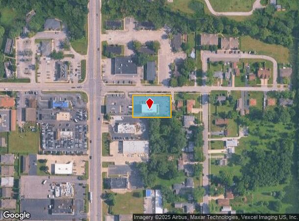
Property Record
2426 Martha St, Highland, IN 46322

Current Lease Availabilities
NEARBY LISTINGS FOR SALE OR LEASE
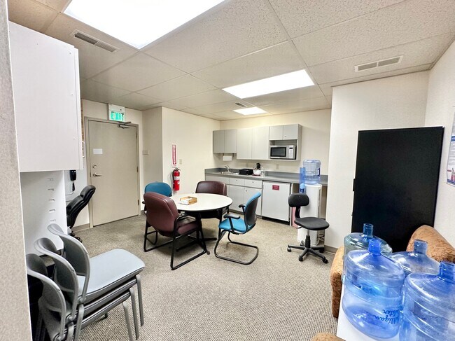
Property Detail
2426 Martha St
Chicago-Naperville-Elgin, IL-IN-WI
Schuyler Square
45-07-28-151-002.000-026
SCHUYLER SQUARE SOUTH LOT 2
Officebuilding
Lake
AE
Indiana
18089C0136F
2
2023
0.69 AC
2024
Indiana
040501
Chicago
13,074 SF
DEMOGRAPHICS near 2426 Martha St
1 Mile
3 Mile
5 Mile
2024 Total Population
11,245
82,239
197,966
2029 Population
11,090
81,484
196,225
Pop Growth 2024-2029
(1.38%)
(0.92%)
(0.88%)
Average Age
42
41
41
2024 Total Households
4,884
33,241
78,152
HH Growth 2024-2029
(1.43%)
(0.95%)
(0.96%)
Median Household Inc
$74,386
$71,277
$64,162
Avg Household Size
2.30
2.40
2.50
2024 Avg HH Vehicles
2.00
2.00
2.00
Median Home Value
$216,237
$209,366
$184,757
Median Year Built
1967
1965
1965
Nearby Places
Map Layers
Map Styles
 Street
 Aerial
- Restaurants
- Banks
- Shops
- Fitness
- Groceries
PUBLIC TRANSPORTATION
COMMUTER RAIL
Dyer Amtrak (Cardinal - Amtrak)
DRIVE
WALK
Distance
Dyer Amtrak (Cardinal - Amtrak)
11 min
4.6 mi
AIRPORT
Chicago Midway International
DRIVE
WALK
Distance
Chicago Midway International
45 min
29.3 mi
Freight Ports
Port Milwaukee
DRIVE
WALK
Distance
Port Milwaukee
148 min
115.8 mi
Nearby Properties
Address
Land Use
TOTAL SIZE
Lot Size
Zoning
Address
Land Use
TOTAL SIZE
Lot Size
Zoning
879,191 SF
13.93 AC
Address
Land Use
TOTAL SIZE
Lot Size
Zoning
308,022 SF
31.99 AC
R33
Address
Land Use
TOTAL SIZE
Lot Size
Zoning
168,766 SF
19.16 AC
Address
Land Use
TOTAL SIZE
Lot Size
Zoning
296,588 SF
36.83 AC
R33
Address
Land Use
TOTAL SIZE
Lot Size
Zoning
125,938 SF
12.86 AC
Address
Land Use
TOTAL SIZE
Lot Size
Zoning
350,110 SF
24.01 AC
R33
Address
Land Use
TOTAL SIZE
Lot Size
Zoning
454,750 SF
21.15 AC
Address
Land Use
TOTAL SIZE
Lot Size
Zoning
668,326 SF
28.87 AC
Address
Land Use
TOTAL SIZE
Lot Size
Zoning
130,558 SF
9.89 AC
R33
Address
Land Use
TOTAL SIZE
Lot Size
Zoning
190,457 SF
10.63 AC
Address
Land Use
TOTAL SIZE
Lot Size
Zoning
133,120 SF
32.04 AC
Address
Land Use
TOTAL SIZE
Lot Size
Zoning
394,442 SF
16.83 AC
Address
Land Use
TOTAL SIZE
Lot Size
Zoning
214,752 SF
10.41 AC
R3
Address
Land Use
TOTAL SIZE
Lot Size
Zoning
153,073 SF
4.88 AC
Address
Land Use
TOTAL SIZE
Lot Size
Zoning
97,046 SF
3.36 AC
Address
Land Use
TOTAL SIZE
Lot Size
Zoning
80,444 SF
13.41 AC
R3
Address
Land Use
TOTAL SIZE
Lot Size
Zoning
70,017 SF
11 AC
R33
Address
Land Use
TOTAL SIZE
Lot Size
Zoning
197,080 SF
R33
Address
Land Use
TOTAL SIZE
Lot Size
Zoning
77,091 SF
2.08 AC
Address
Land Use
TOTAL SIZE
Lot Size
Zoning
79,169 SF
2.76 AC
Address
Land Use
TOTAL SIZE
Lot Size
Zoning
140,360 SF
15 AC
R33
Address
Land Use
TOTAL SIZE
Lot Size
Zoning
135,617 SF
7.80 AC
Address
Land Use
TOTAL SIZE
Lot Size
Zoning
233,769 SF
29.04 AC
R3
Address
Land Use
TOTAL SIZE
Lot Size
Zoning
217,104 SF
10.45 AC
Address
Land Use
TOTAL SIZE
Lot Size
Zoning
251,700 SF
19.86 AC
Address
Land Use
TOTAL SIZE
Lot Size
Zoning
82,272 SF
12.55 AC
R3
Address
Land Use
TOTAL SIZE
Lot Size
Zoning
189,392 SF
23.77 AC
Address
Land Use
TOTAL SIZE
Lot Size
Zoning
87,166 SF
7.82 AC
Address
Land Use
TOTAL SIZE
Lot Size
Zoning
64,971 SF
6.98 AC
Address
Land Use
TOTAL SIZE
Lot Size
Zoning
119,059 SF
10.12 AC
R33
The World's #1 Commercial Real Estate Marketplace
Connect with us
© 2025 CoStar Group
The information above has been obtained from sources believed reliable. While we do not doubt its accuracy we have not verified it and make no guarantee, warranty or representation about it. It is your responsibility to independently confirm its accuracy and completeness. Any projections, opinions, assumptions, or estimates used are for example only and do not represent the current or future performance of the property. The value of this transaction to you depends on tax and other factors which should be evaluated by your tax, financial, and legal advisors. You and your advisors should conduct a careful, independent investigation of the property to determine to your satisfaction the suitability of the property for your needs.