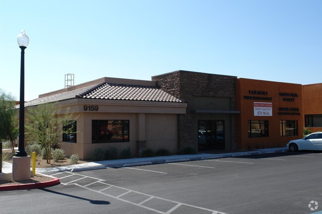
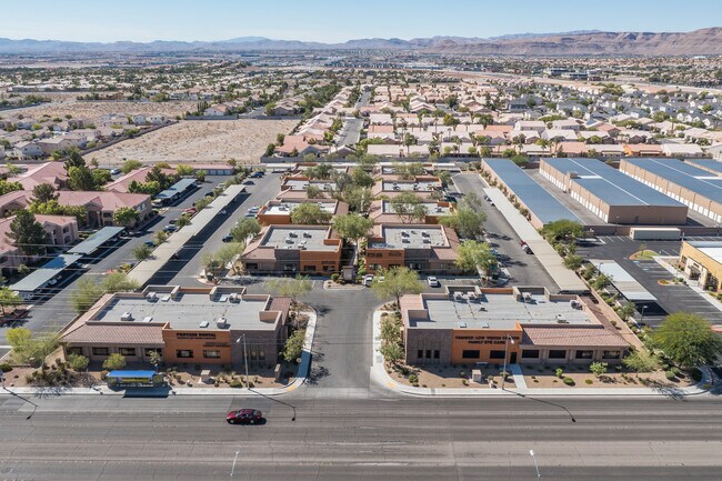
Property Record
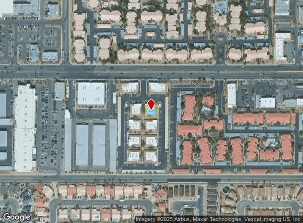
9159 W Flamingo Rd, Las Vegas, NV 89147

NEARBY LISTINGS FOR SALE OR LEASE
Property Detail
9159 W Flamingo Rd
Las Vegas-Henderson-Paradise, NV
Flamingo Trails Professional Plaza
163-20-117-005
FLAMINGO TRAILS PROFESSIONAL PLAZA PLAT BOOK 120 PAGE 14 PT LOT 1
Commercialnec
Clark
X
Nevada
32003C2535F
1
2025
0.14 AC
2025
Southwest Las Vegas
005849
Las Vegas
5,279 SF
DEMOGRAPHICS near 9159 W Flamingo Rd
1 Mile
3 Mile
5 Mile
2024 Total Population
24,711
173,700
361,466
2029 Population
26,517
186,761
388,794
Pop Growth 2024-2029
+ 7.31%
+ 7.52%
+ 7.56%
Average Age
40
41
41
2024 Total Households
9,704
70,280
145,786
HH Growth 2024-2029
+ 7.28%
+ 7.50%
+ 7.52%
Median Household Inc
$61,719
$71,544
$66,927
Avg Household Size
2.50
2.40
2.40
2024 Avg HH Vehicles
2.00
2.00
2.00
Median Home Value
$415,895
$416,427
$395,643
Median Year Built
1997
1998
1996
Nearby Places
Map Layers
Map Styles
 Street
 Aerial
- Restaurants
- Banks
- Shops
- Fitness
- Groceries
PUBLIC TRANSPORTATION
AIRPORT
Harry Reid International
DRIVE
WALK
Distance
Harry Reid International
19 min
14.1 mi
Boulder City Municipal
DRIVE
WALK
Distance
Boulder City Municipal
45 min
33.8 mi
SALE & LEASE HISTORY
LISTING DATE
SALE/LEASE

Oct 01, 2021
For Sale
Mar 28, 2019
For Lease
Mar 15, 2019
For Sale
Dec 10, 2018
For Lease
Apr 01, 2022
For Lease
Nearby Properties
Address
Land Use
TOTAL SIZE
Lot Size
Zoning
Address
Land Use
TOTAL SIZE
Lot Size
Zoning
190,129 SF
36.24 AC
C1
Address
Land Use
TOTAL SIZE
Lot Size
Zoning
174,108 SF
52.16 AC
RU
Address
Land Use
TOTAL SIZE
Lot Size
Zoning
466,224 SF
11.85 AC
C:C-2
Address
Land Use
TOTAL SIZE
Lot Size
Zoning
9,279 SF
24.36 AC
Address
Land Use
TOTAL SIZE
Lot Size
Zoning
40 AC
PF
Address
Land Use
TOTAL SIZE
Lot Size
Zoning
504,632 SF
6.25 AC
Address
Land Use
TOTAL SIZE
Lot Size
Zoning
4,542 SF
18.72 AC
Address
Land Use
TOTAL SIZE
Lot Size
Zoning
Address
Land Use
TOTAL SIZE
Lot Size
Zoning
401,023 SF
17.61 AC
R-3
Address
Land Use
TOTAL SIZE
Lot Size
Zoning
Address
Land Use
TOTAL SIZE
Lot Size
Zoning
Address
Land Use
TOTAL SIZE
Lot Size
Zoning
33.24 AC
C1
Address
Land Use
TOTAL SIZE
Lot Size
Zoning
4,446 SF
16.17 AC
Address
Land Use
TOTAL SIZE
Lot Size
Zoning
5,374 SF
12.36 AC
Address
Land Use
TOTAL SIZE
Lot Size
Zoning
43,264 SF
3.56 AC
Address
Land Use
TOTAL SIZE
Lot Size
Zoning
322,127 SF
9.32 AC
Address
Land Use
TOTAL SIZE
Lot Size
Zoning
4,382 SF
13.65 AC
C2
Address
Land Use
TOTAL SIZE
Lot Size
Zoning
485,241 SF
13.77 AC
R3
Address
Land Use
TOTAL SIZE
Lot Size
Zoning
11,942 SF
17.01 AC
R3
Address
Land Use
TOTAL SIZE
Lot Size
Zoning
21.17 AC
PF
Address
Land Use
TOTAL SIZE
Lot Size
Zoning
310,672 SF
8.84 AC
Address
Land Use
TOTAL SIZE
Lot Size
Zoning
220,053 SF
3.04 AC
Address
Land Use
TOTAL SIZE
Lot Size
Zoning
2,754 SF
17.17 AC
RPD20
Address
Land Use
TOTAL SIZE
Lot Size
Zoning
223,030 SF
18.11 AC
C1
Address
Land Use
TOTAL SIZE
Lot Size
Zoning
4,872 SF
18.22 AC
R3
Address
Land Use
TOTAL SIZE
Lot Size
Zoning
184,152 SF
12.49 AC
Address
Land Use
TOTAL SIZE
Lot Size
Zoning
18,686 SF
4.23 AC
RE
Address
Land Use
TOTAL SIZE
Lot Size
Zoning
4,718 SF
9.17 AC
R-4
Address
Land Use
TOTAL SIZE
Lot Size
Zoning
7,408 SF
10.99 AC
R4
The World's #1 Commercial Real Estate Marketplace
Connect with us
© 2025 CoStar Group
The information above has been obtained from sources believed reliable. While we do not doubt its accuracy we have not verified it and make no guarantee, warranty or representation about it. It is your responsibility to independently confirm its accuracy and completeness. Any projections, opinions, assumptions, or estimates used are for example only and do not represent the current or future performance of the property. The value of this transaction to you depends on tax and other factors which should be evaluated by your tax, financial, and legal advisors. You and your advisors should conduct a careful, independent investigation of the property to determine to your satisfaction the suitability of the property for your needs.