Property Record
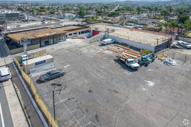
919 El Cajon Blvd, El Cajon, CA 92020


NEARBY LISTINGS FOR SALE OR LEASE
Property Detail
919 El Cajon Blvd
San Diego-Carlsbad, CA
Parcel Map No 11671
492-642-19
PAR 1 TR PM11671
Vehiclerentalsvehiclesales
San Diego
X
California
06073C1661G
1
2024
0.95 AC
2025
El Cajon
015902
San Diego
13,312 SF
DEMOGRAPHICS near 919 El Cajon Blvd
1 Mile
3 Mile
5 Mile
2024 Total Population
19,783
165,702
376,066
2029 Population
19,577
163,846
371,765
Pop Growth 2024-2029
(1.04%)
(1.12%)
(1.14%)
Average Age
38
39
39
2024 Total Households
6,527
58,591
133,180
HH Growth 2024-2029
(1.23%)
(1.30%)
(1.31%)
Median Household Inc
$73,993
$71,628
$80,715
Avg Household Size
2.90
2.70
2.70
2024 Avg HH Vehicles
2.00
2.00
2.00
Median Home Value
$706,450
$711,270
$691,143
Median Year Built
1966
1970
1973
Nearby Places
Map Layers
Map Styles
 Street
 Aerial
- Restaurants
- Banks
- Shops
- Fitness
- Groceries
PUBLIC TRANSPORTATION
TRANSIT/SUBWAY
El Cajon Transit Center (Green Line - San Diego Metropolitan Transit System Trolley (San Diego Trolley), Orange Line - San Diego Metropolitan Transit System Trolley (San Diego Trolley))
DRIVE
WALK
Distance
El Cajon Transit Center (Green Line - San Diego Metropolitan Transit System Trolley (San Diego Trolley), Orange Line - San Diego Metropolitan Transit System Trolley (San Diego Trolley))
2 min
13 min
0.7 mi
El Cajon Station (Santee - El Cajon - MTS)
DRIVE
WALK
Distance
El Cajon Station (Santee - El Cajon - MTS)
1 min
13 min
0.7 mi
AIRPORT
San Diego International
DRIVE
WALK
Distance
San Diego International
22 min
15.2 mi
Freight Ports
Port of San Diego
DRIVE
WALK
Distance
Port of San Diego
21 min
14.0 mi
Nearby Properties
Address
Land Use
TOTAL SIZE
Lot Size
Zoning
Address
Land Use
TOTAL SIZE
Lot Size
Zoning
30.38 AC
RB
Address
Land Use
TOTAL SIZE
Lot Size
Zoning
62.04 AC
C
Address
Land Use
TOTAL SIZE
Lot Size
Zoning
6.79 AC
C
Address
Land Use
TOTAL SIZE
Lot Size
Zoning
4.77 AC
C
Address
Land Use
TOTAL SIZE
Lot Size
Zoning
6.84 AC
M
Address
Land Use
TOTAL SIZE
Lot Size
Zoning
8.24 AC
RU
Address
Land Use
TOTAL SIZE
Lot Size
Zoning
7.46 AC
RM-2200
Address
Land Use
TOTAL SIZE
Lot Size
Zoning
5.90 AC
RM-2200
Address
Land Use
TOTAL SIZE
Lot Size
Zoning
39.17 AC
C-R
Address
Land Use
TOTAL SIZE
Lot Size
Zoning
2.82 AC
R3
Address
Land Use
TOTAL SIZE
Lot Size
Zoning
8.82 AC
RM-2200
Address
Land Use
TOTAL SIZE
Lot Size
Zoning
4.10 AC
RB
Address
Land Use
TOTAL SIZE
Lot Size
Zoning
11.28 AC
C
Address
Land Use
TOTAL SIZE
Lot Size
Zoning
5.47 AC
R3
Address
Land Use
TOTAL SIZE
Lot Size
Zoning
13.48 AC
CC-1-3
Address
Land Use
TOTAL SIZE
Lot Size
Zoning
Address
Land Use
TOTAL SIZE
Lot Size
Zoning
5.83 AC
RM-2200
Address
Land Use
TOTAL SIZE
Lot Size
Zoning
92,988 SF
6.12 AC
RB
Address
Land Use
TOTAL SIZE
Lot Size
Zoning
9.38 AC
RU
Address
Land Use
TOTAL SIZE
Lot Size
Zoning
5.17 AC
R3
Address
Land Use
TOTAL SIZE
Lot Size
Zoning
5.77 AC
RM-2200
Address
Land Use
TOTAL SIZE
Lot Size
Zoning
64,900 SF
4.55 AC
RM-2200
Address
Land Use
TOTAL SIZE
Lot Size
Zoning
83,198 SF
5 AC
RM-2200
Address
Land Use
TOTAL SIZE
Lot Size
Zoning
6.72 AC
RM-3-7
Address
Land Use
TOTAL SIZE
Lot Size
Zoning
63,964 SF
5.25 AC
R3
Address
Land Use
TOTAL SIZE
Lot Size
Zoning
4.39 AC
RM-2200
Address
Land Use
TOTAL SIZE
Lot Size
Zoning
96,664 SF
1.63 AC
CIVIC CENT
Address
Land Use
TOTAL SIZE
Lot Size
Zoning
9.76 AC
C31
Address
Land Use
TOTAL SIZE
Lot Size
Zoning
4.69 AC
RU
Address
Land Use
TOTAL SIZE
Lot Size
Zoning
98,752 SF
4.10 AC
RU
The World's #1 Commercial Real Estate Marketplace
Connect with us
© 2025 CoStar Group
The information above has been obtained from sources believed reliable. While we do not doubt its accuracy we have not verified it and make no guarantee, warranty or representation about it. It is your responsibility to independently confirm its accuracy and completeness. Any projections, opinions, assumptions, or estimates used are for example only and do not represent the current or future performance of the property. The value of this transaction to you depends on tax and other factors which should be evaluated by your tax, financial, and legal advisors. You and your advisors should conduct a careful, independent investigation of the property to determine to your satisfaction the suitability of the property for your needs.