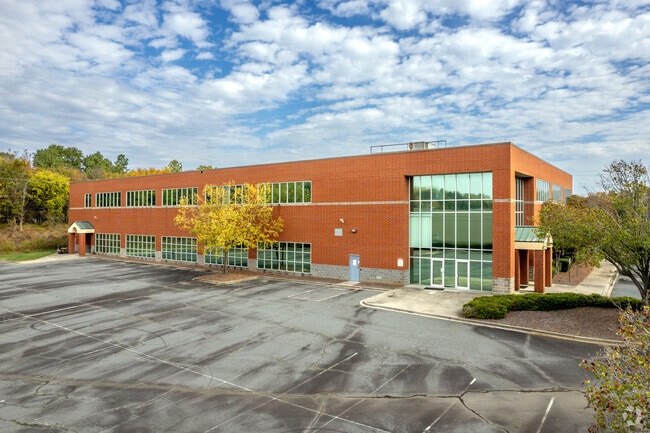
Property Record
9217 Forsyth Park Dr, Charlotte, NC 28273


NEARBY LISTINGS FOR SALE OR LEASE
Property Detail
9217 Forsyth Park Dr
Charlotte-Concord-Gastonia, NC-SC
Steele Crk Park Map 01
201-311-08
L7 M20-963 & L10 M20-964
Industrialgeneral
Mecklenburg
X
North Carolina
3710451100K
7
2024
4.40 AC
2025
State Line
005913
Charlotte
65,026 SF
DEMOGRAPHICS near 9217 Forsyth Park Dr
1 Mile
3 Mile
5 Mile
2024 Total Population
5,534
53,908
131,702
2029 Population
5,858
56,990
141,312
Pop Growth 2024-2029
+ 5.85%
+ 5.72%
+ 7.30%
Average Age
38
37
36
2024 Total Households
2,110
21,810
51,833
HH Growth 2024-2029
+ 5.97%
+ 5.70%
+ 7.29%
Median Household Inc
$71,891
$79,654
$75,896
Avg Household Size
2.40
2.40
2.50
2024 Avg HH Vehicles
2.00
2.00
2.00
Median Home Value
$245,470
$281,629
$302,177
Median Year Built
1993
2003
2001
Nearby Places
Map Layers
Map Styles
 Street
 Aerial
- Restaurants
- Banks
- Shops
- Fitness
- Groceries
PUBLIC TRANSPORTATION
AIRPORT
Charlotte/Douglas International
DRIVE
WALK
Distance
Charlotte/Douglas International
18 min
8.0 mi
Concord-Padgett Regional
DRIVE
WALK
Distance
Concord-Padgett Regional
40 min
30.3 mi
Freight Ports
North Charleston Terminal
DRIVE
WALK
Distance
North Charleston Terminal
219 min
192.4 mi
SALE & LEASE HISTORY
LISTING DATE
SALE/LEASE

Oct 19, 2020
For Sale
Dec 19, 2019
For Sale
Nearby Properties
Address
Land Use
TOTAL SIZE
Lot Size
Zoning
Address
Land Use
TOTAL SIZE
Lot Size
Zoning
459,020 SF
42 AC
R3
Address
Land Use
TOTAL SIZE
Lot Size
Zoning
1,255,063 SF
292.46 AC
I2
Address
Land Use
TOTAL SIZE
Lot Size
Zoning
393,779 SF
26.71 AC
R17MF
Address
Land Use
TOTAL SIZE
Lot Size
Zoning
315,386 SF
26.83 AC
MX1
Address
Land Use
TOTAL SIZE
Lot Size
Zoning
395,382 SF
9.84 AC
MUDDO
Address
Land Use
TOTAL SIZE
Lot Size
Zoning
298,298 SF
16.60 AC
R17MFCD
Address
Land Use
TOTAL SIZE
Lot Size
Zoning
399,178 SF
17.59 AC
Address
Land Use
TOTAL SIZE
Lot Size
Zoning
604,827 SF
41.01 AC
O1CD
Address
Land Use
TOTAL SIZE
Lot Size
Zoning
283,424 SF
24.95 AC
R17MFCD
Address
Land Use
TOTAL SIZE
Lot Size
Zoning
289,148 SF
17.12 AC
Address
Land Use
TOTAL SIZE
Lot Size
Zoning
292,097 SF
16.26 AC
CC
Address
Land Use
TOTAL SIZE
Lot Size
Zoning
293,943 SF
12.90 AC
Address
Land Use
TOTAL SIZE
Lot Size
Zoning
272,801 SF
12.90 AC
Address
Land Use
TOTAL SIZE
Lot Size
Zoning
280,293 SF
25.47 AC
R3
Address
Land Use
TOTAL SIZE
Lot Size
Zoning
250,307 SF
15.53 AC
R17MFCD
Address
Land Use
TOTAL SIZE
Lot Size
Zoning
329,369 SF
23.03 AC
Address
Land Use
TOTAL SIZE
Lot Size
Zoning
267,294 SF
16.43 AC
NS
Address
Land Use
TOTAL SIZE
Lot Size
Zoning
229,094 SF
7.29 AC
R3
Address
Land Use
TOTAL SIZE
Lot Size
Zoning
1,396,936 SF
68.78 AC
I2
Address
Land Use
TOTAL SIZE
Lot Size
Zoning
899,731 SF
73.49 AC
Address
Land Use
TOTAL SIZE
Lot Size
Zoning
136,576 SF
4.75 AC
Address
Land Use
TOTAL SIZE
Lot Size
Zoning
254,393 SF
12.48 AC
Address
Land Use
TOTAL SIZE
Lot Size
Zoning
334,858 SF
40.40 AC
I-2
Address
Land Use
TOTAL SIZE
Lot Size
Zoning
857,532 SF
73.57 AC
I1
Address
Land Use
TOTAL SIZE
Lot Size
Zoning
218,322 SF
15.93 AC
R17MFCD
Address
Land Use
TOTAL SIZE
Lot Size
Zoning
269,639 SF
15.32 AC
R17MFCD
Address
Land Use
TOTAL SIZE
Lot Size
Zoning
245,573 SF
23.62 AC
R12MFCD
Address
Land Use
TOTAL SIZE
Lot Size
Zoning
415,871 SF
66.17 AC
R3
Address
Land Use
TOTAL SIZE
Lot Size
Zoning
32.80 AC
MUDD-O
Address
Land Use
TOTAL SIZE
Lot Size
Zoning
254,214 SF
15.39 AC
The World's #1 Commercial Real Estate Marketplace
Connect with us
© 2025 CoStar Group
The information above has been obtained from sources believed reliable. While we do not doubt its accuracy we have not verified it and make no guarantee, warranty or representation about it. It is your responsibility to independently confirm its accuracy and completeness. Any projections, opinions, assumptions, or estimates used are for example only and do not represent the current or future performance of the property. The value of this transaction to you depends on tax and other factors which should be evaluated by your tax, financial, and legal advisors. You and your advisors should conduct a careful, independent investigation of the property to determine to your satisfaction the suitability of the property for your needs.