Property Record
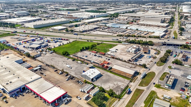
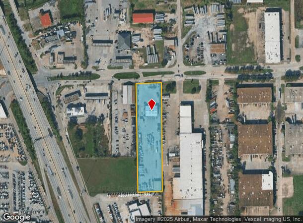
9222 Wallisville Rd, Houston, TX 77013
Current Lease Availabilities
NEARBY LISTINGS FOR SALE OR LEASE
Property Detail
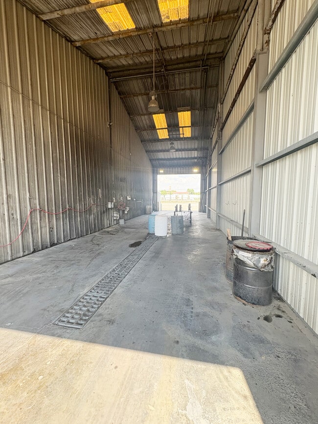
9222 Wallisville Rd
0410700010105
Abst 114 W M Black
Warehouse
TR 12C ABST 114 W M BLACK
X
Harris
48201C0695M
Texas
2024
2.90 AC
2025
Northeast I-10
232600
Houston
8,600 SF
Houston-The Woodlands-Sugar Land, TX
DEMOGRAPHICS near 9222 Wallisville Rd
1 Mile
3 Mile
5 Mile
2024 Total Population
1,490
55,097
216,159
2029 Population
1,515
56,659
222,822
Pop Growth 2024-2029
+ 1.68%
+ 2.84%
+ 3.08%
Average Age
39
37
37
2024 Total Households
458
18,004
72,005
HH Growth 2024-2029
+ 1.53%
+ 2.82%
+ 3.09%
Median Household Inc
$39,011
$37,600
$38,390
Avg Household Size
3.20
3.00
2.90
2024 Avg HH Vehicles
2.00
2.00
2.00
Median Home Value
$95,170
$105,395
$115,030
Median Year Built
1957
1963
1966
Nearby Places
- Restaurants
- Banks
- Shops
- Fitness
- Groceries
PUBLIC TRANSPORTATION
COMMUTER RAIL
Houston (Sunset Limited - Amtrak)
DRIVE
WALK
Distance
Houston (Sunset Limited - Amtrak)
12 min
7.5 mi
AIRPORT
William P Hobby
DRIVE
WALK
Distance
William P Hobby
24 min
13.3 mi
George Bush Intcntl/Houston
DRIVE
WALK
Distance
George Bush Intcntl/Houston
26 min
19.3 mi
Freight Ports
Port of Houston
DRIVE
WALK
Distance
Port of Houston
11 min
5.3 mi
Nearby Properties
Address
Land Use
TOTAL SIZE
Lot Size
Zoning
Address
Land Use
TOTAL SIZE
Lot Size
Zoning
100.26 AC
Address
Land Use
TOTAL SIZE
Lot Size
Zoning
12,206,592 SF
212.18 AC
Address
Land Use
TOTAL SIZE
Lot Size
Zoning
1,392,720 SF
83.75 AC
Address
Land Use
TOTAL SIZE
Lot Size
Zoning
793,077 SF
49.76 AC
Address
Land Use
TOTAL SIZE
Lot Size
Zoning
663,147 SF
40.63 AC
Address
Land Use
TOTAL SIZE
Lot Size
Zoning
520,866 SF
23.25 AC
Address
Land Use
TOTAL SIZE
Lot Size
Zoning
228,576 SF
11.46 AC
Address
Land Use
TOTAL SIZE
Lot Size
Zoning
422,526 SF
27.45 AC
Address
Land Use
TOTAL SIZE
Lot Size
Zoning
351,250 SF
23.84 AC
Address
Land Use
TOTAL SIZE
Lot Size
Zoning
450,084 SF
15.13 AC
Address
Land Use
TOTAL SIZE
Lot Size
Zoning
Address
Land Use
TOTAL SIZE
Lot Size
Zoning
357,510 SF
29.15 AC
Address
Land Use
TOTAL SIZE
Lot Size
Zoning
343,265 SF
41.52 AC
Address
Land Use
TOTAL SIZE
Lot Size
Zoning
438,196 SF
89.88 AC
Address
Land Use
TOTAL SIZE
Lot Size
Zoning
Address
Land Use
TOTAL SIZE
Lot Size
Zoning
240,968 SF
12.45 AC
Address
Land Use
TOTAL SIZE
Lot Size
Zoning
214,200 SF
12.92 AC
Address
Land Use
TOTAL SIZE
Lot Size
Zoning
311,550 SF
12.49 AC
Address
Land Use
TOTAL SIZE
Lot Size
Zoning
190,512 SF
8.81 AC
Address
Land Use
TOTAL SIZE
Lot Size
Zoning
150,632 SF
36.03 AC
Address
Land Use
TOTAL SIZE
Lot Size
Zoning
141,017 SF
11.90 AC
Address
Land Use
TOTAL SIZE
Lot Size
Zoning
225,393 SF
20.59 AC
Address
Land Use
TOTAL SIZE
Lot Size
Zoning
300,000 SF
12.83 AC
Address
Land Use
TOTAL SIZE
Lot Size
Zoning
433,639 SF
19.89 AC
Address
Land Use
TOTAL SIZE
Lot Size
Zoning
264,866 SF
10.46 AC
Address
Land Use
TOTAL SIZE
Lot Size
Zoning
205,768 SF
9.51 AC
Address
Land Use
TOTAL SIZE
Lot Size
Zoning
163,807 SF
8.58 AC
Address
Land Use
TOTAL SIZE
Lot Size
Zoning
261,327 SF
19.31 AC
Address
Land Use
TOTAL SIZE
Lot Size
Zoning
296,850 SF
20.04 AC
Address
Land Use
TOTAL SIZE
Lot Size
Zoning
175,172 SF
8.81 AC
The World's #1 Commercial Real Estate Marketplace
Connect with us
© 2025 CoStar Group
The information above has been obtained from sources believed reliable. While we do not doubt its accuracy we have not verified it and make no guarantee, warranty or representation about it. It is your responsibility to independently confirm its accuracy and completeness. Any projections, opinions, assumptions, or estimates used are for example only and do not represent the current or future performance of the property. The value of this transaction to you depends on tax and other factors which should be evaluated by your tax, financial, and legal advisors. You and your advisors should conduct a careful, independent investigation of the property to determine to your satisfaction the suitability of the property for your needs.