Property Record
924 Bloxham Ave, Punta Gorda, FL 33982
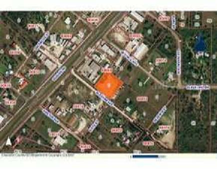

NEARBY LISTINGS FOR SALE OR LEASE
Property Detail
924 Bloxham Ave
Punta Gorda, FL
Cleveland North
402335158003
N CLEVELAND BLK 73 LTS 1 & 4 AND 1/2 VAC SIXTH ST ADJ THERETO 3.28A M/L 347/585 439/978 RE2630/277 RES2824/1344 3333340 CLN 000 0069 0001 N CLEVELAND BLK 69 LT 1 281/212 756/224 1232/55 1609/1867 RE2630/277 3333340
Commercialacreage
Charlotte
AE
Florida
12015C0253G
1,4
0
1.99 AC
2025
Charlotte County
010200
Southwest Florida
1,558 SF
DEMOGRAPHICS near 924 Bloxham Ave
1 mile
3 mile
5 mile
2024 Total Population
2,352
9,174
41,280
2029 Population
2,838
11,053
49,827
Pop Growth 2024-2029
+ 20.66%
+ 20.48%
+ 20.70%
Average Age
51
50
52
2024 Total Households
1,090
4,237
19,092
HH Growth 2024-2029
+ 20.92%
+ 20.72%
+ 21.02%
Median Household Inc
$44,901
$44,886
$49,392
Avg Household Size
2.10
2.10
2.10
2024 Avg HH Vehicles
2.00
2.00
2.00
Median Home Value
$152,243
$205,239
$238,663
Median Year Built
1989
1989
1992
Nearby Places
Map Layers
Map Styles
 Street
 Aerial
Transit
 Traffic
 Biking
Places
Listings with unknown addresses are not visible on the map
- Restaurants
- Banks
- Shops
- Fitness
- Groceries
PUBLIC TRANSPORTATION
AIRPORT
Punta Gorda
Drive
Walk
Distance
Punta Gorda
9 min
4.7 mi
Freight Ports
Port Manatee
Drive
Walk
Distance
Port Manatee
86 min
72.9 mi
Nearby Properties
Address
Land Use
TOTAL SIZE
Lot Size
Zoning
Address
Land Use
TOTAL SIZE
Lot Size
Zoning
161,439 SF
171 AC
RE1
Address
Land Use
TOTAL SIZE
Lot Size
Zoning
121,585 SF
696.03 AC
RE1
Address
Land Use
TOTAL SIZE
Lot Size
Zoning
254.31 AC
PD
Address
Land Use
TOTAL SIZE
Lot Size
Zoning
62,415 SF
281.65 AC
ECAP
Address
Land Use
TOTAL SIZE
Lot Size
Zoning
385,350 SF
374.81 AC
ECAP
Address
Land Use
TOTAL SIZE
Lot Size
Zoning
4,715 SF
48.73 AC
MHP
Address
Land Use
TOTAL SIZE
Lot Size
Zoning
134,308 SF
16 AC
RSF3.5
Address
Land Use
TOTAL SIZE
Lot Size
Zoning
125.54 AC
PD
Address
Land Use
TOTAL SIZE
Lot Size
Zoning
116,186 SF
20.02 AC
RMF10
Address
Land Use
TOTAL SIZE
Lot Size
Zoning
136.11 AC
ECAP
Address
Land Use
TOTAL SIZE
Lot Size
Zoning
60,000 SF
9.87 AC
ECAP
Address
Land Use
TOTAL SIZE
Lot Size
Zoning
66,461 SF
10.86 AC
CG
Address
Land Use
TOTAL SIZE
Lot Size
Zoning
54.25 AC
RMF10
Address
Land Use
TOTAL SIZE
Lot Size
Zoning
103,870 SF
17.06 AC
CG
Address
Land Use
TOTAL SIZE
Lot Size
Zoning
1,556 SF
23.08 AC
CG
Address
Land Use
TOTAL SIZE
Lot Size
Zoning
60,000 SF
1.44 AC
ECAP
Address
Land Use
TOTAL SIZE
Lot Size
Zoning
60.56 AC
PD
Address
Land Use
TOTAL SIZE
Lot Size
Zoning
46,912 SF
3.41 AC
CG
Address
Land Use
TOTAL SIZE
Lot Size
Zoning
30,719 SF
107.17 AC
PKR
Address
Land Use
TOTAL SIZE
Lot Size
Zoning
5,029 SF
9.83 AC
MHP
Address
Land Use
TOTAL SIZE
Lot Size
Zoning
31,194 SF
7.93 AC
CG
Address
Land Use
TOTAL SIZE
Lot Size
Zoning
12,780 SF
86.57 AC
ECAP
Address
Land Use
TOTAL SIZE
Lot Size
Zoning
34,854 SF
655 AC
ES
Address
Land Use
TOTAL SIZE
Lot Size
Zoning
106.30 AC
PD
Address
Land Use
TOTAL SIZE
Lot Size
Zoning
7,128 SF
0.76 AC
ECAP
Address
Land Use
TOTAL SIZE
Lot Size
Zoning
37,150 SF
3.66 AC
ECAP
Address
Land Use
TOTAL SIZE
Lot Size
Zoning
28.40 AC
PD
Address
Land Use
TOTAL SIZE
Lot Size
Zoning
8,750 SF
21.19 AC
CG
Address
Land Use
TOTAL SIZE
Lot Size
Zoning
80,000 SF
1.88 AC
ECAP
Address
Land Use
TOTAL SIZE
Lot Size
Zoning
546 SF
0.76 AC
ECAP
The World's #1 Commercial Real Estate Marketplace
Connect with us
© 2026 CoStar Group
The information above has been obtained from sources believed reliable. While we do not doubt its accuracy we have not verified it and make no guarantee, warranty or representation about it. It is your responsibility to independently confirm its accuracy and completeness. Any projections, opinions, assumptions, or estimates used are for example only and do not represent the current or future performance of the property. The value of this transaction to you depends on tax and other factors which should be evaluated by your tax, financial, and legal advisors. You and your advisors should conduct a careful, independent investigation of the property to determine to your satisfaction the suitability of the property for your needs.