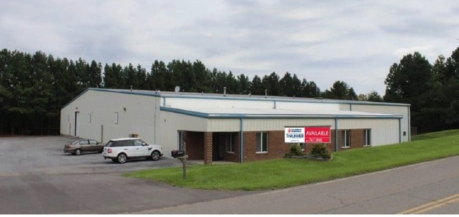
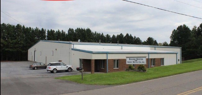
Property Record
930 3Rd St, Vinton, VA 24179

Property Detail
930 3Rd St
070.08-01-01.04-0000
TRACT 3 SOUTH VINTON INDUSTRIAL PARK
Manufacturinglight
Roanoke
M2
Virginia
B and X Area of moderate flood hazard, usually the area between the limits of the 100-year and 500-year floods.
3 AC
2025
Southeast Roanoke
2025
Roanoke
031101
Roanoke, VA
27,020 SF
NEARBY LISTINGS FOR SALE OR LEASE
DEMOGRAPHICS near 930 3Rd St
1 mile
3 mile
5 mile
2025 Total Population
6,288
44,106
103,504
2030 Population
6,355
44,335
103,479
Pop Growth 2025-2030
+ 1.07%
+ 0.52%
(0.02%)
Average Age
41
40
41
2025 Total Households
2,852
19,422
45,337
HH Growth 2025-2030
+ 0.98%
+ 0.52%
(0.08%)
Median Household Inc
$52,494
$54,012
$56,666
Avg Household Size
2.10
2.20
2.20
2025 Avg HH Vehicles
2.00
2.00
2.00
Median Home Value
$164,709
$198,222
$235,316
Median Year Built
1968
1965
1964
Nearby Places
Map Layers
Map Styles
 Street
 Aerial
Transit
 Traffic
 Biking
Places
Listings with unknown addresses are not visible on the map
- Restaurants
- Banks
- Shops
- Fitness
- Groceries
PUBLIC TRANSPORTATION
COMMUTER RAIL
Roanoke (Northeast Regional - Amtrak)
Drive
Walk
Distance
Roanoke (Northeast Regional - Amtrak)
8 min
3.5 mi
AIRPORT
Roanoke/Blacksburg Regional (Woodrum Field)
Drive
Walk
Distance
Roanoke/Blacksburg Regional (Woodrum Field)
17 min
8.6 mi
Freight Ports
Virginia Port Authority - Richmond
Drive
Walk
Distance
Virginia Port Authority - Richmond
218 min
161.4 mi
Nearby Properties
Address
Land Use
TOTAL SIZE
Lot Size
Zoning
Address
Land Use
TOTAL SIZE
Lot Size
Zoning
998,139 SF
20.12 AC
INPUD
Address
Land Use
TOTAL SIZE
Lot Size
Zoning
370 SF
105.25 AC
I-2
Address
Land Use
TOTAL SIZE
Lot Size
Zoning
476,613 SF
5.29 AC
D
Address
Land Use
TOTAL SIZE
Lot Size
Zoning
214,543 SF
38.29 AC
R1S
Address
Land Use
TOTAL SIZE
Lot Size
Zoning
96,620 SF
26.84 AC
D
Address
Land Use
TOTAL SIZE
Lot Size
Zoning
217,815 SF
3.02 AC
INPUD
Address
Land Use
TOTAL SIZE
Lot Size
Zoning
87,406 SF
1.15 AC
D
Address
Land Use
TOTAL SIZE
Lot Size
Zoning
211,622 SF
2.18 AC
INPUD
Address
Land Use
TOTAL SIZE
Lot Size
Zoning
4,901 SF
17.41 AC
MXPUD
Address
Land Use
TOTAL SIZE
Lot Size
Zoning
1.51 AC
INPUD
Address
Land Use
TOTAL SIZE
Lot Size
Zoning
262,715 SF
5.09 AC
D
Address
Land Use
TOTAL SIZE
Lot Size
Zoning
100,606 SF
2.10 AC
INPUD
Address
Land Use
TOTAL SIZE
Lot Size
Zoning
71,696 SF
71.64 AC
INPUD/ROS
Address
Land Use
TOTAL SIZE
Lot Size
Zoning
1.25 AC
D
Address
Land Use
TOTAL SIZE
Lot Size
Zoning
504,343 SF
2.80 AC
INPUD
Address
Land Use
TOTAL SIZE
Lot Size
Zoning
81,500 SF
0.63 AC
D
Address
Land Use
TOTAL SIZE
Lot Size
Zoning
12,220 SF
5.09 AC
D
Address
Land Use
TOTAL SIZE
Lot Size
Zoning
150,151 SF
0.84 AC
D
Address
Land Use
TOTAL SIZE
Lot Size
Zoning
65,502 SF
2.89 AC
INPUD
Address
Land Use
TOTAL SIZE
Lot Size
Zoning
33,249 SF
5.50 AC
D
Address
Land Use
TOTAL SIZE
Lot Size
Zoning
141,056 SF
2.49 AC
D
Address
Land Use
TOTAL SIZE
Lot Size
Zoning
206,418 SF
1.50 AC
D
Address
Land Use
TOTAL SIZE
Lot Size
Zoning
67,486 SF
3.99 AC
RMF
Address
Land Use
TOTAL SIZE
Lot Size
Zoning
73,575 SF
2.52 AC
D
Address
Land Use
TOTAL SIZE
Lot Size
Zoning
122,814 SF
0.98 AC
INPUD
Address
Land Use
TOTAL SIZE
Lot Size
Zoning
238,125 SF
0.37 AC
D
Address
Land Use
TOTAL SIZE
Lot Size
Zoning
152,424 SF
1.49 AC
D
Address
Land Use
TOTAL SIZE
Lot Size
Zoning
160,537 SF
11.08 AC
I-1
Address
Land Use
TOTAL SIZE
Lot Size
Zoning
402,320 SF
42.13 AC
I1C
Address
Land Use
TOTAL SIZE
Lot Size
Zoning
142,048 SF
21.38 AC
I-1
The World's #1 Commercial Real Estate Marketplace
Connect with us
© 2026 CoStar Group
The information above has been obtained from sources believed reliable. While we do not doubt its accuracy we have not verified it and make no guarantee, warranty or representation about it. It is your responsibility to independently confirm its accuracy and completeness. Any projections, opinions, assumptions, or estimates used are for example only and do not represent the current or future performance of the property. The value of this transaction to you depends on tax and other factors which should be evaluated by your tax, financial, and legal advisors. You and your advisors should conduct a careful, independent investigation of the property to determine to your satisfaction the suitability of the property for your needs.