Property Record
930 S 37Th Dr, Phoenix, AZ 85009
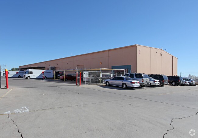

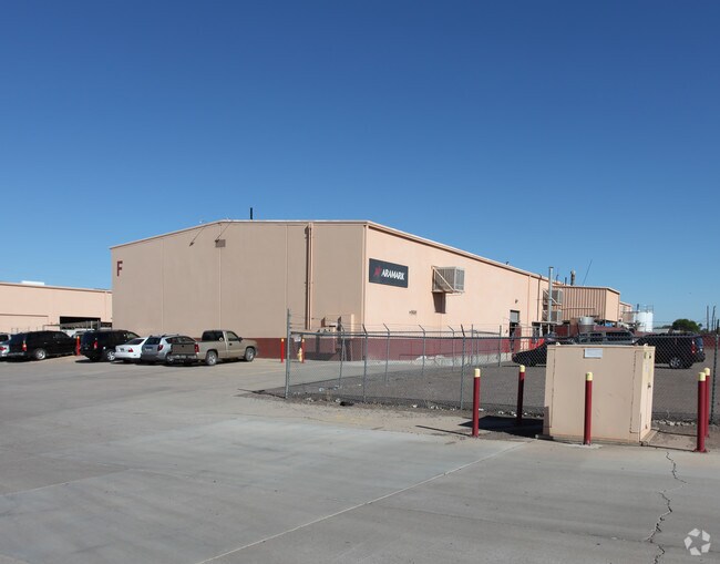
Property Detail
930 S 37Th Dr
106-24-003H
BUCKEYE INDUSTRIAL MCR 1833-50
Warehouse
MARICOPA
I-1
Arizona
C and X Area of minimal flood hazard, usually depicted on FIRMs as above the 500-year flood level.
2
2025
7.57 AC
2025
SW N of Buckeye Road
112700
Phoenix
91,000 SF
Phoenix-Mesa-Chandler, AZ
NEARBY LISTINGS FOR SALE OR LEASE
DEMOGRAPHICS near 930 S 37Th Dr
1 mile
3 mile
5 mile
2025 Total Population
5,041
71,567
339,436
2030 Population
5,208
74,239
352,859
Pop Growth 2025-2030
+ 3.31%
+ 3.73%
+ 3.95%
Average Age
34
34
34
2025 Total Households
1,299
20,417
105,303
HH Growth 2025-2030
+ 3.23%
+ 3.86%
+ 4.33%
Median Household Inc
$42,118
$51,608
$63,088
Avg Household Size
3.50
3.30
3.10
2025 Avg HH Vehicles
2.00
2.00
2.00
Median Home Value
$220,000
$254,470
$350,565
Median Year Built
1964
1971
1978
Nearby Places
Map Layers
Map Styles
 Street
 Aerial
Layers
 Traffic
 Biking
Places
Listings with unknown addresses are not visible on the map
- Restaurants
- Banks
- Shops
- Fitness
- Groceries
PUBLIC TRANSPORTATION
AIRPORT
Phoenix Sky Harbor International
Drive
Walk
Distance
Phoenix Sky Harbor International
19 min
8.6 mi
Phoenix-Mesa Gateway
Drive
Walk
Distance
Phoenix-Mesa Gateway
49 min
35.3 mi
Freight Ports
Port of San Diego
Drive
Walk
Distance
Port of San Diego
394 min
352.6 mi
Nearby Properties
Address
Land Use
TOTAL SIZE
Lot Size
Zoning
Address
Land Use
TOTAL SIZE
Lot Size
Zoning
270,000 SF
12.90 AC
I-1
Address
Land Use
TOTAL SIZE
Lot Size
Zoning
68,452 SF
37.95 AC
R-35
Address
Land Use
TOTAL SIZE
Lot Size
Zoning
781,334 SF
59.96 AC
I-1
Address
Land Use
TOTAL SIZE
Lot Size
Zoning
182,984 SF
146.12 AC
I-1
Address
Land Use
TOTAL SIZE
Lot Size
Zoning
1,378,775 SF
86.09 AC
M-H
Address
Land Use
TOTAL SIZE
Lot Size
Zoning
86,350 SF
25.82 AC
I-1
Address
Land Use
TOTAL SIZE
Lot Size
Zoning
33.15 AC
Address
Land Use
TOTAL SIZE
Lot Size
Zoning
20,430 SF
24.57 AC
I-1
Address
Land Use
TOTAL SIZE
Lot Size
Zoning
440,160 SF
42.43 AC
A1
Address
Land Use
TOTAL SIZE
Lot Size
Zoning
61,508 SF
23.76 AC
I-1
Address
Land Use
TOTAL SIZE
Lot Size
Zoning
69,542 SF
4.92 AC
I-P
Address
Land Use
TOTAL SIZE
Lot Size
Zoning
377,037 SF
35.46 AC
R1-6
Address
Land Use
TOTAL SIZE
Lot Size
Zoning
1,205,743 SF
59.34 AC
I-1
Address
Land Use
TOTAL SIZE
Lot Size
Zoning
1,063,188 SF
59.94 AC
Address
Land Use
TOTAL SIZE
Lot Size
Zoning
554,581 SF
37.82 AC
A1
Address
Land Use
TOTAL SIZE
Lot Size
Zoning
416,837 SF
5.35 AC
C-2
Address
Land Use
TOTAL SIZE
Lot Size
Zoning
335,897 SF
2.07 AC
R-5
Address
Land Use
TOTAL SIZE
Lot Size
Zoning
550,683 SF
1.98 AC
C-C
Address
Land Use
TOTAL SIZE
Lot Size
Zoning
250,448 SF
3.59 AC
C-3
Address
Land Use
TOTAL SIZE
Lot Size
Zoning
14.16 AC
Address
Land Use
TOTAL SIZE
Lot Size
Zoning
449,802 SF
27.08 AC
A-1
Address
Land Use
TOTAL SIZE
Lot Size
Zoning
554,011 SF
26.10 AC
I-P
Address
Land Use
TOTAL SIZE
Lot Size
Zoning
489,284 SF
28.64 AC
I-1
Address
Land Use
TOTAL SIZE
Lot Size
Zoning
662,796 SF
42.11 AC
I-1
Address
Land Use
TOTAL SIZE
Lot Size
Zoning
532,713 SF
27.31 AC
Address
Land Use
TOTAL SIZE
Lot Size
Zoning
474,532 SF
26.17 AC
I-1
Address
Land Use
TOTAL SIZE
Lot Size
Zoning
347,565 SF
21.44 AC
A1
Address
Land Use
TOTAL SIZE
Lot Size
Zoning
603,910 SF
30.70 AC
I-1
Address
Land Use
TOTAL SIZE
Lot Size
Zoning
200,538 SF
2.09 AC
R-5
The World's #1 Commercial Real Estate Marketplace
Connect with us
© 2026 CoStar Group
The information above has been obtained from sources believed reliable. While we do not doubt its accuracy we have not verified it and make no guarantee, warranty or representation about it. It is your responsibility to independently confirm its accuracy and completeness. Any projections, opinions, assumptions, or estimates used are for example only and do not represent the current or future performance of the property. The value of this transaction to you depends on tax and other factors which should be evaluated by your tax, financial, and legal advisors. You and your advisors should conduct a careful, independent investigation of the property to determine to your satisfaction the suitability of the property for your needs.