Property Record
936 S Baldwin Rd, Clarkston, MI 48348

Save to a Folder
{{folder.Name}}
{{folder.ListingIds.length}} Properties
{{folder.ListingIds.length}} Property
Create a New Folder
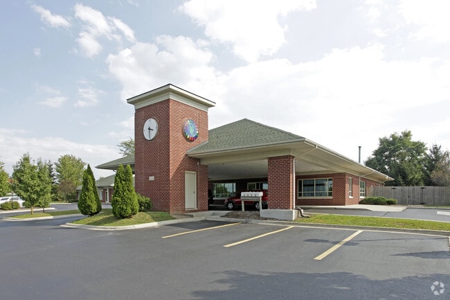
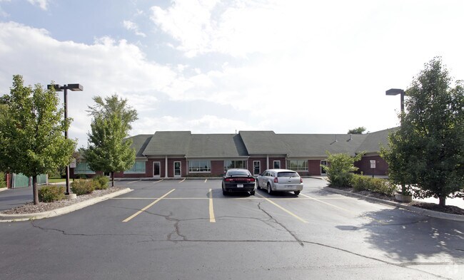
Property Detail
936 S Baldwin Rd
09-07-477-035
T4N, R10E, SEC 7 CLARKSTON-ORION COMMERCIAL SUB LOTS 19, 20 & 21 9-13-01 FR 009, 010 & 011
Officebuilding
Oakland
BI
Michigan
B and X Area of moderate flood hazard, usually the area between the limits of the 100-year and 500-year floods.
9,19-21
2025
1.71 AC
2025
St Clair & Lapeer Counties
128600
Detroit
10,064 SF
Detroit-Warren-Dearborn, MI
NEARBY LISTINGS FOR SALE OR LEASE
-
-
View all Clarkston listings for sale on LoopNet.com
DEMOGRAPHICS near 936 S Baldwin Rd
1 mile
3 mile
5 mile
2025 Total Population
1,926
25,594
81,143
2030 Population
1,957
26,037
82,978
Pop Growth 2025-2030
+ 1.61%
+ 1.73%
+ 2.26%
Average Age
42
42
41
2025 Total Households
652
9,328
30,930
HH Growth 2025-2030
+ 1.69%
+ 1.82%
+ 2.31%
Median Household Inc
$155,435
$121,835
$108,093
Avg Household Size
2.90
2.70
2.60
2025 Avg HH Vehicles
2.00
2.00
2.00
Median Home Value
$460,399
$397,867
$362,146
Median Year Built
1991
1987
1988
Nearby Places
Map Layers
Map Styles
 Street
 Aerial
Layers
 Traffic
 Biking
Places
Listings with unknown addresses are not visible on the map
- Restaurants
- Banks
- Shops
- Fitness
- Groceries
PUBLIC TRANSPORTATION
COMMUTER RAIL
Drive
Walk
Distance
20 min
9.9 mi
AIRPORT
Bishop International
Drive
Walk
Distance
Bishop International
52 min
34.5 mi
Windsor International
Drive
Walk
Distance
Windsor International
71 min
48.5 mi
Nearby Properties
Address
Land Use
TOTAL SIZE
Lot Size
Zoning
Address
Land Use
TOTAL SIZE
Lot Size
Zoning
70,710 SF
13.38 AC
BI
Address
Land Use
TOTAL SIZE
Lot Size
Zoning
180,852 SF
40.32 AC
AI
Address
Land Use
TOTAL SIZE
Lot Size
Zoning
207,942 SF
29.20 AC
AI
Address
Land Use
TOTAL SIZE
Lot Size
Zoning
133,226 SF
11.81 AC
Address
Land Use
TOTAL SIZE
Lot Size
Zoning
182,795 SF
19.39 AC
II
Address
Land Use
TOTAL SIZE
Lot Size
Zoning
33,365 SF
320.73 AC
PRD
Address
Land Use
TOTAL SIZE
Lot Size
Zoning
56,653 SF
7.98 AC
BI
Address
Land Use
TOTAL SIZE
Lot Size
Zoning
58,009 SF
168.28 AC
BI
Address
Land Use
TOTAL SIZE
Lot Size
Zoning
40,505 SF
3.46 AC
BV
Address
Land Use
TOTAL SIZE
Lot Size
Zoning
90,189 SF
15.47 AC
Address
Land Use
TOTAL SIZE
Lot Size
Zoning
43,760 SF
4.76 AC
BI
Address
Land Use
TOTAL SIZE
Lot Size
Zoning
81,895 SF
Address
Land Use
TOTAL SIZE
Lot Size
Zoning
93,950 SF
10.78 AC
II
Address
Land Use
TOTAL SIZE
Lot Size
Zoning
27.06 AC
Address
Land Use
TOTAL SIZE
Lot Size
Zoning
29,530 SF
0.94 AC
Address
Land Use
TOTAL SIZE
Lot Size
Zoning
18,096 SF
5.59 AC
BI
Address
Land Use
TOTAL SIZE
Lot Size
Zoning
14,736 SF
2.27 AC
BI
Address
Land Use
TOTAL SIZE
Lot Size
Zoning
6,576 SF
7.34 AC
BI
Address
Land Use
TOTAL SIZE
Lot Size
Zoning
10,840 SF
1.23 AC
BI
Address
Land Use
TOTAL SIZE
Lot Size
Zoning
18,065 SF
3.02 AC
BV
Address
Land Use
TOTAL SIZE
Lot Size
Zoning
12,985 SF
2.25 AC
BI
Address
Land Use
TOTAL SIZE
Lot Size
Zoning
41,521 SF
Address
Land Use
TOTAL SIZE
Lot Size
Zoning
5,548 SF
0.92 AC
BI
Address
Land Use
TOTAL SIZE
Lot Size
Zoning
59,564 SF
3.90 AC
II
Address
Land Use
TOTAL SIZE
Lot Size
Zoning
5,087 SF
2.90 AC
BV
Address
Land Use
TOTAL SIZE
Lot Size
Zoning
21,740 SF
66.65 AC
BI
Address
Land Use
TOTAL SIZE
Lot Size
Zoning
4,285 SF
1.20 AC
BI
Address
Land Use
TOTAL SIZE
Lot Size
Zoning
5,588 SF
0.13 AC
Address
Land Use
TOTAL SIZE
Lot Size
Zoning
10,795 SF
0.32 AC
BI
The World's #1 Commercial Real Estate Marketplace
Connect with us
© 2026 CoStar Group
The information above has been obtained from sources believed reliable. While we do not doubt its accuracy we have not verified it and make no guarantee, warranty or representation about it. It is your responsibility to independently confirm its accuracy and completeness. Any projections, opinions, assumptions, or estimates used are for example only and do not represent the current or future performance of the property. The value of this transaction to you depends on tax and other factors which should be evaluated by your tax, financial, and legal advisors. You and your advisors should conduct a careful, independent investigation of the property to determine to your satisfaction the suitability of the property for your needs.