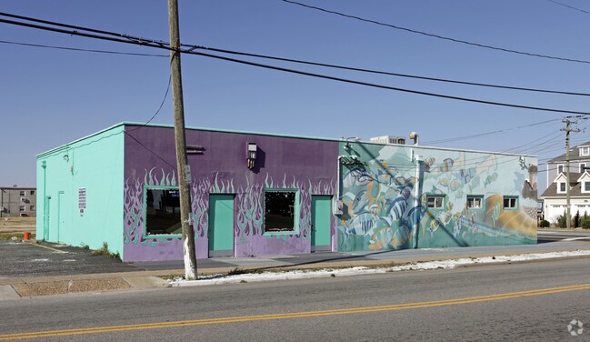
Property Record
943 E Ocean View Ave, Norfolk, VA 23503


Property Detail
943 E Ocean View Ave
28644700
22 BLK 2 O V COTTAGE
Storebuilding
Norfolk City
C2
Virginia
B and X Area of moderate flood hazard, usually the area between the limits of the 100-year and 500-year floods.
0.18 AC
2025
Little Creek
2025
Hampton Roads
000201
Virginia Beach-Chesapeake-Norfolk, VA-NC
2,972 SF
NEARBY LISTINGS FOR SALE OR LEASE
DEMOGRAPHICS near 943 E Ocean View Ave
1 mile
3 mile
5 mile
2025 Total Population
12,759
62,389
138,572
2030 Population
12,571
61,272
136,194
Pop Growth 2025-2030
(1.47%)
(1.79%)
(1.72%)
Average Age
38
39
37
2025 Total Households
5,725
26,698
53,589
HH Growth 2025-2030
(1.47%)
(1.83%)
(1.90%)
Median Household Inc
$59,932
$61,464
$65,153
Avg Household Size
2.20
2.20
2.30
2025 Avg HH Vehicles
2.00
2.00
2.00
Median Home Value
$324,232
$293,700
$306,929
Median Year Built
1966
1963
1964
Nearby Places
Map Layers
Map Styles
 Street
 Aerial
Transit
 Traffic
 Biking
Places
Listings with unknown addresses are not visible on the map
- Restaurants
- Banks
- Shops
- Fitness
- Groceries
PUBLIC TRANSPORTATION
COMMUTER RAIL
Drive
Walk
Distance
16 min
9.4 mi
AIRPORT
Norfolk International
Drive
Walk
Distance
Norfolk International
12 min
5.7 mi
Newport News/Williamsburg International
Drive
Walk
Distance
Newport News/Williamsburg International
33 min
22.4 mi
Freight Ports
Virginia Port Authority - Norfolk
Drive
Walk
Distance
Virginia Port Authority - Norfolk
18 min
7.4 mi
SALE & LEASE HISTORY
LISTING DATE
SALE/LEASE

Sep 25, 2016
For Lease
Mar 18, 2026
For Lease
Nearby Properties
Address
Land Use
TOTAL SIZE
Lot Size
Zoning
Address
Land Use
TOTAL SIZE
Lot Size
Zoning
8,423 SF
53.95 AC
Address
Land Use
TOTAL SIZE
Lot Size
Zoning
40.37 AC
R6
Address
Land Use
TOTAL SIZE
Lot Size
Zoning
167,279 SF
9.97 AC
IN1
Address
Land Use
TOTAL SIZE
Lot Size
Zoning
103,496 SF
25.81 AC
IN1
Address
Land Use
TOTAL SIZE
Lot Size
Zoning
41,754 SF
6.01 AC
Address
Land Use
TOTAL SIZE
Lot Size
Zoning
170,152 SF
6.07 AC
PDMU1
Address
Land Use
TOTAL SIZE
Lot Size
Zoning
25,880 SF
31.21 AC
91
Address
Land Use
TOTAL SIZE
Lot Size
Zoning
23.85 AC
IN1
Address
Land Use
TOTAL SIZE
Lot Size
Zoning
15,898 SF
9.91 AC
IN1
Address
Land Use
TOTAL SIZE
Lot Size
Zoning
21.65 AC
Address
Land Use
TOTAL SIZE
Lot Size
Zoning
177,766 SF
21.65 AC
C3
Address
Land Use
TOTAL SIZE
Lot Size
Zoning
3,944 SF
10.73 AC
R7
Address
Land Use
TOTAL SIZE
Lot Size
Zoning
213,832 SF
20.36 AC
C3
Address
Land Use
TOTAL SIZE
Lot Size
Zoning
280 SF
16.84 AC
IN1
Address
Land Use
TOTAL SIZE
Lot Size
Zoning
41,140 SF
7.80 AC
BC1
Address
Land Use
TOTAL SIZE
Lot Size
Zoning
3.22 AC
PDR6
Address
Land Use
TOTAL SIZE
Lot Size
Zoning
24.67 AC
IN1
Address
Land Use
TOTAL SIZE
Lot Size
Zoning
213,832 SF
15.61 AC
Address
Land Use
TOTAL SIZE
Lot Size
Zoning
3,696 SF
8.23 AC
R11
Address
Land Use
TOTAL SIZE
Lot Size
Zoning
28,064 SF
7.48 AC
C2
Address
Land Use
TOTAL SIZE
Lot Size
Zoning
7.28 AC
IN1
Address
Land Use
TOTAL SIZE
Lot Size
Zoning
63,459 SF
20.06 AC
IN1
Address
Land Use
TOTAL SIZE
Lot Size
Zoning
51,849 SF
3.13 AC
PDR6
Address
Land Use
TOTAL SIZE
Lot Size
Zoning
28,708 SF
3.16 AC
C2
Address
Land Use
TOTAL SIZE
Lot Size
Zoning
251.28 AC
OSP
Address
Land Use
TOTAL SIZE
Lot Size
Zoning
79,136 SF
0.85 AC
Address
Land Use
TOTAL SIZE
Lot Size
Zoning
3.66 AC
Address
Land Use
TOTAL SIZE
Lot Size
Zoning
136,526 SF
10.63 AC
Address
Land Use
TOTAL SIZE
Lot Size
Zoning
99,838 SF
20.73 AC
R6
Address
Land Use
TOTAL SIZE
Lot Size
Zoning
11.05 AC
The World's #1 Commercial Real Estate Marketplace
Connect with us
© 2026 CoStar Group
The information above has been obtained from sources believed reliable. While we do not doubt its accuracy we have not verified it and make no guarantee, warranty or representation about it. It is your responsibility to independently confirm its accuracy and completeness. Any projections, opinions, assumptions, or estimates used are for example only and do not represent the current or future performance of the property. The value of this transaction to you depends on tax and other factors which should be evaluated by your tax, financial, and legal advisors. You and your advisors should conduct a careful, independent investigation of the property to determine to your satisfaction the suitability of the property for your needs.