Property Record
944 S 1950 W, Payson, UT 84651
Save to a Folder
{{folder.Name}}
{{folder.ListingIds.length}} Properties
{{folder.ListingIds.length}} Property
Create a New Folder
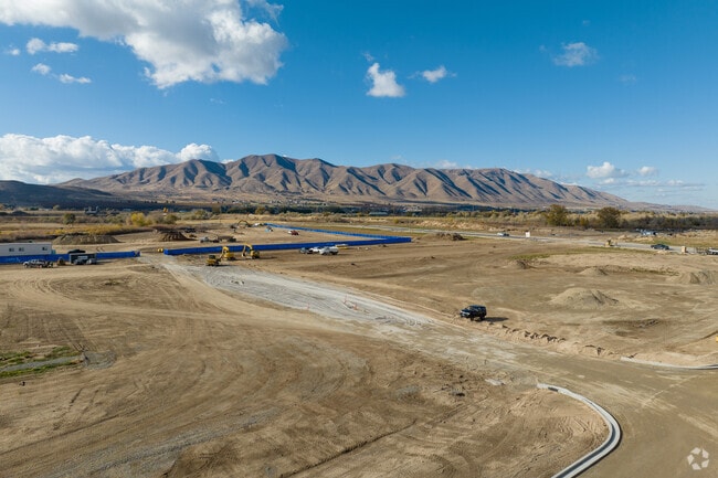
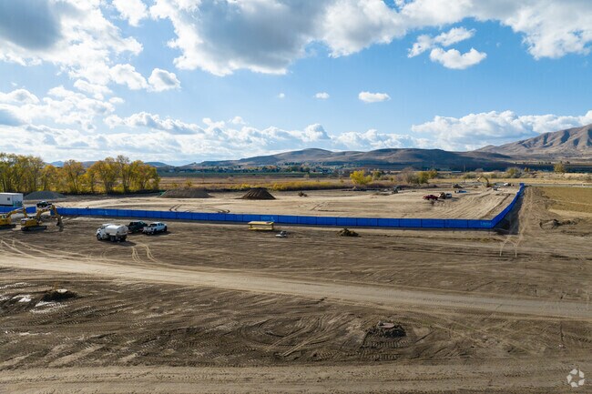
This Property Is For Sale
Current Lease Availabilities
Property Detail
944 S 1950 W
Salt Lake City
LOT 9, PLAT A, RED BRIDGE SUB AREA 0.439 AC.
Provo-Orem-Lehi, UT
UTAH
51-739-0013
Utah
Vacantlandnec
9
2025
6.46 AC
2026
Utah County
003405
NEARBY LISTINGS FOR SALE OR LEASE
DEMOGRAPHICS near 944 S 1950 W
1 mile
3 mile
5 mile
2025 Total Population
2,963
27,006
48,750
2030 Population
3,289
29,688
53,843
Pop Growth 2025-2030
+ 11.00%
+ 9.93%
+ 10.45%
Average Age
34
34
33
2025 Total Households
883
7,742
13,513
HH Growth 2025-2030
+ 11.78%
+ 10.66%
+ 11.15%
Median Household Inc
$87,931
$92,743
$98,805
Avg Household Size
3.40
3.50
3.60
2025 Avg HH Vehicles
2.00
3.00
3.00
Median Home Value
$510,659
$470,044
$498,539
Median Year Built
2004
1998
2000
Nearby Places
Map Layers
Map Styles
 Street
 Aerial
Layers
 Traffic
 Biking
Places
Listings with unknown addresses are not visible on the map
- Restaurants
- Banks
- Shops
- Fitness
- Groceries
PUBLIC TRANSPORTATION
AIRPORT
Provo Municipal
Drive
Walk
Distance
Provo Municipal
25 min
19.0 mi
Freight Ports
Port of Stockton
Drive
Walk
Distance
Port of Stockton
775 min
755.6 mi
Nearby Properties
Address
Land Use
TOTAL SIZE
Lot Size
Zoning
Address
Land Use
TOTAL SIZE
Lot Size
Zoning
91,942 SF
13.34 AC
Address
Land Use
TOTAL SIZE
Lot Size
Zoning
356,234 SF
22.12 AC
Address
Land Use
TOTAL SIZE
Lot Size
Zoning
324,996 SF
23.15 AC
Address
Land Use
TOTAL SIZE
Lot Size
Zoning
332,095 SF
8.44 AC
Address
Land Use
TOTAL SIZE
Lot Size
Zoning
285,374 SF
10.98 AC
Address
Land Use
TOTAL SIZE
Lot Size
Zoning
184,314 SF
22.67 AC
Address
Land Use
TOTAL SIZE
Lot Size
Zoning
163,147 SF
8 AC
Address
Land Use
TOTAL SIZE
Lot Size
Zoning
64,375 SF
25.19 AC
Address
Land Use
TOTAL SIZE
Lot Size
Zoning
185,917 SF
11.19 AC
Address
Land Use
TOTAL SIZE
Lot Size
Zoning
194,159 SF
14.47 AC
Address
Land Use
TOTAL SIZE
Lot Size
Zoning
95,684 SF
5.90 AC
Address
Land Use
TOTAL SIZE
Lot Size
Zoning
150,427 SF
44.48 AC
RA5
Address
Land Use
TOTAL SIZE
Lot Size
Zoning
95,684 SF
6.14 AC
Address
Land Use
TOTAL SIZE
Lot Size
Zoning
107,284 SF
Address
Land Use
TOTAL SIZE
Lot Size
Zoning
32,028 SF
5 AC
Address
Land Use
TOTAL SIZE
Lot Size
Zoning
125,459 SF
10 AC
Address
Land Use
TOTAL SIZE
Lot Size
Zoning
95,818 SF
4.04 AC
Address
Land Use
TOTAL SIZE
Lot Size
Zoning
47,405 SF
3.96 AC
Address
Land Use
TOTAL SIZE
Lot Size
Zoning
39,168 SF
3.54 AC
Address
Land Use
TOTAL SIZE
Lot Size
Zoning
81,217 SF
5.74 AC
Address
Land Use
TOTAL SIZE
Lot Size
Zoning
58,152 SF
1.47 AC
Address
Land Use
TOTAL SIZE
Lot Size
Zoning
54,940 SF
3.08 AC
Address
Land Use
TOTAL SIZE
Lot Size
Zoning
35,180 SF
2 AC
Address
Land Use
TOTAL SIZE
Lot Size
Zoning
51,755 SF
4.76 AC
Address
Land Use
TOTAL SIZE
Lot Size
Zoning
52,884 SF
3.71 AC
Address
Land Use
TOTAL SIZE
Lot Size
Zoning
27,547 SF
5 AC
Address
Land Use
TOTAL SIZE
Lot Size
Zoning
48,024 SF
3.64 AC
Address
Land Use
TOTAL SIZE
Lot Size
Zoning
49,629 SF
2.36 AC
Address
Land Use
TOTAL SIZE
Lot Size
Zoning
35,637 SF
1.94 AC
The World's #1 Commercial Real Estate Marketplace
Connect with us
© 2026 CoStar Group
The information above has been obtained from sources believed reliable. While we do not doubt its accuracy we have not verified it and make no guarantee, warranty or representation about it. It is your responsibility to independently confirm its accuracy and completeness. Any projections, opinions, assumptions, or estimates used are for example only and do not represent the current or future performance of the property. The value of this transaction to you depends on tax and other factors which should be evaluated by your tax, financial, and legal advisors. You and your advisors should conduct a careful, independent investigation of the property to determine to your satisfaction the suitability of the property for your needs.