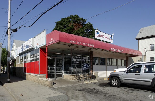
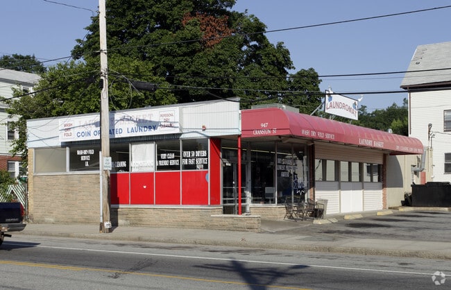
Property Record
947 Cranston St, Cranston, RI 02920
NEARBY LISTINGS FOR SALE OR LEASE
Property Detail
947 Cranston St
CRAN-000007-000001-001193
Providence
Commercialbuilding
Rhode Island
X
1193
44007C0312H
0.07 AC
2025
Cranston
2025
Providence
014100
Providence-Warwick, RI-MA
2,764 SF
DEMOGRAPHICS near 947 Cranston St
1 Mile
3 Mile
5 Mile
2024 Total Population
31,036
204,607
371,260
2029 Population
30,254
202,040
368,458
Pop Growth 2024-2029
(2.52%)
(1.25%)
(0.75%)
Average Age
35
37
39
2024 Total Households
10,585
76,750
147,171
HH Growth 2024-2029
(2.57%)
(1.13%)
(0.69%)
Median Household Inc
$50,077
$59,494
$65,635
Avg Household Size
2.80
2.40
2.30
2024 Avg HH Vehicles
2.00
1.00
2.00
Median Home Value
$277,616
$279,084
$296,759
Median Year Built
1947
1949
1953
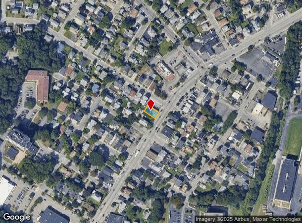
Nearby Places
Map Layers
Map Styles
 Street
 Aerial
- Restaurants
- Banks
- Shops
- Fitness
- Groceries
PUBLIC TRANSPORTATION
COMMUTER RAIL
Providence (Providence/Stoughton Line - Massachusetts Bay Transportation Authority Commuter Rail (Purple Line))
DRIVE
WALK
Distance
Providence (Providence/Stoughton Line - Massachusetts Bay Transportation Authority Commuter Rail (Purple Line))
5 min
3.3 mi
DRIVE
WALK
Distance
13 min
6.2 mi
AIRPORT
Rhode Island Tf Green International
DRIVE
WALK
Distance
Rhode Island Tf Green International
18 min
8.0 mi
Worcester Regional
DRIVE
WALK
Distance
Worcester Regional
62 min
46.4 mi
Freight Ports
Port of Davisville, RI
DRIVE
WALK
Distance
Port of Davisville, RI
33 min
19.4 mi
Nearby Properties
Address
Land Use
TOTAL SIZE
Lot Size
Zoning
Address
Land Use
TOTAL SIZE
Lot Size
Zoning
162,816 SF
16.52 AC
D-1-10
Address
Land Use
TOTAL SIZE
Lot Size
Zoning
8.93 AC
OS
Address
Land Use
TOTAL SIZE
Lot Size
Zoning
268,679 SF
8.64 AC
I-1-75
Address
Land Use
TOTAL SIZE
Lot Size
Zoning
233,468 SF
1.55 AC
I-1-20
Address
Land Use
TOTAL SIZE
Lot Size
Zoning
396,000 SF
0.12 AC
D-1-30
Address
Land Use
TOTAL SIZE
Lot Size
Zoning
244,872 SF
1.25 AC
D-1-12
Address
Land Use
TOTAL SIZE
Lot Size
Zoning
205,551 SF
1.38 AC
C-2
Address
Land Use
TOTAL SIZE
Lot Size
Zoning
314,273 SF
D-1-20
Address
Land Use
TOTAL SIZE
Lot Size
Zoning
28.92 AC
PS
Address
Land Use
TOTAL SIZE
Lot Size
Zoning
2.01 AC
I-2
Address
Land Use
TOTAL SIZE
Lot Size
Zoning
57,688 SF
0.46 AC
I-2
Address
Land Use
TOTAL SIZE
Lot Size
Zoning
9.06 AC
PS
Address
Land Use
TOTAL SIZE
Lot Size
Zoning
174,352 SF
2.50 AC
I-1-20
Address
Land Use
TOTAL SIZE
Lot Size
Zoning
3.44 AC
D-1-20
Address
Land Use
TOTAL SIZE
Lot Size
Zoning
4.88 AC
I-2
Address
Land Use
TOTAL SIZE
Lot Size
Zoning
2.01 AC
I-2
Address
Land Use
TOTAL SIZE
Lot Size
Zoning
149,663 SF
1.90 AC
D-1-10
Address
Land Use
TOTAL SIZE
Lot Size
Zoning
13.40 AC
C3
Address
Land Use
TOTAL SIZE
Lot Size
Zoning
293,736 SF
1.24 AC
D-1-75
Address
Land Use
TOTAL SIZE
Lot Size
Zoning
91.15 AC
PUD
Address
Land Use
TOTAL SIZE
Lot Size
Zoning
Address
Land Use
TOTAL SIZE
Lot Size
Zoning
277,453 SF
1.83 AC
M-MU-9
Address
Land Use
TOTAL SIZE
Lot Size
Zoning
95,064 SF
1.38 AC
I-2
Address
Land Use
TOTAL SIZE
Lot Size
Zoning
202,461 SF
1.64 AC
D-1-10
Address
Land Use
TOTAL SIZE
Lot Size
Zoning
221,151 SF
2.13 AC
D-1-12
Address
Land Use
TOTAL SIZE
Lot Size
Zoning
270,505 SF
2.85 AC
D-1-75
Address
Land Use
TOTAL SIZE
Lot Size
Zoning
218,167 SF
2.74 AC
D-1-20
Address
Land Use
TOTAL SIZE
Lot Size
Zoning
97,097 SF
0.99 AC
D-1-20
Address
Land Use
TOTAL SIZE
Lot Size
Zoning
2.91 AC
I-2
Address
Land Use
TOTAL SIZE
Lot Size
Zoning
101,060 SF
0.66 AC
I-2
The World's #1 Commercial Real Estate Marketplace
Connect with us
© 2026 CoStar Group
The information above has been obtained from sources believed reliable. While we do not doubt its accuracy we have not verified it and make no guarantee, warranty or representation about it. It is your responsibility to independently confirm its accuracy and completeness. Any projections, opinions, assumptions, or estimates used are for example only and do not represent the current or future performance of the property. The value of this transaction to you depends on tax and other factors which should be evaluated by your tax, financial, and legal advisors. You and your advisors should conduct a careful, independent investigation of the property to determine to your satisfaction the suitability of the property for your needs.