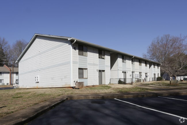
Property Record
950 Cherry St, Pendleton, SC 29670

Property Detail
950 Cherry St
062-02-04-006
CP 000/000 PP 077/522 F121 D655 EDGEWOOD SQUARE APTS 8.48 AC
Commercialofficeresidentialmixeduse
Anderson
B and X Area of moderate flood hazard, usually the area between the limits of the 100-year and 500-year floods.
South Carolina
2025
8.48 AC
2024
Pendleton
010702
Greenville/Spartanburg
14,706 SF
Greenville-Anderson-Greer, SC
NEARBY LISTINGS FOR SALE OR LEASE
-
-
View all Pendleton listings for sale on LoopNet.com
DEMOGRAPHICS near 950 Cherry St
1 mile
3 mile
5 mile
2025 Total Population
3,083
11,814
35,537
2030 Population
3,264
12,485
36,903
Pop Growth 2025-2030
+ 5.87%
+ 5.68%
+ 3.84%
Average Age
40
40
35
2025 Total Households
1,350
4,885
13,214
HH Growth 2025-2030
+ 6.22%
+ 6.33%
+ 4.50%
Median Household Inc
$68,448
$71,404
$56,724
Avg Household Size
2.30
2.20
2.30
2025 Avg HH Vehicles
2.00
2.00
2.00
Median Home Value
$234,030
$276,504
$285,331
Median Year Built
1989
1990
1991
Nearby Places
Map Layers
Map Styles
 Street
 Aerial
Transit
 Traffic
 Biking
Places
Listings with unknown addresses are not visible on the map
- Restaurants
- Banks
- Shops
- Fitness
- Groceries
PUBLIC TRANSPORTATION
COMMUTER RAIL
Clemson Amtrak Station (Crescent - Amtrak)
Drive
Walk
Distance
Clemson Amtrak Station (Crescent - Amtrak)
10 min
5.2 mi
Freight Ports
Georgia Ports - Savannah
Drive
Walk
Distance
Georgia Ports - Savannah
315 min
224.2 mi
SALE & LEASE HISTORY
LISTING DATE
SALE/LEASE

Jan 02, 2024
For Sale
Nearby Properties
Address
Land Use
TOTAL SIZE
Lot Size
Zoning
Address
Land Use
TOTAL SIZE
Lot Size
Zoning
7,692 SF
0.40 AC
RIL
Address
Land Use
TOTAL SIZE
Lot Size
Zoning
254,000 SF
94.59 AC
Address
Land Use
TOTAL SIZE
Lot Size
Zoning
6,000 SF
0.99 AC
Address
Land Use
TOTAL SIZE
Lot Size
Zoning
54,244 SF
1.17 AC
RIL
Address
Land Use
TOTAL SIZE
Lot Size
Zoning
11.42 AC
Address
Land Use
TOTAL SIZE
Lot Size
Zoning
191,000 SF
36.59 AC
RM 3 MULTI
Address
Land Use
TOTAL SIZE
Lot Size
Zoning
64,306 SF
0.96 AC
RIL
Address
Land Use
TOTAL SIZE
Lot Size
Zoning
5,484.32 AC
Address
Land Use
TOTAL SIZE
Lot Size
Zoning
75,260 SF
2.20 AC
Address
Land Use
TOTAL SIZE
Lot Size
Zoning
11,881 SF
14.21 AC
Address
Land Use
TOTAL SIZE
Lot Size
Zoning
1.52 AC
Address
Land Use
TOTAL SIZE
Lot Size
Zoning
17,676 SF
0.55 AC
RIL
Address
Land Use
TOTAL SIZE
Lot Size
Zoning
32,524 SF
0.33 AC
RIL
Address
Land Use
TOTAL SIZE
Lot Size
Zoning
20,000 SF
14.18 AC
Address
Land Use
TOTAL SIZE
Lot Size
Zoning
3.83 AC
RM 2 TWO F
Address
Land Use
TOTAL SIZE
Lot Size
Zoning
27.50 AC
Address
Land Use
TOTAL SIZE
Lot Size
Zoning
69,208 SF
10.68 AC
Address
Land Use
TOTAL SIZE
Lot Size
Zoning
1,530 SF
41.37 AC
Address
Land Use
TOTAL SIZE
Lot Size
Zoning
14.58 AC
R 20 SINGL
Address
Land Use
TOTAL SIZE
Lot Size
Zoning
5,839 SF
5.45 AC
Address
Land Use
TOTAL SIZE
Lot Size
Zoning
13,930 SF
0.33 AC
RIL
Address
Land Use
TOTAL SIZE
Lot Size
Zoning
3,730 SF
1.98 AC
Address
Land Use
TOTAL SIZE
Lot Size
Zoning
12,148 SF
0.31 AC
RIL
Address
Land Use
TOTAL SIZE
Lot Size
Zoning
14,537 SF
0.34 AC
RIL
Address
Land Use
TOTAL SIZE
Lot Size
Zoning
9,600 SF
1.79 AC
Address
Land Use
TOTAL SIZE
Lot Size
Zoning
6,282 SF
2.92 AC
Address
Land Use
TOTAL SIZE
Lot Size
Zoning
10,054 SF
1.20 AC
The World's #1 Commercial Real Estate Marketplace
Connect with us
© 2026 CoStar Group
The information above has been obtained from sources believed reliable. While we do not doubt its accuracy we have not verified it and make no guarantee, warranty or representation about it. It is your responsibility to independently confirm its accuracy and completeness. Any projections, opinions, assumptions, or estimates used are for example only and do not represent the current or future performance of the property. The value of this transaction to you depends on tax and other factors which should be evaluated by your tax, financial, and legal advisors. You and your advisors should conduct a careful, independent investigation of the property to determine to your satisfaction the suitability of the property for your needs.