Property Record
950 Tharp Rd, Yuba City, CA 95993
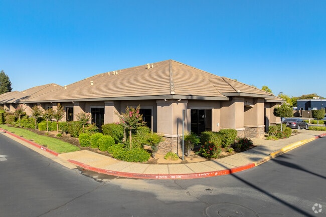


Property Detail
950 Tharp Rd
Yuba City, CA
FORMERLY PORTION OF 58-050-074 PARCEL 1 AS SHOWN ON PM 1130 RECORDED 12/12/07 IN BOOK 7 OF PARCEL MAPS, PAGE 100
58-050-081
SUTTER
Commercialnec
California
CO
1
2024
0.68 AC
2025
Sutter County
050501
Sacramento
6,806 SF
NEARBY LISTINGS FOR SALE OR LEASE
DEMOGRAPHICS near 950 Tharp Rd
1 mile
3 mile
5 mile
2025 Total Population
9,797
71,541
101,729
2030 Population
9,784
71,409
102,806
Pop Growth 2025-2030
(0.13%)
(0.18%)
+ 1.06%
Average Age
39
39
39
2025 Total Households
3,204
24,167
34,203
HH Growth 2025-2030
(0.06%)
(0.16%)
+ 1.23%
Median Household Inc
$62,246
$71,785
$71,635
Avg Household Size
3.00
2.90
2.90
2025 Avg HH Vehicles
2.00
2.00
2.00
Median Home Value
$430,465
$427,217
$412,192
Median Year Built
1986
1980
1979
Nearby Places
Map Layers
Map Styles
 Street
 Aerial
Layers
 Traffic
 Biking
Places
Listings with unknown addresses are not visible on the map
- Restaurants
- Banks
- Shops
- Fitness
- Groceries
SALE & LEASE HISTORY
LISTING DATE
SALE/LEASE

Nov 17, 2025
For Lease
Dec 13, 2017
For Sale
Dec 08, 2025
For Sale
Nearby Properties
Address
Land Use
TOTAL SIZE
Lot Size
Zoning
Address
Land Use
TOTAL SIZE
Lot Size
Zoning
25,580 SF
9.48 AC
C3
Address
Land Use
TOTAL SIZE
Lot Size
Zoning
1,028,560 SF
52.30 AC
M1
Address
Land Use
TOTAL SIZE
Lot Size
Zoning
48,348 SF
3.25 AC
Address
Land Use
TOTAL SIZE
Lot Size
Zoning
143,368 SF
11.40 AC
Address
Land Use
TOTAL SIZE
Lot Size
Zoning
92,312 SF
17.04 AC
Address
Land Use
TOTAL SIZE
Lot Size
Zoning
120,622 SF
2.25 AC
Address
Land Use
TOTAL SIZE
Lot Size
Zoning
259,011 SF
14.20 AC
M1
Address
Land Use
TOTAL SIZE
Lot Size
Zoning
147,546 SF
7.55 AC
R3
Address
Land Use
TOTAL SIZE
Lot Size
Zoning
49,817 SF
2.81 AC
C3
Address
Land Use
TOTAL SIZE
Lot Size
Zoning
55,702 SF
3.16 AC
Address
Land Use
TOTAL SIZE
Lot Size
Zoning
18,675 SF
2.98 AC
C3
Address
Land Use
TOTAL SIZE
Lot Size
Zoning
176,181 SF
6.99 AC
CM
Address
Land Use
TOTAL SIZE
Lot Size
Zoning
74,040 SF
5.97 AC
R3
Address
Land Use
TOTAL SIZE
Lot Size
Zoning
53,600 SF
8.15 AC
Address
Land Use
TOTAL SIZE
Lot Size
Zoning
50,270 SF
4.16 AC
CO
Address
Land Use
TOTAL SIZE
Lot Size
Zoning
137,178 SF
11.01 AC
C3
Address
Land Use
TOTAL SIZE
Lot Size
Zoning
140,846 SF
12.98 AC
C3
Address
Land Use
TOTAL SIZE
Lot Size
Zoning
138,490 SF
18.72 AC
C3
Address
Land Use
TOTAL SIZE
Lot Size
Zoning
48,117 SF
1.81 AC
R1
Address
Land Use
TOTAL SIZE
Lot Size
Zoning
115,058 SF
13.03 AC
Address
Land Use
TOTAL SIZE
Lot Size
Zoning
37,854 SF
6 AC
C3
Address
Land Use
TOTAL SIZE
Lot Size
Zoning
105,160 SF
8.99 AC
Address
Land Use
TOTAL SIZE
Lot Size
Zoning
56,257 SF
1.73 AC
Address
Land Use
TOTAL SIZE
Lot Size
Zoning
203,184 SF
17.82 AC
C3
Address
Land Use
TOTAL SIZE
Lot Size
Zoning
39,340 SF
6.51 AC
Address
Land Use
TOTAL SIZE
Lot Size
Zoning
1.67 AC
Address
Land Use
TOTAL SIZE
Lot Size
Zoning
2.53 AC
Address
Land Use
TOTAL SIZE
Lot Size
Zoning
42,986 SF
4.85 AC
C3
Address
Land Use
TOTAL SIZE
Lot Size
Zoning
193,952 SF
9.93 AC
C3
Address
Land Use
TOTAL SIZE
Lot Size
Zoning
47,686 SF
2 AC
R2
The World's #1 Commercial Real Estate Marketplace
Connect with us
© 2026 CoStar Group
The information above has been obtained from sources believed reliable. While we do not doubt its accuracy we have not verified it and make no guarantee, warranty or representation about it. It is your responsibility to independently confirm its accuracy and completeness. Any projections, opinions, assumptions, or estimates used are for example only and do not represent the current or future performance of the property. The value of this transaction to you depends on tax and other factors which should be evaluated by your tax, financial, and legal advisors. You and your advisors should conduct a careful, independent investigation of the property to determine to your satisfaction the suitability of the property for your needs.