Property Record
9520 Calimesa Blvd, Calimesa, CA 92320
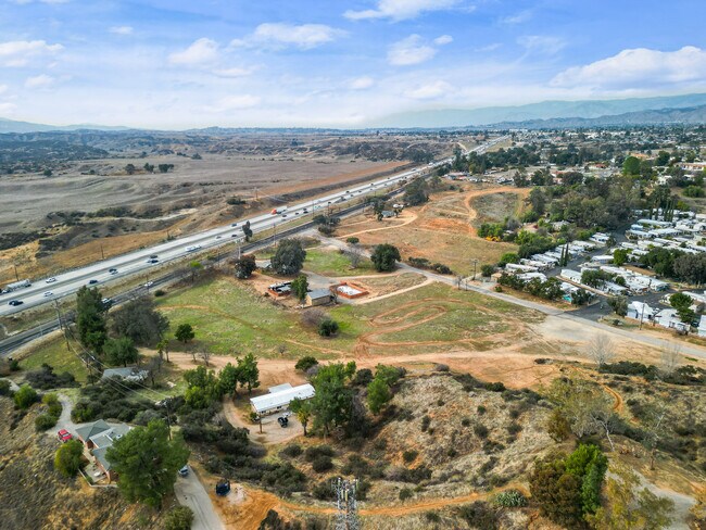

Property Detail
9520 Calimesa Blvd
413-250-058
1.30 ACRES M/L IN POR LOT 94 BLK 6 MB 013/047 KADOTA CITY FIG GROVES AND POR LOT 1 AM 001/048 ASSESSORS MAP 43
Commercialacreage
RIVERSIDE
RA1
California
B and X Area of moderate flood hazard, usually the area between the limits of the 100-year and 500-year floods.
94
2024
1.30 AC
2025
Beaumont/Hemet
043802
Inland Empire (California)
581 SF
Riverside-San Bernardino-Ontario, CA
NEARBY LISTINGS FOR SALE OR LEASE
DEMOGRAPHICS near 9520 Calimesa Blvd
1 mile
3 mile
5 mile
2025 Total Population
4,213
41,802
93,048
2030 Population
4,373
43,143
95,498
Pop Growth 2025-2030
+ 3.80%
+ 3.21%
+ 2.63%
Average Age
39
40
40
2025 Total Households
1,389
14,502
32,017
HH Growth 2025-2030
+ 3.46%
+ 2.92%
+ 2.35%
Median Household Inc
$114,285
$91,497
$99,412
Avg Household Size
3.00
2.80
2.90
2025 Avg HH Vehicles
2.00
2.00
2.00
Median Home Value
$640,012
$517,287
$553,948
Median Year Built
1989
1990
1989
Nearby Places
Map Layers
Map Styles
 Street
 Aerial
Layers
 Traffic
 Biking
Places
Listings with unknown addresses are not visible on the map
- Restaurants
- Banks
- Shops
- Fitness
- Groceries
PUBLIC TRANSPORTATION
COMMUTER RAIL
Redlands - University Metrolink Station (Metrolink San Bernardino Line - Metrolink Trains)
Drive
Walk
Distance
Redlands - University Metrolink Station (Metrolink San Bernardino Line - Metrolink Trains)
13 min
9.4 mi
Freight Ports
Port of Long Beach
Drive
Walk
Distance
Port of Long Beach
101 min
80.3 mi
SALE & LEASE HISTORY
LISTING DATE
SALE/LEASE

Feb 22, 2025
For Sale
Nearby Properties
Address
Land Use
TOTAL SIZE
Lot Size
Zoning
Address
Land Use
TOTAL SIZE
Lot Size
Zoning
1,013,356 SF
135.79 AC
Address
Land Use
TOTAL SIZE
Lot Size
Zoning
810,962 SF
85.23 AC
Address
Land Use
TOTAL SIZE
Lot Size
Zoning
369,838 SF
19.32 AC
Address
Land Use
TOTAL SIZE
Lot Size
Zoning
82,694 SF
3.41 AC
Address
Land Use
TOTAL SIZE
Lot Size
Zoning
5.47 AC
Address
Land Use
TOTAL SIZE
Lot Size
Zoning
45,712 SF
4.87 AC
Address
Land Use
TOTAL SIZE
Lot Size
Zoning
56,491 SF
7.50 AC
Address
Land Use
TOTAL SIZE
Lot Size
Zoning
Address
Land Use
TOTAL SIZE
Lot Size
Zoning
56,491 SF
3.39 AC
Address
Land Use
TOTAL SIZE
Lot Size
Zoning
22,308 SF
1.87 AC
Address
Land Use
TOTAL SIZE
Lot Size
Zoning
24,510 SF
6.88 AC
Address
Land Use
TOTAL SIZE
Lot Size
Zoning
15,980 SF
1.56 AC
Address
Land Use
TOTAL SIZE
Lot Size
Zoning
33.42 AC
Address
Land Use
TOTAL SIZE
Lot Size
Zoning
41,005 SF
3.27 AC
MIX
Address
Land Use
TOTAL SIZE
Lot Size
Zoning
73,670 SF
4.49 AC
Address
Land Use
TOTAL SIZE
Lot Size
Zoning
18,800 SF
4.07 AC
CC
Address
Land Use
TOTAL SIZE
Lot Size
Zoning
14,738 SF
1.49 AC
C1
Address
Land Use
TOTAL SIZE
Lot Size
Zoning
50,936 SF
6.50 AC
936
Address
Land Use
TOTAL SIZE
Lot Size
Zoning
35,688 SF
3.03 AC
Address
Land Use
TOTAL SIZE
Lot Size
Zoning
15,211 SF
2.15 AC
Address
Land Use
TOTAL SIZE
Lot Size
Zoning
3,967 SF
0.64 AC
CP
Address
Land Use
TOTAL SIZE
Lot Size
Zoning
22.97 AC
Address
Land Use
TOTAL SIZE
Lot Size
Zoning
15,924 SF
4.13 AC
C1
Address
Land Use
TOTAL SIZE
Lot Size
Zoning
43,138 SF
6.87 AC
Address
Land Use
TOTAL SIZE
Lot Size
Zoning
22.82 AC
Address
Land Use
TOTAL SIZE
Lot Size
Zoning
64,187 SF
9.45 AC
R1
Address
Land Use
TOTAL SIZE
Lot Size
Zoning
3,491 SF
31.32 AC
MIX
Address
Land Use
TOTAL SIZE
Lot Size
Zoning
21.88 AC
The World's #1 Commercial Real Estate Marketplace
Connect with us
© 2026 CoStar Group
The information above has been obtained from sources believed reliable. While we do not doubt its accuracy we have not verified it and make no guarantee, warranty or representation about it. It is your responsibility to independently confirm its accuracy and completeness. Any projections, opinions, assumptions, or estimates used are for example only and do not represent the current or future performance of the property. The value of this transaction to you depends on tax and other factors which should be evaluated by your tax, financial, and legal advisors. You and your advisors should conduct a careful, independent investigation of the property to determine to your satisfaction the suitability of the property for your needs.