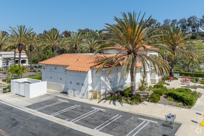
Property Record
957 Avenida Pico, San Clemente, CA 92673


NEARBY LISTINGS FOR SALE OR LEASE
Property Detail
957 Avenida Pico
Anaheim-Santa Ana-Irvine, CA
Tract No. 15786
688-021-14
N TR 15786 BLK LOT 9
Commercialnec
Orange
X
California
06073C0100G
9
2024
0.81 AC
2025
San Juan Cap/S Clemente/Dana Pt/Cap Bch
042112
Orange County (California)
DEMOGRAPHICS near 957 Avenida Pico
1 mile
3 mile
5 mile
2024 Total Population
6,357
62,677
106,388
2029 Population
6,343
62,298
105,837
Pop Growth 2024-2029
(0.22%)
(0.60%)
(0.52%)
Average Age
42
43
43
2024 Total Households
2,436
23,874
39,662
HH Growth 2024-2029
(0.08%)
(0.57%)
(0.53%)
Median Household Inc
$129,321
$131,926
$119,989
Avg Household Size
2.60
2.60
2.60
2024 Avg HH Vehicles
2.00
2.00
2.00
Median Home Value
$965,664
$1,058,890
$1,039,338
Median Year Built
1992
1982
1981
Nearby Places
Map Layers
Map Styles
 Street
 Aerial
Transit
 Traffic
 Biking
Places
Listings with unknown addresses are not visible on the map
- Restaurants
- Banks
- Shops
- Fitness
- Groceries
PUBLIC TRANSPORTATION
COMMUTER RAIL
Drive
Walk
Distance
6 min
2.4 mi
San Clemente Pier (Orange County Line - Southern California Regional Rail Authority (Metrolink))
Drive
Walk
Distance
San Clemente Pier (Orange County Line - Southern California Regional Rail Authority (Metrolink))
9 min
3.3 mi
AIRPORT
John Wayne/Orange County
Drive
Walk
Distance
John Wayne/Orange County
35 min
27.7 mi
Long Beach (Daugherty Field)
Drive
Walk
Distance
Long Beach (Daugherty Field)
58 min
47.8 mi
Freight Ports
Port of Long Beach
Drive
Walk
Distance
Port of Long Beach
64 min
47.4 mi
Nearby Properties
Address
Land Use
TOTAL SIZE
Lot Size
Zoning
Address
Land Use
TOTAL SIZE
Lot Size
Zoning
Address
Land Use
TOTAL SIZE
Lot Size
Zoning
Address
Land Use
TOTAL SIZE
Lot Size
Zoning
Address
Land Use
TOTAL SIZE
Lot Size
Zoning
Address
Land Use
TOTAL SIZE
Lot Size
Zoning
66.67 AC
Address
Land Use
TOTAL SIZE
Lot Size
Zoning
17.29 AC
Address
Land Use
TOTAL SIZE
Lot Size
Zoning
Address
Land Use
TOTAL SIZE
Lot Size
Zoning
Address
Land Use
TOTAL SIZE
Lot Size
Zoning
Address
Land Use
TOTAL SIZE
Lot Size
Zoning
Address
Land Use
TOTAL SIZE
Lot Size
Zoning
Address
Land Use
TOTAL SIZE
Lot Size
Zoning
Address
Land Use
TOTAL SIZE
Lot Size
Zoning
Address
Land Use
TOTAL SIZE
Lot Size
Zoning
1,458 SF
11.59 AC
Address
Land Use
TOTAL SIZE
Lot Size
Zoning
Address
Land Use
TOTAL SIZE
Lot Size
Zoning
Address
Land Use
TOTAL SIZE
Lot Size
Zoning
Address
Land Use
TOTAL SIZE
Lot Size
Zoning
Address
Land Use
TOTAL SIZE
Lot Size
Zoning
61,317 SF
3.62 AC
C3
Address
Land Use
TOTAL SIZE
Lot Size
Zoning
Address
Land Use
TOTAL SIZE
Lot Size
Zoning
12,768 SF
0.60 AC
C
Address
Land Use
TOTAL SIZE
Lot Size
Zoning
5,256 SF
1.48 AC
Address
Land Use
TOTAL SIZE
Lot Size
Zoning
31,500 SF
1.13 AC
OP
Address
Land Use
TOTAL SIZE
Lot Size
Zoning
Address
Land Use
TOTAL SIZE
Lot Size
Zoning
Address
Land Use
TOTAL SIZE
Lot Size
Zoning
10.75 AC
Address
Land Use
TOTAL SIZE
Lot Size
Zoning
Address
Land Use
TOTAL SIZE
Lot Size
Zoning
43.55 AC
Address
Land Use
TOTAL SIZE
Lot Size
Zoning
Address
Land Use
TOTAL SIZE
Lot Size
Zoning
The World's #1 Commercial Real Estate Marketplace
Connect with us
© 2026 CoStar Group
The information above has been obtained from sources believed reliable. While we do not doubt its accuracy we have not verified it and make no guarantee, warranty or representation about it. It is your responsibility to independently confirm its accuracy and completeness. Any projections, opinions, assumptions, or estimates used are for example only and do not represent the current or future performance of the property. The value of this transaction to you depends on tax and other factors which should be evaluated by your tax, financial, and legal advisors. You and your advisors should conduct a careful, independent investigation of the property to determine to your satisfaction the suitability of the property for your needs.