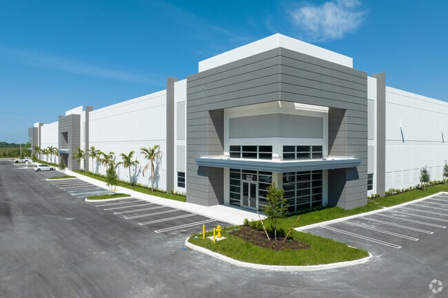
Property Record
9535 Nw 174Th St, Hialeah, FL 33018
Current Lease Availabilities
NEARBY LISTINGS FOR SALE OR LEASE
Property Detail
9535 Nw 174Th St
Miami-Miami Beach-Kendall, FL
Natura
30-2009-013-0010
NATURA PB 176-060 T-24311 TR A LOT SIZE 1007609 SQ FT M/L FAU 30-2009-001-0450-0460 & 0475
Warehouse
Miami/Dade
2024
Florida
2025
23.13 AC
012403
Outlying Miami-Dade
507,170 SF
South Florida
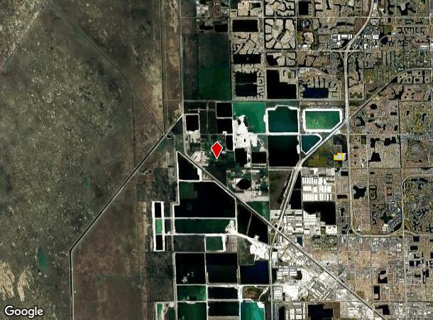
DEMOGRAPHICS near 9535 Nw 174Th St
1 mile
3 mile
5 mile
2024 Total Population
11,161
111,536
301,408
2029 Population
11,164
109,181
294,137
Pop Growth 2024-2029
+ 0.03%
(2.11%)
(2.41%)
Average Age
36
39
41
2024 Total Households
3,190
35,620
97,461
HH Growth 2024-2029
(0.41%)
(2.51%)
(2.83%)
Median Household Inc
$115,748
$80,252
$67,353
Avg Household Size
3.40
3.10
3.00
2024 Avg HH Vehicles
2.00
2.00
2.00
Median Home Value
$463,667
$400,157
$363,999
Median Year Built
2010
1994
1990
Nearby Places
Map Layers
Map Styles
 Street
 Aerial
Transit
 Traffic
 Biking
Places
Listings with unknown addresses are not visible on the map
- Restaurants
- Banks
- Shops
- Fitness
- Groceries
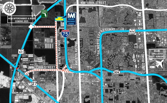
PUBLIC TRANSPORTATION
AIRPORT
Miami International
Drive
Walk
Distance
Miami International
33 min
16.1 mi
Fort Lauderdale/Hollywood International
Drive
Walk
Distance
Fort Lauderdale/Hollywood International
43 min
28.2 mi
Freight Ports
Port of Miami
Drive
Walk
Distance
Port of Miami
45 min
22.6 mi
Nearby Properties
Address
Land Use
TOTAL SIZE
Lot Size
Zoning
Address
Land Use
TOTAL SIZE
Lot Size
Zoning
483,328 SF
63.80 AC
7701
Address
Land Use
TOTAL SIZE
Lot Size
Zoning
724,587 SF
48.54 AC
7701
Address
Land Use
TOTAL SIZE
Lot Size
Zoning
225,631 SF
11.39 AC
7701
Address
Land Use
TOTAL SIZE
Lot Size
Zoning
214,502 SF
10.20 AC
7701
Address
Land Use
TOTAL SIZE
Lot Size
Zoning
205,148 SF
10.26 AC
7701
Address
Land Use
TOTAL SIZE
Lot Size
Zoning
201,348 SF
9.48 AC
7701
Address
Land Use
TOTAL SIZE
Lot Size
Zoning
201,141 SF
9.48 AC
7701
Address
Land Use
TOTAL SIZE
Lot Size
Zoning
201,141 SF
9.47 AC
7701
Address
Land Use
TOTAL SIZE
Lot Size
Zoning
207,952 SF
8.93 AC
7100
Address
Land Use
TOTAL SIZE
Lot Size
Zoning
212,000 SF
8.98 AC
7100
Address
Land Use
TOTAL SIZE
Lot Size
Zoning
193,111 SF
9.60 AC
7701
Address
Land Use
TOTAL SIZE
Lot Size
Zoning
81,113 SF
23.96 AC
7701
Address
Land Use
TOTAL SIZE
Lot Size
Zoning
179,352 SF
11.74 AC
7100
Address
Land Use
TOTAL SIZE
Lot Size
Zoning
163,658 SF
8.46 AC
7700
Address
Land Use
TOTAL SIZE
Lot Size
Zoning
243,128 SF
16.61 AC
7700
Address
Land Use
TOTAL SIZE
Lot Size
Zoning
137,666 SF
16.83 AC
7700
Address
Land Use
TOTAL SIZE
Lot Size
Zoning
89,502 SF
9000
Address
Land Use
TOTAL SIZE
Lot Size
Zoning
59,257 SF
9.61 AC
6501
Address
Land Use
TOTAL SIZE
Lot Size
Zoning
702 SF
51.20 AC
9000
Address
Land Use
TOTAL SIZE
Lot Size
Zoning
65,626 SF
3.76 AC
7100
Address
Land Use
TOTAL SIZE
Lot Size
Zoning
582.04 AC
RL
Address
Land Use
TOTAL SIZE
Lot Size
Zoning
42,836 SF
9000
Address
Land Use
TOTAL SIZE
Lot Size
Zoning
6,591 SF
1.89 AC
9000
Address
Land Use
TOTAL SIZE
Lot Size
Zoning
9,173 SF
316.26 AC
9000
Address
Land Use
TOTAL SIZE
Lot Size
Zoning
30,513 SF
9000
Address
Land Use
TOTAL SIZE
Lot Size
Zoning
29,198 SF
9000
The World's #1 Commercial Real Estate Marketplace
Connect with us
© 2026 CoStar Group
The information above has been obtained from sources believed reliable. While we do not doubt its accuracy we have not verified it and make no guarantee, warranty or representation about it. It is your responsibility to independently confirm its accuracy and completeness. Any projections, opinions, assumptions, or estimates used are for example only and do not represent the current or future performance of the property. The value of this transaction to you depends on tax and other factors which should be evaluated by your tax, financial, and legal advisors. You and your advisors should conduct a careful, independent investigation of the property to determine to your satisfaction the suitability of the property for your needs.