Property Record
9600 Murray Dr, La Mesa, CA 91942


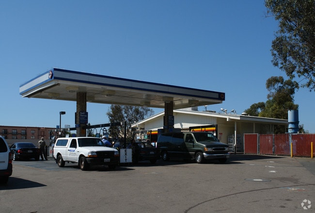
Property Detail
9600 Murray Dr
San Diego-Chula Vista-Carlsbad, CA
BLK 29 LOT 1 POR TR 000593
486-840-09
San Diego
Servicestation
California
CN
1
B and X Area of moderate flood hazard, usually the area between the limits of the 100-year and 500-year floods.
0.64 AC
2024
La Mesa
2025
San Diego
015100
NEARBY LISTINGS FOR SALE OR LEASE
DEMOGRAPHICS near 9600 Murray Dr
1 mile
3 mile
5 mile
2025 Total Population
12,112
163,919
412,596
2030 Population
12,125
164,142
412,610
Pop Growth 2025-2030
+ 0.11%
+ 0.14%
0.00%
Average Age
42
40
39
2025 Total Households
4,521
60,117
144,167
HH Growth 2025-2030
(0.07%)
+ 0.02%
(0.13%)
Median Household Inc
$106,559
$88,477
$91,546
Avg Household Size
2.60
2.60
2.70
2025 Avg HH Vehicles
2.00
2.00
2.00
Median Home Value
$847,361
$793,101
$753,889
Median Year Built
1961
1970
1973
Nearby Places
Map Layers
Map Styles
 Street
 Aerial
Layers
 Traffic
 Biking
Places
Listings with unknown addresses are not visible on the map
- Restaurants
- Banks
- Shops
- Fitness
- Groceries
PUBLIC TRANSPORTATION
TRANSIT/SUBWAY
Amaya Drive (Green Line - San Diego Metropolitan Transit System Trolley (San Diego Trolley), Orange Line - San Diego Metropolitan Transit System Trolley (San Diego Trolley))
Drive
Walk
Distance
Amaya Drive (Green Line - San Diego Metropolitan Transit System Trolley (San Diego Trolley), Orange Line - San Diego Metropolitan Transit System Trolley (San Diego Trolley))
3 min
20 min
1.0 mi
AIRPORT
San Diego International
Drive
Walk
Distance
San Diego International
22 min
15.6 mi
Freight Ports
Port of San Diego
Drive
Walk
Distance
Port of San Diego
19 min
13.0 mi
Nearby Properties
Address
Land Use
TOTAL SIZE
Lot Size
Zoning
Address
Land Use
TOTAL SIZE
Lot Size
Zoning
30.38 AC
RB
Address
Land Use
TOTAL SIZE
Lot Size
Zoning
62.04 AC
C
Address
Land Use
TOTAL SIZE
Lot Size
Zoning
6.79 AC
C
Address
Land Use
TOTAL SIZE
Lot Size
Zoning
4.77 AC
C
Address
Land Use
TOTAL SIZE
Lot Size
Zoning
6.84 AC
M
Address
Land Use
TOTAL SIZE
Lot Size
Zoning
8.65 AC
R3
Address
Land Use
TOTAL SIZE
Lot Size
Zoning
8.24 AC
RU
Address
Land Use
TOTAL SIZE
Lot Size
Zoning
7.46 AC
RM-2200
Address
Land Use
TOTAL SIZE
Lot Size
Zoning
5.90 AC
RM-2200
Address
Land Use
TOTAL SIZE
Lot Size
Zoning
92,500 SF
7.05 AC
R3
Address
Land Use
TOTAL SIZE
Lot Size
Zoning
39.17 AC
C-R
Address
Land Use
TOTAL SIZE
Lot Size
Zoning
2.82 AC
R3
Address
Land Use
TOTAL SIZE
Lot Size
Zoning
8.82 AC
RM-2200
Address
Land Use
TOTAL SIZE
Lot Size
Zoning
4.10 AC
RB
Address
Land Use
TOTAL SIZE
Lot Size
Zoning
11.28 AC
C
Address
Land Use
TOTAL SIZE
Lot Size
Zoning
5.47 AC
R3
Address
Land Use
TOTAL SIZE
Lot Size
Zoning
6.14 AC
R3
Address
Land Use
TOTAL SIZE
Lot Size
Zoning
13.48 AC
CC-1-3
Address
Land Use
TOTAL SIZE
Lot Size
Zoning
Address
Land Use
TOTAL SIZE
Lot Size
Zoning
5.83 AC
RM-2200
Address
Land Use
TOTAL SIZE
Lot Size
Zoning
84,900 SF
3.54 AC
R3
Address
Land Use
TOTAL SIZE
Lot Size
Zoning
92,988 SF
6.12 AC
RB
Address
Land Use
TOTAL SIZE
Lot Size
Zoning
5.17 AC
R3
Address
Land Use
TOTAL SIZE
Lot Size
Zoning
5.77 AC
RM-2200
Address
Land Use
TOTAL SIZE
Lot Size
Zoning
83,198 SF
5 AC
RM-2200
Address
Land Use
TOTAL SIZE
Lot Size
Zoning
6.72 AC
RM-3-7
Address
Land Use
TOTAL SIZE
Lot Size
Zoning
63,964 SF
5.25 AC
R3
Address
Land Use
TOTAL SIZE
Lot Size
Zoning
96,664 SF
1.63 AC
CIVIC CENT
Address
Land Use
TOTAL SIZE
Lot Size
Zoning
9.76 AC
C31
Address
Land Use
TOTAL SIZE
Lot Size
Zoning
98,752 SF
4.10 AC
RU
The World's #1 Commercial Real Estate Marketplace
Connect with us
© 2026 CoStar Group
The information above has been obtained from sources believed reliable. While we do not doubt its accuracy we have not verified it and make no guarantee, warranty or representation about it. It is your responsibility to independently confirm its accuracy and completeness. Any projections, opinions, assumptions, or estimates used are for example only and do not represent the current or future performance of the property. The value of this transaction to you depends on tax and other factors which should be evaluated by your tax, financial, and legal advisors. You and your advisors should conduct a careful, independent investigation of the property to determine to your satisfaction the suitability of the property for your needs.