Property Record
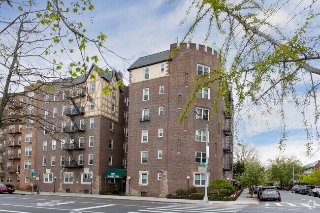
9615 Shore Rd, Brooklyn, NY 11209


NEARBY LISTINGS FOR SALE OR LEASE
Property Detail
9615 Shore Rd
06124-00012G
Kings
Cooperative
New York
X
1
3604970331F
0.22 AC
2024
Bay Ridge
2025
Long Island (New York)
005601
New York-Jersey City-White Plains, NY-NJ
44,400 SF
DEMOGRAPHICS near 9615 Shore Rd
1 mile
3 mile
5 mile
2024 Total Population
41,982
490,060
1,240,370
2029 Population
39,545
454,150
1,167,763
Pop Growth 2024-2029
(5.80%)
(7.33%)
(5.85%)
Average Age
43
39
40
2024 Total Households
18,572
162,017
432,376
HH Growth 2024-2029
(6.24%)
(7.55%)
(6.09%)
Median Household Inc
$80,255
$62,785
$67,806
Avg Household Size
2.20
2.90
2.70
2024 Avg HH Vehicles
1.00
1.00
1.00
Median Home Value
$841,591
$819,766
$799,801
Median Year Built
1947
1947
1948
Nearby Places
Map Layers
Map Styles
 Street
 Aerial
Transit
 Traffic
 Biking
Places
Listings with unknown addresses are not visible on the map
- Restaurants
- Banks
- Shops
- Fitness
- Groceries
PUBLIC TRANSPORTATION
TRANSIT/SUBWAY
Bay Ridge-95 Street (R - New York MTA Subway (The Subway))
Drive
Walk
Distance
Bay Ridge-95 Street (R - New York MTA Subway (The Subway))
2 min
10 min
0.5 mi
86 Street (R Line) (R - New York MTA Subway (The Subway))
Drive
Walk
Distance
86 Street (R Line) (R - New York MTA Subway (The Subway))
2 min
18 min
1.0 mi
COMMUTER RAIL
Clifton (Staten Island Railway - New York MTA Subway (The Subway))
Drive
Walk
Distance
Clifton (Staten Island Railway - New York MTA Subway (The Subway))
11 min
5.3 mi
Stapleton (Staten Island Railway - New York MTA Subway (The Subway))
Drive
Walk
Distance
Stapleton (Staten Island Railway - New York MTA Subway (The Subway))
13 min
6.0 mi
AIRPORT
LaGuardia
Drive
Walk
Distance
LaGuardia
31 min
18.1 mi
John F Kennedy International
Drive
Walk
Distance
John F Kennedy International
28 min
19.8 mi
Newark Liberty International
Drive
Walk
Distance
Newark Liberty International
32 min
20.0 mi
Freight Ports
GCT Bayonne
Drive
Walk
Distance
GCT Bayonne
29 min
15.8 mi
Nearby Properties
Address
Land Use
TOTAL SIZE
Lot Size
Zoning
Address
Land Use
TOTAL SIZE
Lot Size
Zoning
1,524,659 SF
170.96 AC
R4
Address
Land Use
TOTAL SIZE
Lot Size
Zoning
965,600 SF
6.65 AC
R5
Address
Land Use
TOTAL SIZE
Lot Size
Zoning
460,000 SF
3.21 AC
R6
Address
Land Use
TOTAL SIZE
Lot Size
Zoning
305,093 SF
0.60 AC
C1-9
Address
Land Use
TOTAL SIZE
Lot Size
Zoning
335,800 SF
1.51 AC
R6
Address
Land Use
TOTAL SIZE
Lot Size
Zoning
340,837 SF
0.61 AC
C1-9
Address
Land Use
TOTAL SIZE
Lot Size
Zoning
397,354 SF
0.61 AC
C5-2
Address
Land Use
TOTAL SIZE
Lot Size
Zoning
340,068 SF
0.58 AC
C2-8
Address
Land Use
TOTAL SIZE
Lot Size
Zoning
340,068 SF
0.58 AC
C2-8
Address
Land Use
TOTAL SIZE
Lot Size
Zoning
135,000 SF
117.71 AC
PARK
Address
Land Use
TOTAL SIZE
Lot Size
Zoning
236,591 SF
207.66 AC
R3-2
Address
Land Use
TOTAL SIZE
Lot Size
Zoning
537,885 SF
2.98 AC
R8
Address
Land Use
TOTAL SIZE
Lot Size
Zoning
808,372 SF
0.18 AC
R6
Address
Land Use
TOTAL SIZE
Lot Size
Zoning
5,359,400 SF
59.07 AC
M2-1
Address
Land Use
TOTAL SIZE
Lot Size
Zoning
286,000 SF
12.63 AC
PARK
Address
Land Use
TOTAL SIZE
Lot Size
Zoning
370,248 SF
0.52 AC
C1-9
Address
Land Use
TOTAL SIZE
Lot Size
Zoning
418,000 SF
0.78 AC
R10A
Address
Land Use
TOTAL SIZE
Lot Size
Zoning
301,400 SF
22.27 AC
M3-1
Address
Land Use
TOTAL SIZE
Lot Size
Zoning
310,068 SF
0.58 AC
C2-8
Address
Land Use
TOTAL SIZE
Lot Size
Zoning
492,962 SF
8.12 AC
M1-1
Address
Land Use
TOTAL SIZE
Lot Size
Zoning
139,557 SF
11.47 AC
M1-1
Address
Land Use
TOTAL SIZE
Lot Size
Zoning
171,591 SF
0.14 AC
C5-2
Address
Land Use
TOTAL SIZE
Lot Size
Zoning
305,093 SF
0.60 AC
C1-9
Address
Land Use
TOTAL SIZE
Lot Size
Zoning
581,250 SF
3.22 AC
M3-1
Address
Land Use
TOTAL SIZE
Lot Size
Zoning
112,900 SF
0.22 AC
R10A
Address
Land Use
TOTAL SIZE
Lot Size
Zoning
369,046 SF
2.11 AC
R6A
Address
Land Use
TOTAL SIZE
Lot Size
Zoning
369,046 SF
2.11 AC
R6A
Address
Land Use
TOTAL SIZE
Lot Size
Zoning
369,046 SF
2.11 AC
R6A
Address
Land Use
TOTAL SIZE
Lot Size
Zoning
369,046 SF
2.11 AC
R6A
Address
Land Use
TOTAL SIZE
Lot Size
Zoning
369,046 SF
2.11 AC
R6A
The World's #1 Commercial Real Estate Marketplace
Connect with us
© 2026 CoStar Group
The information above has been obtained from sources believed reliable. While we do not doubt its accuracy we have not verified it and make no guarantee, warranty or representation about it. It is your responsibility to independently confirm its accuracy and completeness. Any projections, opinions, assumptions, or estimates used are for example only and do not represent the current or future performance of the property. The value of this transaction to you depends on tax and other factors which should be evaluated by your tax, financial, and legal advisors. You and your advisors should conduct a careful, independent investigation of the property to determine to your satisfaction the suitability of the property for your needs.