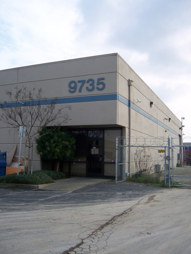
Property Record
9766 Waterman Rd, Elk Grove, CA 95624
NEARBY LISTINGS FOR SALE OR LEASE
Property Detail
9766 Waterman Rd
134-0580-018
Jmvz Industrial Park
Multitenantindustrial
PCLS 10 AND 11 IN BK 63 OF PARCEL MAPS, PG 14. CONTG2.10 AC M/L.
X
Sacramento
06067C0338H
California
2024
2.10 AC
2025
Elk Grove/Laguna
009310
Sacramento
27,976 SF
Sacramento--Roseville--Arden-Arcade, CA
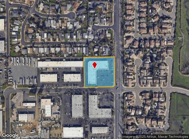
DEMOGRAPHICS near 9766 Waterman Rd
1 Mile
3 Mile
5 Mile
2024 Total Population
16,403
60,208
188,754
2029 Population
16,609
60,939
190,249
Pop Growth 2024-2029
+ 1.26%
+ 1.21%
+ 0.79%
Average Age
39
39
38
2024 Total Households
5,006
18,706
57,311
HH Growth 2024-2029
+ 1.10%
+ 1.14%
+ 0.75%
Median Household Inc
$116,481
$113,266
$104,456
Avg Household Size
3.20
3.10
3.20
2024 Avg HH Vehicles
2.00
2.00
2.00
Median Home Value
$588,095
$600,069
$525,904
Median Year Built
1997
1996
1999
Nearby Places
Map Layers
Map Styles
 Street
 Aerial
- Restaurants
- Banks
- Shops
- Fitness
- Groceries
PUBLIC TRANSPORTATION
AIRPORT
Sacramento International
DRIVE
WALK
Distance
Sacramento International
40 min
27.9 mi
Stockton Metro
DRIVE
WALK
Distance
Stockton Metro
51 min
39.5 mi
SALE & LEASE HISTORY
LISTING DATE
SALE/LEASE

Sep 24, 2016
For Lease
Nearby Properties
Address
Land Use
TOTAL SIZE
Lot Size
Zoning
Address
Land Use
TOTAL SIZE
Lot Size
Zoning
43.54 AC
LI
Address
Land Use
TOTAL SIZE
Lot Size
Zoning
7.65 AC
RD-20
Address
Land Use
TOTAL SIZE
Lot Size
Zoning
43.06 AC
LRSPA
Address
Land Use
TOTAL SIZE
Lot Size
Zoning
221,556 SF
20.10 AC
HI
Address
Land Use
TOTAL SIZE
Lot Size
Zoning
147,920 SF
18.20 AC
SC
Address
Land Use
TOTAL SIZE
Lot Size
Zoning
64,579 SF
5.41 AC
LRSPA
Address
Land Use
TOTAL SIZE
Lot Size
Zoning
242,577 SF
0.10 AC
RD-20
Address
Land Use
TOTAL SIZE
Lot Size
Zoning
105,511 SF
4.79 AC
BP
Address
Land Use
TOTAL SIZE
Lot Size
Zoning
105,511 SF
6.67 AC
BP
Address
Land Use
TOTAL SIZE
Lot Size
Zoning
111,489 SF
4.96 AC
MP
Address
Land Use
TOTAL SIZE
Lot Size
Zoning
76,090 SF
3.32 AC
RD-25
Address
Land Use
TOTAL SIZE
Lot Size
Zoning
110,372 SF
2.68 AC
BP
Address
Land Use
TOTAL SIZE
Lot Size
Zoning
102,526 SF
4.06 AC
MP
Address
Land Use
TOTAL SIZE
Lot Size
Zoning
100 SF
50.85 AC
LRSPA
Address
Land Use
TOTAL SIZE
Lot Size
Zoning
66,793 SF
2.48 AC
SC
Address
Land Use
TOTAL SIZE
Lot Size
Zoning
5.38 AC
SC
Address
Land Use
TOTAL SIZE
Lot Size
Zoning
71,987 SF
3.73 AC
BP
Address
Land Use
TOTAL SIZE
Lot Size
Zoning
63,550 SF
5.53 AC
AC
Address
Land Use
TOTAL SIZE
Lot Size
Zoning
21.18 AC
HI
Address
Land Use
TOTAL SIZE
Lot Size
Zoning
45,413 SF
7.31 AC
SC
Address
Land Use
TOTAL SIZE
Lot Size
Zoning
53,949 SF
5.33 AC
AC
Address
Land Use
TOTAL SIZE
Lot Size
Zoning
15.50 AC
LRSPA
Address
Land Use
TOTAL SIZE
Lot Size
Zoning
1.99 AC
GC
Address
Land Use
TOTAL SIZE
Lot Size
Zoning
14.46 AC
LRSPA
Address
Land Use
TOTAL SIZE
Lot Size
Zoning
13.28 AC
LRSPA
Address
Land Use
TOTAL SIZE
Lot Size
Zoning
125,640 SF
10.25 AC
SC
Address
Land Use
TOTAL SIZE
Lot Size
Zoning
150,210 SF
6.25 AC
LI
Address
Land Use
TOTAL SIZE
Lot Size
Zoning
94,365 SF
6.49 AC
RD-20
Address
Land Use
TOTAL SIZE
Lot Size
Zoning
3.71 AC
RD-20
Address
Land Use
TOTAL SIZE
Lot Size
Zoning
56,892 SF
6.18 AC
AC
The World's #1 Commercial Real Estate Marketplace
Connect with us
© 2026 CoStar Group
The information above has been obtained from sources believed reliable. While we do not doubt its accuracy we have not verified it and make no guarantee, warranty or representation about it. It is your responsibility to independently confirm its accuracy and completeness. Any projections, opinions, assumptions, or estimates used are for example only and do not represent the current or future performance of the property. The value of this transaction to you depends on tax and other factors which should be evaluated by your tax, financial, and legal advisors. You and your advisors should conduct a careful, independent investigation of the property to determine to your satisfaction the suitability of the property for your needs.