Property Record
984 2Nd Street Pike, Richboro, PA 18954


NEARBY LISTINGS FOR SALE OR LEASE
-
-
View all Richboro listings for sale on LoopNet.com
Property Detail
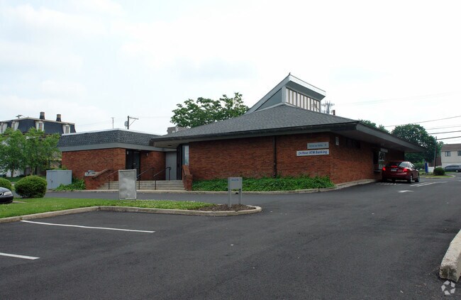
984 2Nd Street Pike
31-009-011
EXEMPT 36.73AC WS 2ND ST PIKE (SR232) 2176FT N OF STREET
Financialbuilding
Bucks
X
Pennsylvania
42017C0409K
2.12 AC
0
Lower Bucks County
2025
Philadelphia
105013
Philadelphia-Camden-Wilmington, PA-NJ-DE-MD
3,812 SF
DEMOGRAPHICS near 984 2Nd Street Pike
1 Mile
3 Mile
5 Mile
2024 Total Population
6,622
40,510
138,949
2029 Population
6,598
40,346
139,075
Pop Growth 2024-2029
(0.36%)
(0.40%)
+ 0.09%
Average Age
44
44
44
2024 Total Households
2,186
14,040
52,693
HH Growth 2024-2029
(0.32%)
(0.43%)
+ 0.15%
Median Household Inc
$143,403
$126,036
$107,480
Avg Household Size
3.00
2.80
2.60
2024 Avg HH Vehicles
2.00
2.00
2.00
Median Home Value
$482,226
$449,512
$412,835
Median Year Built
1979
1976
1978
Nearby Places
Map Layers
Map Styles
 Street
 Aerial
- Restaurants
- Banks
- Shops
- Fitness
- Groceries
PUBLIC TRANSPORTATION
COMMUTER RAIL
Warminster (R2 - Southeastern Pennsylvania Transportation Authority Regional Rail (SEPTA Regional Rail))
DRIVE
WALK
Distance
Warminster (R2 - Southeastern Pennsylvania Transportation Authority Regional Rail (SEPTA Regional Rail))
12 min
6.2 mi
Trevose (R3 - Southeastern Pennsylvania Transportation Authority Regional Rail (SEPTA Regional Rail))
DRIVE
WALK
Distance
Trevose (R3 - Southeastern Pennsylvania Transportation Authority Regional Rail (SEPTA Regional Rail))
13 min
6.7 mi
AIRPORT
Trenton Mercer
DRIVE
WALK
Distance
Trenton Mercer
25 min
14.1 mi
Philadelphia International
DRIVE
WALK
Distance
Philadelphia International
56 min
33.1 mi
Lehigh Valley International
DRIVE
WALK
Distance
Lehigh Valley International
77 min
43.8 mi
Freight Ports
Port of Philadelphia
DRIVE
WALK
Distance
Port of Philadelphia
33 min
18.8 mi
Nearby Properties
Address
Land Use
TOTAL SIZE
Lot Size
Zoning
Address
Land Use
TOTAL SIZE
Lot Size
Zoning
78,743 SF
44.63 AC
IP
Address
Land Use
TOTAL SIZE
Lot Size
Zoning
56,440 SF
11.55 AC
R2
Address
Land Use
TOTAL SIZE
Lot Size
Zoning
110,473 SF
13.96 AC
C
Address
Land Use
TOTAL SIZE
Lot Size
Zoning
94,271 SF
8.96 AC
C3
Address
Land Use
TOTAL SIZE
Lot Size
Zoning
155,000 SF
16.18 AC
I1
Address
Land Use
TOTAL SIZE
Lot Size
Zoning
800 SF
147.62 AC
QA
Address
Land Use
TOTAL SIZE
Lot Size
Zoning
26,082 SF
11.39 AC
R2
Address
Land Use
TOTAL SIZE
Lot Size
Zoning
31,626 SF
3.26 AC
C2
Address
Land Use
TOTAL SIZE
Lot Size
Zoning
24,276 SF
153.05 AC
AR
Address
Land Use
TOTAL SIZE
Lot Size
Zoning
56,301 SF
12.02 AC
I1
Address
Land Use
TOTAL SIZE
Lot Size
Zoning
19,410 SF
7.53 AC
IP
Address
Land Use
TOTAL SIZE
Lot Size
Zoning
70,250 SF
6.40 AC
I1
Address
Land Use
TOTAL SIZE
Lot Size
Zoning
78,824 SF
5.34 AC
I1
Address
Land Use
TOTAL SIZE
Lot Size
Zoning
71,654 SF
5.56 AC
I1
Address
Land Use
TOTAL SIZE
Lot Size
Zoning
1,494 SF
0.46 AC
R2
Address
Land Use
TOTAL SIZE
Lot Size
Zoning
61,965 SF
17.64 AC
I
Address
Land Use
TOTAL SIZE
Lot Size
Zoning
57,007 SF
5.65 AC
I1
Address
Land Use
TOTAL SIZE
Lot Size
Zoning
54,616 SF
4.32 AC
I1
Address
Land Use
TOTAL SIZE
Lot Size
Zoning
49,980 SF
4.63 AC
I1
Address
Land Use
TOTAL SIZE
Lot Size
Zoning
49,680 SF
4.03 AC
I1
Address
Land Use
TOTAL SIZE
Lot Size
Zoning
23,492 SF
1.61 AC
I1
Address
Land Use
TOTAL SIZE
Lot Size
Zoning
41,263 SF
4.19 AC
I-1
Address
Land Use
TOTAL SIZE
Lot Size
Zoning
20,121 SF
2.25 AC
C2
Address
Land Use
TOTAL SIZE
Lot Size
Zoning
55,750 SF
4.06 AC
R1
Address
Land Use
TOTAL SIZE
Lot Size
Zoning
5,312 SF
1.94 AC
R2
Address
Land Use
TOTAL SIZE
Lot Size
Zoning
30,000 SF
2.28 AC
I1
Address
Land Use
TOTAL SIZE
Lot Size
Zoning
33,335 SF
2.22 AC
I1
Address
Land Use
TOTAL SIZE
Lot Size
Zoning
39,231 SF
4.07 AC
I1
Address
Land Use
TOTAL SIZE
Lot Size
Zoning
23,070 SF
3.97 AC
C2
Address
Land Use
TOTAL SIZE
Lot Size
Zoning
8,075 SF
2.38 AC
R1
The World's #1 Commercial Real Estate Marketplace
Connect with us
© 2025 CoStar Group
The information above has been obtained from sources believed reliable. While we do not doubt its accuracy we have not verified it and make no guarantee, warranty or representation about it. It is your responsibility to independently confirm its accuracy and completeness. Any projections, opinions, assumptions, or estimates used are for example only and do not represent the current or future performance of the property. The value of this transaction to you depends on tax and other factors which should be evaluated by your tax, financial, and legal advisors. You and your advisors should conduct a careful, independent investigation of the property to determine to your satisfaction the suitability of the property for your needs.