Property Record
Andre Dr, Chalfont, PA 18914

Save to a Folder
{{folder.Name}}
{{folder.ListingIds.length}} Properties
{{folder.ListingIds.length}} Property
Create a New Folder
Property Detail
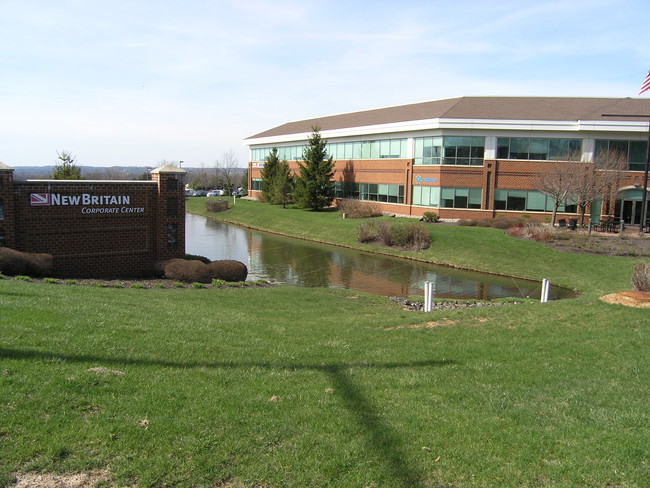
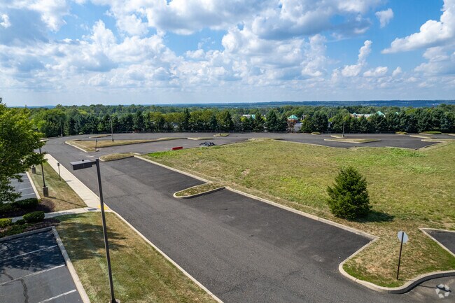
Andre Dr
Philadelphia-Camden-Wilmington, PA-NJ-DE-MD
6.68AC LOT #2 NEW BRITAIN CORP CTR(REV) 215 ON ANDRE DR
26-005-049-012
BUCKS
Commercialnec
Pennsylvania
C3
2
B and X Area of moderate flood hazard, usually the area between the limits of the 100-year and 500-year floods.
6.68 AC
2025
Upper Bucks County
2026
Philadelphia
101900
NEARBY LISTINGS FOR SALE OR LEASE
DEMOGRAPHICS near Andre Dr
1 mile
3 mile
5 mile
2025 Total Population
9,680
53,538
146,749
2030 Population
9,736
54,362
150,251
Pop Growth 2025-2030
+ 0.58%
+ 1.54%
+ 2.39%
Average Age
43
43
42
2025 Total Households
3,695
19,616
54,394
HH Growth 2025-2030
+ 0.62%
+ 1.60%
+ 2.27%
Median Household Inc
$115,922
$127,690
$112,837
Avg Household Size
2.60
2.70
2.60
2025 Avg HH Vehicles
2.00
2.00
2.00
Median Home Value
$454,587
$482,897
$480,141
Median Year Built
1986
1986
1982
Nearby Places
Map Layers
Map Styles
 Street
 Aerial
Layers
 Traffic
 Biking
Places
Listings with unknown addresses are not visible on the map
- Restaurants
- Banks
- Shops
- Fitness
- Groceries
PUBLIC TRANSPORTATION
COMMUTER RAIL
Link Belt (R5 - Southeastern Pennsylvania Transportation Authority Regional Rail (SEPTA Regional Rail))
Drive
Walk
Distance
Link Belt (R5 - Southeastern Pennsylvania Transportation Authority Regional Rail (SEPTA Regional Rail))
4 min
1.8 mi
Colmar (R5 - Southeastern Pennsylvania Transportation Authority Regional Rail (SEPTA Regional Rail))
Drive
Walk
Distance
Colmar (R5 - Southeastern Pennsylvania Transportation Authority Regional Rail (SEPTA Regional Rail))
6 min
2.4 mi
AIRPORT
Trenton Mercer
Drive
Walk
Distance
Trenton Mercer
50 min
29.2 mi
Lehigh Valley International
Drive
Walk
Distance
Lehigh Valley International
57 min
34.7 mi
Philadelphia International
Drive
Walk
Distance
Philadelphia International
62 min
36.3 mi
Freight Ports
Port of Philadelphia
Drive
Walk
Distance
Port of Philadelphia
41 min
24.8 mi
SALE & LEASE HISTORY
LISTING DATE
SALE/LEASE

Sep 24, 2016
For Sale
Jul 08, 2019
For Lease
Jan 31, 2017
For Sale
Aug 09, 2018
For Sale
Aug 09, 2018
For Lease
Apr 21, 2017
For Sale
Nearby Properties
Address
Land Use
TOTAL SIZE
Lot Size
Zoning
Address
Land Use
TOTAL SIZE
Lot Size
Zoning
258,179 SF
65.34 AC
IN
Address
Land Use
TOTAL SIZE
Lot Size
Zoning
1,127,663 SF
14.16 AC
RS
Address
Land Use
TOTAL SIZE
Lot Size
Zoning
319,136 SF
18.35 AC
HDR
Address
Land Use
TOTAL SIZE
Lot Size
Zoning
301,431 SF
41.90 AC
S
Address
Land Use
TOTAL SIZE
Lot Size
Zoning
517,834 SF
31.33 AC
GA
Address
Land Use
TOTAL SIZE
Lot Size
Zoning
418,962 SF
37.87 AC
O1
Address
Land Use
TOTAL SIZE
Lot Size
Zoning
283,615 SF
9.43 AC
LI
Address
Land Use
TOTAL SIZE
Lot Size
Zoning
245,104 SF
31.21 AC
C
Address
Land Use
TOTAL SIZE
Lot Size
Zoning
203,378 SF
24.65 AC
RC
Address
Land Use
TOTAL SIZE
Lot Size
Zoning
985,663 SF
64.82 AC
RC
Address
Land Use
TOTAL SIZE
Lot Size
Zoning
334,450 SF
18.86 AC
GA
Address
Land Use
TOTAL SIZE
Lot Size
Zoning
142,336 SF
3.17 AC
RS
Address
Land Use
TOTAL SIZE
Lot Size
Zoning
333,600 SF
24.72 AC
LI
Address
Land Use
TOTAL SIZE
Lot Size
Zoning
135,540 SF
27.77 AC
A1
Address
Land Use
TOTAL SIZE
Lot Size
Zoning
89,349 SF
18.11 AC
R1
Address
Land Use
TOTAL SIZE
Lot Size
Zoning
87,819 SF
1.82 AC
S
Address
Land Use
TOTAL SIZE
Lot Size
Zoning
77,875 SF
18.59 AC
RA
Address
Land Use
TOTAL SIZE
Lot Size
Zoning
119,740 SF
9.80 AC
BP
Address
Land Use
TOTAL SIZE
Lot Size
Zoning
136,473 SF
9.44 AC
LI
Address
Land Use
TOTAL SIZE
Lot Size
Zoning
88,060 SF
20.74 AC
R1
Address
Land Use
TOTAL SIZE
Lot Size
Zoning
76,464 SF
21.67 AC
A1
Address
Land Use
TOTAL SIZE
Lot Size
Zoning
77,805 SF
21.18 AC
R2
Address
Land Use
TOTAL SIZE
Lot Size
Zoning
148,670 SF
4.63 AC
C
Address
Land Use
TOTAL SIZE
Lot Size
Zoning
134,272 SF
3.11 AC
S
Address
Land Use
TOTAL SIZE
Lot Size
Zoning
38,713 SF
12.89 AC
LI
Address
Land Use
TOTAL SIZE
Lot Size
Zoning
164,376 SF
12.87 AC
LI
Address
Land Use
TOTAL SIZE
Lot Size
Zoning
57,420 SF
2 AC
IN
Address
Land Use
TOTAL SIZE
Lot Size
Zoning
65,890 SF
5.01 AC
LI
Address
Land Use
TOTAL SIZE
Lot Size
Zoning
183,600 SF
18.26 AC
LI
Address
Land Use
TOTAL SIZE
Lot Size
Zoning
380,875 SF
40.10 AC
LI
The World's #1 Commercial Real Estate Marketplace
Connect with us
© 2026 CoStar Group
The information above has been obtained from sources believed reliable. While we do not doubt its accuracy we have not verified it and make no guarantee, warranty or representation about it. It is your responsibility to independently confirm its accuracy and completeness. Any projections, opinions, assumptions, or estimates used are for example only and do not represent the current or future performance of the property. The value of this transaction to you depends on tax and other factors which should be evaluated by your tax, financial, and legal advisors. You and your advisors should conduct a careful, independent investigation of the property to determine to your satisfaction the suitability of the property for your needs.