Property Record
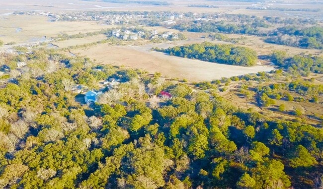
Arsburn Rd, Charleston, SC 29412

Property Detail
Arsburn Rd
Charleston-North Charleston, SC
DESCRIPTION -LOT 4
334-05-00-071
CHARLESTON
Residentialacreage
South Carolina
AE The base floodplain where base flood elevations are provided. AE Zones are now used on new format FIRMs instead of A1-A30 Zones.
4
2025
1.34 AC
2024
James Island/Folly Beach
002002
Charleston/N Charleston
NEARBY LISTINGS FOR SALE OR LEASE
DEMOGRAPHICS near Arsburn Rd
1 mile
3 mile
5 mile
2025 Total Population
2,887
17,144
41,957
2030 Population
3,036
17,658
43,290
Pop Growth 2025-2030
+ 5.16%
+ 3.00%
+ 3.18%
Average Age
44
43
42
2025 Total Households
1,310
7,776
18,479
HH Growth 2025-2030
+ 5.27%
+ 3.07%
+ 3.27%
Median Household Inc
$93,111
$100,258
$102,369
Avg Household Size
2.20
2.20
2.20
2025 Avg HH Vehicles
2.00
2.00
2.00
Median Home Value
$493,468
$463,353
$512,758
Median Year Built
2002
1992
1989
Nearby Places
Map Layers
Map Styles
 Street
 Aerial
Layers
 Traffic
 Biking
Places
Listings with unknown addresses are not visible on the map
- Restaurants
- Banks
- Shops
- Fitness
- Groceries
PUBLIC TRANSPORTATION
AIRPORT
Charleston AFB/International
Drive
Walk
Distance
Charleston AFB/International
36 min
20.1 mi
Freight Ports
Columbus Street Terminal
Drive
Walk
Distance
Columbus Street Terminal
17 min
9.3 mi
SALE & LEASE HISTORY
LISTING DATE
SALE/LEASE

Sep 09, 2018
For Sale
Feb 04, 2020
For Sale
Apr 10, 2019
For Sale
Nearby Properties
Address
Land Use
TOTAL SIZE
Lot Size
Zoning
Address
Land Use
TOTAL SIZE
Lot Size
Zoning
3,780 SF
14.35 AC
Address
Land Use
TOTAL SIZE
Lot Size
Zoning
14,474 SF
23.53 AC
Address
Land Use
TOTAL SIZE
Lot Size
Zoning
119.64 AC
Address
Land Use
TOTAL SIZE
Lot Size
Zoning
Address
Land Use
TOTAL SIZE
Lot Size
Zoning
Address
Land Use
TOTAL SIZE
Lot Size
Zoning
2,896 SF
18.13 AC
Address
Land Use
TOTAL SIZE
Lot Size
Zoning
11.80 AC
Address
Land Use
TOTAL SIZE
Lot Size
Zoning
7.46 AC
Address
Land Use
TOTAL SIZE
Lot Size
Zoning
3.94 AC
Address
Land Use
TOTAL SIZE
Lot Size
Zoning
39,428 SF
17.98 AC
Address
Land Use
TOTAL SIZE
Lot Size
Zoning
1,348 SF
6.87 AC
Address
Land Use
TOTAL SIZE
Lot Size
Zoning
122,930 SF
22.78 AC
Address
Land Use
TOTAL SIZE
Lot Size
Zoning
11,270 SF
1.16 AC
Address
Land Use
TOTAL SIZE
Lot Size
Zoning
Address
Land Use
TOTAL SIZE
Lot Size
Zoning
2,459 SF
0.39 AC
Address
Land Use
TOTAL SIZE
Lot Size
Zoning
34,233 SF
9.64 AC
Address
Land Use
TOTAL SIZE
Lot Size
Zoning
16,188 SF
2.28 AC
Address
Land Use
TOTAL SIZE
Lot Size
Zoning
11,428 SF
3.05 AC
Address
Land Use
TOTAL SIZE
Lot Size
Zoning
3,208 SF
1.36 AC
Address
Land Use
TOTAL SIZE
Lot Size
Zoning
4,108 SF
0.23 AC
Address
Land Use
TOTAL SIZE
Lot Size
Zoning
5,341 SF
1.31 AC
Address
Land Use
TOTAL SIZE
Lot Size
Zoning
Address
Land Use
TOTAL SIZE
Lot Size
Zoning
1,489 SF
0.23 AC
Address
Land Use
TOTAL SIZE
Lot Size
Zoning
0.48 AC
Address
Land Use
TOTAL SIZE
Lot Size
Zoning
2,002 SF
0.23 AC
Address
Land Use
TOTAL SIZE
Lot Size
Zoning
1,182 SF
0.22 AC
Address
Land Use
TOTAL SIZE
Lot Size
Zoning
0.24 AC
Address
Land Use
TOTAL SIZE
Lot Size
Zoning
1.05 AC
Address
Land Use
TOTAL SIZE
Lot Size
Zoning
0.24 AC
Address
Land Use
TOTAL SIZE
Lot Size
Zoning
1,200 SF
0.58 AC
The World's #1 Commercial Real Estate Marketplace
Connect with us
© 2026 CoStar Group
The information above has been obtained from sources believed reliable. While we do not doubt its accuracy we have not verified it and make no guarantee, warranty or representation about it. It is your responsibility to independently confirm its accuracy and completeness. Any projections, opinions, assumptions, or estimates used are for example only and do not represent the current or future performance of the property. The value of this transaction to you depends on tax and other factors which should be evaluated by your tax, financial, and legal advisors. You and your advisors should conduct a careful, independent investigation of the property to determine to your satisfaction the suitability of the property for your needs.