Property Record
Bliss Ave, Attleboro, MA 02703


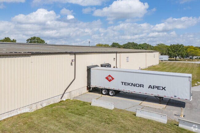
Property Detail
Bliss Ave
ATTL-000021-000000-000137
BRISTOL
Industrialgeneral
Massachusetts
I
137
B and X Area of moderate flood hazard, usually the area between the limits of the 100-year and 500-year floods.
30.73 AC
2020
Attleboro/New Bedford
2025
Boston
631200
Providence-Warwick, RI-MA
46,400 SF
NEARBY LISTINGS FOR SALE OR LEASE
DEMOGRAPHICS near Bliss Ave
1 mile
3 mile
5 mile
2025 Total Population
4,798
52,999
178,572
2030 Population
4,854
54,088
182,508
Pop Growth 2025-2030
+ 1.17%
+ 2.05%
+ 2.20%
Average Age
41
41
40
2025 Total Households
1,809
20,845
70,874
HH Growth 2025-2030
+ 1.00%
+ 2.03%
+ 2.24%
Median Household Inc
$93,204
$90,084
$77,012
Avg Household Size
2.60
2.50
2.40
2025 Avg HH Vehicles
2.00
2.00
2.00
Median Home Value
$439,141
$394,786
$401,878
Median Year Built
1982
1961
1959
Nearby Places
Map Layers
Map Styles
 Street
 Aerial
Layers
 Traffic
 Biking
Places
Listings with unknown addresses are not visible on the map
- Restaurants
- Banks
- Shops
- Fitness
- Groceries
PUBLIC TRANSPORTATION
COMMUTER RAIL
South Attleboro (Providence/Stoughton Line - Massachusetts Bay Transportation Authority Commuter Rail (Purple Line))
Drive
Walk
Distance
South Attleboro (Providence/Stoughton Line - Massachusetts Bay Transportation Authority Commuter Rail (Purple Line))
8 min
3.4 mi
Drive
Walk
Distance
10 min
4.5 mi
AIRPORT
Rhode Island Tf Green International
Drive
Walk
Distance
Rhode Island Tf Green International
33 min
17.7 mi
General Edward Lawrence Logan International
Drive
Walk
Distance
General Edward Lawrence Logan International
65 min
41.5 mi
Worcester Regional
Drive
Walk
Distance
Worcester Regional
67 min
47.5 mi
Freight Ports
Port of Davisville, RI
Drive
Walk
Distance
Port of Davisville, RI
48 min
30.1 mi
SALE & LEASE HISTORY
LISTING DATE
SALE/LEASE

Dec 07, 2020
For Lease
Nearby Properties
Address
Land Use
TOTAL SIZE
Lot Size
Zoning
Address
Land Use
TOTAL SIZE
Lot Size
Zoning
28,208 SF
38.19 AC
PHB
Address
Land Use
TOTAL SIZE
Lot Size
Zoning
193.69 AC
PO
Address
Land Use
TOTAL SIZE
Lot Size
Zoning
64.31 AC
C60
Address
Land Use
TOTAL SIZE
Lot Size
Zoning
5,059 SF
217.41 AC
Address
Land Use
TOTAL SIZE
Lot Size
Zoning
312,784 SF
11.53 AC
MO
Address
Land Use
TOTAL SIZE
Lot Size
Zoning
14,841 SF
15.70 AC
PHB
Address
Land Use
TOTAL SIZE
Lot Size
Zoning
11,110 SF
25.74 AC
Address
Land Use
TOTAL SIZE
Lot Size
Zoning
14.66 AC
CG
Address
Land Use
TOTAL SIZE
Lot Size
Zoning
110,362 SF
16.70 AC
Address
Land Use
TOTAL SIZE
Lot Size
Zoning
10,920 SF
11.03 AC
Address
Land Use
TOTAL SIZE
Lot Size
Zoning
190,458 SF
16.30 AC
C60
Address
Land Use
TOTAL SIZE
Lot Size
Zoning
2.97 AC
MB
Address
Land Use
TOTAL SIZE
Lot Size
Zoning
112,766 SF
31.06 AC
Address
Land Use
TOTAL SIZE
Lot Size
Zoning
55,103 SF
2.98 AC
RT
Address
Land Use
TOTAL SIZE
Lot Size
Zoning
189,308 SF
19.76 AC
I
Address
Land Use
TOTAL SIZE
Lot Size
Zoning
85,626 SF
2.22 AC
RT
Address
Land Use
TOTAL SIZE
Lot Size
Zoning
155,731 SF
41.03 AC
PHB
Address
Land Use
TOTAL SIZE
Lot Size
Zoning
164,001 SF
22.80 AC
Address
Land Use
TOTAL SIZE
Lot Size
Zoning
27,264 SF
6.20 AC
Address
Land Use
TOTAL SIZE
Lot Size
Zoning
90,812 SF
12.39 AC
Address
Land Use
TOTAL SIZE
Lot Size
Zoning
97,027 SF
12.02 AC
C60
Address
Land Use
TOTAL SIZE
Lot Size
Zoning
116,540 SF
9.70 AC
PHB
Address
Land Use
TOTAL SIZE
Lot Size
Zoning
108,382 SF
20.80 AC
Address
Land Use
TOTAL SIZE
Lot Size
Zoning
5,760 SF
23.95 AC
Address
Land Use
TOTAL SIZE
Lot Size
Zoning
44,823 SF
1.87 AC
RT
Address
Land Use
TOTAL SIZE
Lot Size
Zoning
7,364 SF
8.60 AC
Address
Land Use
TOTAL SIZE
Lot Size
Zoning
115,130 SF
16.55 AC
Address
Land Use
TOTAL SIZE
Lot Size
Zoning
85,632 SF
10.25 AC
Address
Land Use
TOTAL SIZE
Lot Size
Zoning
77,174 SF
70 AC
Address
Land Use
TOTAL SIZE
Lot Size
Zoning
0.74 AC
RT
The World's #1 Commercial Real Estate Marketplace
Connect with us
© 2026 CoStar Group
The information above has been obtained from sources believed reliable. While we do not doubt its accuracy we have not verified it and make no guarantee, warranty or representation about it. It is your responsibility to independently confirm its accuracy and completeness. Any projections, opinions, assumptions, or estimates used are for example only and do not represent the current or future performance of the property. The value of this transaction to you depends on tax and other factors which should be evaluated by your tax, financial, and legal advisors. You and your advisors should conduct a careful, independent investigation of the property to determine to your satisfaction the suitability of the property for your needs.