Property Record
Bloomfield Ave, Staten Island, NY 10314


Save to a Folder
{{folder.Name}}
{{folder.ListingIds.length}} Properties
{{folder.ListingIds.length}} Property
Create a New Folder
Current Lease Availabilities
Property Detail
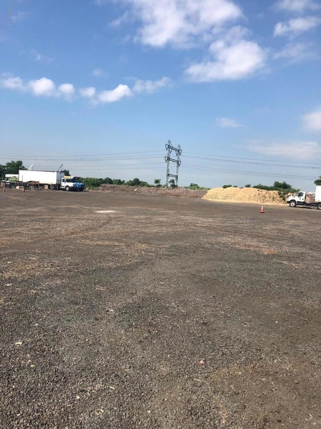
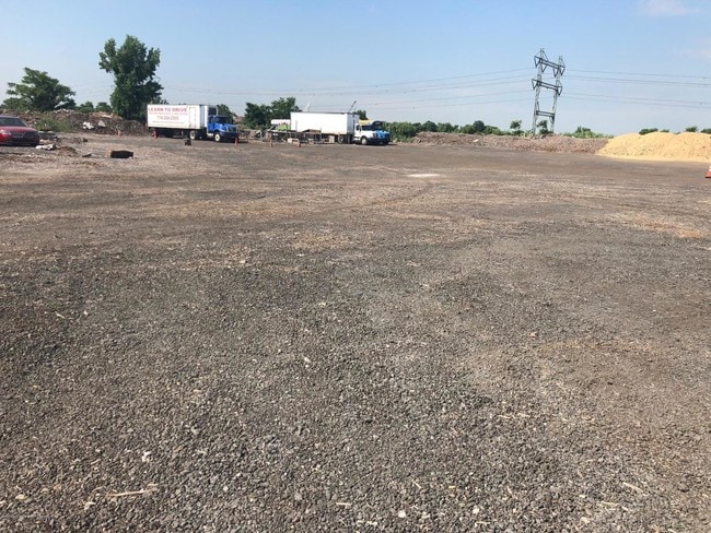
Bloomfield Ave
New York-Jersey City-White Plains, NY-NJ
LAND EASEMENT HELD BY NYC DEPT OF HIGHWAYS
01780-0085
STATEN ISLAND
Commercialnec
New York
M3-1
85
C and X Area of minimal flood hazard, usually depicted on FIRMs as above the 500-year flood level.
0.91 AC
2025
Staten Island
2026
Long Island (New York)
018902
NEARBY LISTINGS FOR SALE OR LEASE
DEMOGRAPHICS near Bloomfield Ave
1 mile
3 mile
5 mile
2025 Total Population
294
142,943
554,836
2030 Population
291
143,164
564,402
Pop Growth 2025-2030
(1.02%)
+ 0.15%
+ 1.72%
Average Age
41
39
40
2025 Total Households
99
47,659
193,517
HH Growth 2025-2030
(2.02%)
+ 0.22%
+ 1.87%
Median Household Inc
$91,666
$90,110
$88,406
Avg Household Size
2.80
2.90
2.80
2025 Avg HH Vehicles
2.00
2.00
2.00
Median Home Value
$745,283
$640,307
$624,193
Median Year Built
1973
1973
1967
Nearby Places
Map Layers
Map Styles
 Street
 Aerial
Layers
 Traffic
 Biking
Places
Listings with unknown addresses are not visible on the map
- Restaurants
- Banks
- Shops
- Fitness
- Groceries
PUBLIC TRANSPORTATION
COMMUTER RAIL
Elizabeth (North Jersey Coast Line - NJ TRANSIT RAIL, Northeast Corridor - NJ TRANSIT RAIL)
Drive
Walk
Distance
Elizabeth (North Jersey Coast Line - NJ TRANSIT RAIL, Northeast Corridor - NJ TRANSIT RAIL)
12 min
5.6 mi
Linden (North Jersey Coast Line - NJ TRANSIT RAIL, Northeast Corridor - NJ TRANSIT RAIL)
Drive
Walk
Distance
Linden (North Jersey Coast Line - NJ TRANSIT RAIL, Northeast Corridor - NJ TRANSIT RAIL)
11 min
6.6 mi
AIRPORT
Newark Liberty International
Drive
Walk
Distance
Newark Liberty International
21 min
11.8 mi
LaGuardia
Drive
Walk
Distance
LaGuardia
46 min
26.8 mi
John F Kennedy International
Drive
Walk
Distance
John F Kennedy International
45 min
29.5 mi
Freight Ports
New York Container Terminal
Drive
Walk
Distance
New York Container Terminal
6 min
2.5 mi
Nearby Properties
Address
Land Use
TOTAL SIZE
Lot Size
Zoning
Address
Land Use
TOTAL SIZE
Lot Size
Zoning
28.40 AC
Address
Land Use
TOTAL SIZE
Lot Size
Zoning
196.03 AC
HIA
Address
Land Use
TOTAL SIZE
Lot Size
Zoning
633,280 SF
202.90 AC
R3-2
Address
Land Use
TOTAL SIZE
Lot Size
Zoning
2.21 AC
Address
Land Use
TOTAL SIZE
Lot Size
Zoning
149.68 AC
H-1
Address
Land Use
TOTAL SIZE
Lot Size
Zoning
404,985 SF
15.32 AC
R25
Address
Land Use
TOTAL SIZE
Lot Size
Zoning
1,258,042 SF
14.47 AC
C4-1
Address
Land Use
TOTAL SIZE
Lot Size
Zoning
91,760 SF
210.43 AC
M3-1
Address
Land Use
TOTAL SIZE
Lot Size
Zoning
102.29 AC
Address
Land Use
TOTAL SIZE
Lot Size
Zoning
20.10 AC
H-1
Address
Land Use
TOTAL SIZE
Lot Size
Zoning
Address
Land Use
TOTAL SIZE
Lot Size
Zoning
360,082 SF
22.45 AC
R50
Address
Land Use
TOTAL SIZE
Lot Size
Zoning
365,784 SF
12.73 AC
HIA
Address
Land Use
TOTAL SIZE
Lot Size
Zoning
566,000 SF
103.31 AC
R3-2
Address
Land Use
TOTAL SIZE
Lot Size
Zoning
12.46 AC
Address
Land Use
TOTAL SIZE
Lot Size
Zoning
1.64 AC
R-25
Address
Land Use
TOTAL SIZE
Lot Size
Zoning
90.28 AC
H-1
Address
Land Use
TOTAL SIZE
Lot Size
Zoning
11.14 AC
Address
Land Use
TOTAL SIZE
Lot Size
Zoning
855,000 SF
48.74 AC
M3-1
Address
Land Use
TOTAL SIZE
Lot Size
Zoning
10 SF
9.18 AC
Address
Land Use
TOTAL SIZE
Lot Size
Zoning
263,925 SF
11.98 AC
R50
Address
Land Use
TOTAL SIZE
Lot Size
Zoning
7.24 AC
Address
Land Use
TOTAL SIZE
Lot Size
Zoning
24.19 AC
Address
Land Use
TOTAL SIZE
Lot Size
Zoning
5,214 SF
93 AC
M3-1
Address
Land Use
TOTAL SIZE
Lot Size
Zoning
21,120 SF
14.45 AC
R50
Address
Land Use
TOTAL SIZE
Lot Size
Zoning
131.25 AC
PARK
Address
Land Use
TOTAL SIZE
Lot Size
Zoning
2.38 AC
Address
Land Use
TOTAL SIZE
Lot Size
Zoning
Address
Land Use
TOTAL SIZE
Lot Size
Zoning
970,000 SF
55.25 AC
M3-1
Address
Land Use
TOTAL SIZE
Lot Size
Zoning
195,395 SF
12.04 AC
R3-2
The World's #1 Commercial Real Estate Marketplace
Connect with us
© 2026 CoStar Group
The information above has been obtained from sources believed reliable. While we do not doubt its accuracy we have not verified it and make no guarantee, warranty or representation about it. It is your responsibility to independently confirm its accuracy and completeness. Any projections, opinions, assumptions, or estimates used are for example only and do not represent the current or future performance of the property. The value of this transaction to you depends on tax and other factors which should be evaluated by your tax, financial, and legal advisors. You and your advisors should conduct a careful, independent investigation of the property to determine to your satisfaction the suitability of the property for your needs.