Property Record
18168 W 92Nd Ln, Arvada, CO 80007
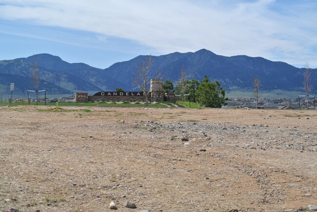

This Property Is For Sale
NEARBY LISTINGS FOR SALE OR LEASE
Property Detail
18168 W 92Nd Ln
Denver-Aurora-Lakewood, CO
Candelas Commercial Flg No 2
20-221-01-011
SECTION 22 TOWNSHIP 02 RANGE 70 SUBDIVISIONCD 108022 SUBDIVISIONNAME CANDELAS COMMERCIAL FLG NO 2 BLOCK 001 LOT 0002 SIZE: 34680 TRACT 00A VALUE: .796
Commercialnec
Jefferson
X
Colorado
08059C0360F
2
2023
0.80 AC
2024
West Denver
060501
Denver
5,679 SF
DEMOGRAPHICS near 18168 W 92Nd Ln
1 Mile
3 Mile
5 Mile
2024 Total Population
5,275
16,716
58,287
2029 Population
5,303
16,614
57,622
Pop Growth 2024-2029
+ 0.53%
(0.61%)
(1.14%)
Average Age
35
38
42
2024 Total Households
1,628
5,475
21,420
HH Growth 2024-2029
+ 0.37%
(0.82%)
(1.13%)
Median Household Inc
$169,912
$168,474
$137,769
Avg Household Size
3.20
3.00
2.70
2024 Avg HH Vehicles
2.00
2.00
2.00
Median Home Value
$780,464
$768,516
$690,645
Median Year Built
2011
2011
1996
Nearby Places
Map Layers
Map Styles
 Street
 Aerial
- Restaurants
- Banks
- Shops
- Fitness
- Groceries
PUBLIC TRANSPORTATION
COMMUTER RAIL
Wheat Ridge - Ward Station Track 1 (Union Station to Wheat Ridge Ward Station - Regional Transportation District)
DRIVE
WALK
Distance
Wheat Ridge - Ward Station Track 1 (Union Station to Wheat Ridge Ward Station - Regional Transportation District)
17 min
8.8 mi
Arvada Ridge Station Track 1 (Union Station to Wheat Ridge Ward Station - Regional Transportation District)
DRIVE
WALK
Distance
Arvada Ridge Station Track 1 (Union Station to Wheat Ridge Ward Station - Regional Transportation District)
17 min
9.7 mi
AIRPORT
Denver International
DRIVE
WALK
Distance
Denver International
53 min
37.0 mi
Freight Ports
Tulsa Port Of Catoosa
DRIVE
WALK
Distance
Tulsa Port Of Catoosa
750 min
722.5 mi
Nearby Properties
Address
Land Use
TOTAL SIZE
Lot Size
Zoning
Address
Land Use
TOTAL SIZE
Lot Size
Zoning
819.44 AC
A2
Address
Land Use
TOTAL SIZE
Lot Size
Zoning
3,318.13 AC
A2
Address
Land Use
TOTAL SIZE
Lot Size
Zoning
1,968.53 AC
Address
Land Use
TOTAL SIZE
Lot Size
Zoning
110,235 SF
2.32 AC
Address
Land Use
TOTAL SIZE
Lot Size
Zoning
53,051 SF
70.19 AC
I2
Address
Land Use
TOTAL SIZE
Lot Size
Zoning
1,653 SF
575.87 AC
Address
Land Use
TOTAL SIZE
Lot Size
Zoning
580.19 AC
Address
Land Use
TOTAL SIZE
Lot Size
Zoning
121,192 SF
12.43 AC
Address
Land Use
TOTAL SIZE
Lot Size
Zoning
95,412 SF
5.32 AC
Address
Land Use
TOTAL SIZE
Lot Size
Zoning
44,797 SF
4.35 AC
Address
Land Use
TOTAL SIZE
Lot Size
Zoning
20,173 SF
142.57 AC
A2
Address
Land Use
TOTAL SIZE
Lot Size
Zoning
53,400 SF
6.40 AC
Address
Land Use
TOTAL SIZE
Lot Size
Zoning
75.88 AC
Address
Land Use
TOTAL SIZE
Lot Size
Zoning
392.69 AC
Address
Land Use
TOTAL SIZE
Lot Size
Zoning
320 AC
A2
Address
Land Use
TOTAL SIZE
Lot Size
Zoning
302.47 AC
MC
Address
Land Use
TOTAL SIZE
Lot Size
Zoning
295.40 AC
Address
Land Use
TOTAL SIZE
Lot Size
Zoning
23,906 SF
1.14 AC
Address
Land Use
TOTAL SIZE
Lot Size
Zoning
37,296 SF
8.45 AC
PD
Address
Land Use
TOTAL SIZE
Lot Size
Zoning
13,180 SF
2.86 AC
Address
Land Use
TOTAL SIZE
Lot Size
Zoning
13,050 SF
1.37 AC
Address
Land Use
TOTAL SIZE
Lot Size
Zoning
10,886 SF
1.47 AC
Address
Land Use
TOTAL SIZE
Lot Size
Zoning
46,071 SF
3.01 AC
PD
Address
Land Use
TOTAL SIZE
Lot Size
Zoning
59.51 AC
Address
Land Use
TOTAL SIZE
Lot Size
Zoning
14,677 SF
2.20 AC
Address
Land Use
TOTAL SIZE
Lot Size
Zoning
959.65 AC
A2
Address
Land Use
TOTAL SIZE
Lot Size
Zoning
29,933 SF
3.04 AC
PD
Address
Land Use
TOTAL SIZE
Lot Size
Zoning
12,789 SF
1.83 AC
Address
Land Use
TOTAL SIZE
Lot Size
Zoning
5,672 SF
1.34 AC
Address
Land Use
TOTAL SIZE
Lot Size
Zoning
11,567 SF
1.37 AC
The World's #1 Commercial Real Estate Marketplace
Connect with us
© 2026 CoStar Group
The information above has been obtained from sources believed reliable. While we do not doubt its accuracy we have not verified it and make no guarantee, warranty or representation about it. It is your responsibility to independently confirm its accuracy and completeness. Any projections, opinions, assumptions, or estimates used are for example only and do not represent the current or future performance of the property. The value of this transaction to you depends on tax and other factors which should be evaluated by your tax, financial, and legal advisors. You and your advisors should conduct a careful, independent investigation of the property to determine to your satisfaction the suitability of the property for your needs.