Property Record
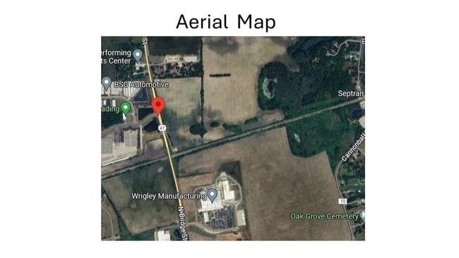
Corneils Rd, Yorkville, IL

Property Detail
Corneils Rd
Chicago-Naperville-Elgin, IL-IN
SEC 13-37-7 DOC 88-5017
02-16-127-014
KENDALL
Farms
Illinois
B and X Area of moderate flood hazard, usually the area between the limits of the 100-year and 500-year floods.
119.37 AC
2024
Western East/West Corr
2024
Chicago
8904001164
NEARBY LISTINGS FOR SALE OR LEASE
DEMOGRAPHICS near Corneils Rd
1 mile
3 mile
5 mile
2025 Total Population
1,735
27,210
72,132
2030 Population
1,899
29,452
77,156
Pop Growth 2025-2030
+ 9.45%
+ 8.24%
+ 6.97%
Average Age
38
37
37
2025 Total Households
541
9,081
23,918
HH Growth 2025-2030
+ 9.24%
+ 8.09%
+ 6.92%
Median Household Inc
$154,293
$106,849
$108,297
Avg Household Size
3.10
2.90
3.00
2025 Avg HH Vehicles
2.00
2.00
2.00
Median Home Value
$337,096
$315,929
$306,235
Median Year Built
2005
2004
2002
Nearby Places
Map Layers
Map Styles
 Street
 Aerial
Layers
 Traffic
 Biking
Places
Listings with unknown addresses are not visible on the map
- Restaurants
- Banks
- Shops
- Fitness
- Groceries
PUBLIC TRANSPORTATION
COMMUTER RAIL
Plano Amtrak Station (Carl Sandburg - Amtrak, Illinois Zephyr - Amtrak)
Drive
Walk
Distance
Plano Amtrak Station (Carl Sandburg - Amtrak, Illinois Zephyr - Amtrak)
14 min
7.4 mi
Aurora Station (Burlington Northern-Santa Fe Railway Line - Northeast Illinois Regional Commuter Railroad (Metra))
Drive
Walk
Distance
Aurora Station (Burlington Northern-Santa Fe Railway Line - Northeast Illinois Regional Commuter Railroad (Metra))
19 min
9.9 mi
Freight Ports
Port Milwaukee
Drive
Walk
Distance
Port Milwaukee
149 min
120.1 mi
SALE & LEASE HISTORY
LISTING DATE
SALE/LEASE

Apr 16, 2024
For Sale
Nearby Properties
Address
Land Use
TOTAL SIZE
Lot Size
Zoning
Address
Land Use
TOTAL SIZE
Lot Size
Zoning
156,075 SF
16.27 AC
Address
Land Use
TOTAL SIZE
Lot Size
Zoning
339,430 SF
6.18 AC
Address
Land Use
TOTAL SIZE
Lot Size
Zoning
64,667 SF
6.15 AC
Address
Land Use
TOTAL SIZE
Lot Size
Zoning
184,454 SF
8.05 AC
Address
Land Use
TOTAL SIZE
Lot Size
Zoning
0.13 AC
Address
Land Use
TOTAL SIZE
Lot Size
Zoning
211,068 SF
13.09 AC
Address
Land Use
TOTAL SIZE
Lot Size
Zoning
120.35 AC
Address
Land Use
TOTAL SIZE
Lot Size
Zoning
177,481 SF
14.11 AC
Address
Land Use
TOTAL SIZE
Lot Size
Zoning
64,781 SF
1.62 AC
Address
Land Use
TOTAL SIZE
Lot Size
Zoning
62,164 SF
6.76 AC
Address
Land Use
TOTAL SIZE
Lot Size
Zoning
43,544 SF
4.34 AC
Address
Land Use
TOTAL SIZE
Lot Size
Zoning
15,913 SF
31.25 AC
Address
Land Use
TOTAL SIZE
Lot Size
Zoning
108,848 SF
5.79 AC
Address
Land Use
TOTAL SIZE
Lot Size
Zoning
1.80 AC
Address
Land Use
TOTAL SIZE
Lot Size
Zoning
107,162 SF
10.49 AC
Address
Land Use
TOTAL SIZE
Lot Size
Zoning
18,774 SF
4.95 AC
Address
Land Use
TOTAL SIZE
Lot Size
Zoning
16,100 SF
5.14 AC
Address
Land Use
TOTAL SIZE
Lot Size
Zoning
21,800 SF
2.79 AC
Address
Land Use
TOTAL SIZE
Lot Size
Zoning
58,960 SF
1.27 AC
Address
Land Use
TOTAL SIZE
Lot Size
Zoning
16,152 SF
2.40 AC
Address
Land Use
TOTAL SIZE
Lot Size
Zoning
54,910 SF
0.88 AC
Address
Land Use
TOTAL SIZE
Lot Size
Zoning
38,500 SF
7.06 AC
Address
Land Use
TOTAL SIZE
Lot Size
Zoning
4,968 SF
1.35 AC
Address
Land Use
TOTAL SIZE
Lot Size
Zoning
19,012 SF
3.02 AC
Address
Land Use
TOTAL SIZE
Lot Size
Zoning
60,078 SF
3.18 AC
Address
Land Use
TOTAL SIZE
Lot Size
Zoning
90,533 SF
7.18 AC
Address
Land Use
TOTAL SIZE
Lot Size
Zoning
20,850 SF
1.06 AC
Address
Land Use
TOTAL SIZE
Lot Size
Zoning
121,275 SF
15.67 AC
Address
Land Use
TOTAL SIZE
Lot Size
Zoning
15,632 SF
2.83 AC
Address
Land Use
TOTAL SIZE
Lot Size
Zoning
5,108 SF
1.70 AC
The World's #1 Commercial Real Estate Marketplace
Connect with us
© 2026 CoStar Group
The information above has been obtained from sources believed reliable. While we do not doubt its accuracy we have not verified it and make no guarantee, warranty or representation about it. It is your responsibility to independently confirm its accuracy and completeness. Any projections, opinions, assumptions, or estimates used are for example only and do not represent the current or future performance of the property. The value of this transaction to you depends on tax and other factors which should be evaluated by your tax, financial, and legal advisors. You and your advisors should conduct a careful, independent investigation of the property to determine to your satisfaction the suitability of the property for your needs.