Property Record
Corner Avenue H 50 Stw, Lancaster, CA 93536


NEARBY LISTINGS FOR SALE OR LEASE
Property Detail
Corner Avenue H 50 Stw
Los Angeles-Long Beach-Glendale, CA
N 1/2 OF NE 1/4 (EX OF STS) OF SEC 11 T 7N R 13W
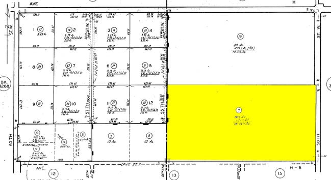
3269-011-015
Los Angeles
Desertorbarrenland
California
X
11
06037C0405F
76.91 AC
2024
Antelope Valley
2025
Los Angeles
901214
DEMOGRAPHICS near Corner Avenue H 50 Stw
1 Mile
3 Mile
5 Mile
2024 Total Population
63
22,448
95,841
2029 Population
61
21,895
93,192
Pop Growth 2024-2029
(3.17%)
(2.46%)
(2.76%)
Average Age
37
36
38
2024 Total Households
22
6,623
31,918
HH Growth 2024-2029
(4.55%)
(2.76%)
(2.99%)
Median Household Inc
$44,999
$105,601
$72,525
Avg Household Size
3.00
3.30
2.90
2024 Avg HH Vehicles
2.00
2.00
2.00
Median Home Value
$399,999
$421,556
$380,988
Median Year Built
2007
2000
1986
Nearby Places
Map Layers
Map Styles
 Street
 Aerial
- Restaurants
- Banks
- Shops
- Fitness
- Groceries
PUBLIC TRANSPORTATION
COMMUTER RAIL
Lancaster (Antelope Valley Line - Southern California Regional Rail Authority (Metrolink))
DRIVE
WALK
Distance
Lancaster (Antelope Valley Line - Southern California Regional Rail Authority (Metrolink))
10 min
6.4 mi
Freight Ports
Port of Long Beach
DRIVE
WALK
Distance
Port of Long Beach
114 min
98.0 mi
Nearby Properties
Address
Land Use
TOTAL SIZE
Lot Size
Zoning
Address
Land Use
TOTAL SIZE
Lot Size
Zoning
2,922,905 SF
85.01 AC
LRLI
Address
Land Use
TOTAL SIZE
Lot Size
Zoning
465,697 SF
27.82 AC
LRSP*
Address
Land Use
TOTAL SIZE
Lot Size
Zoning
249,045 SF
19.74 AC
LRMPD*
Address
Land Use
TOTAL SIZE
Lot Size
Zoning
89,351 SF
17.97 AC
LRMDR
Address
Land Use
TOTAL SIZE
Lot Size
Zoning
81,668 SF
5.47 AC
LRSP80-01*
Address
Land Use
TOTAL SIZE
Lot Size
Zoning
198,494 SF
9.78 AC
LRSP*
Address
Land Use
TOTAL SIZE
Lot Size
Zoning
0.34 AC
LCA22*
Address
Land Use
TOTAL SIZE
Lot Size
Zoning
32.02 AC
LRSP
Address
Land Use
TOTAL SIZE
Lot Size
Zoning
Address
Land Use
TOTAL SIZE
Lot Size
Zoning
99,247 SF
10.11 AC
LRA12*
Address
Land Use
TOTAL SIZE
Lot Size
Zoning
57,050 SF
4.28 AC
LRLI
Address
Land Use
TOTAL SIZE
Lot Size
Zoning
221,325 SF
4.19 AC
LRA22*
Address
Land Use
TOTAL SIZE
Lot Size
Zoning
37.45 AC
LRSP
Address
Land Use
TOTAL SIZE
Lot Size
Zoning
21,873 SF
3.38 AC
LCA22*
Address
Land Use
TOTAL SIZE
Lot Size
Zoning
33,508 SF
6.51 AC
LRA22*
Address
Land Use
TOTAL SIZE
Lot Size
Zoning
72,020 SF
8.53 AC
LRR311U*
Address
Land Use
TOTAL SIZE
Lot Size
Zoning
31,200 SF
2.28 AC
LRLI
Address
Land Use
TOTAL SIZE
Lot Size
Zoning
38,410 SF
4.81 AC
LRA22*
Address
Land Use
TOTAL SIZE
Lot Size
Zoning
19,580 SF
2.02 AC
LRM120000*
Address
Land Use
TOTAL SIZE
Lot Size
Zoning
14,581 SF
0.95 AC
LRSP*
Address
Land Use
TOTAL SIZE
Lot Size
Zoning
20.24 AC
LRSP
Address
Land Use
TOTAL SIZE
Lot Size
Zoning
8.38 AC
LRCPD
Address
Land Use
TOTAL SIZE
Lot Size
Zoning
80 AC
LRA12*
Address
Land Use
TOTAL SIZE
Lot Size
Zoning
9.18 AC
LRC
Address
Land Use
TOTAL SIZE
Lot Size
Zoning
14,581 SF
1.06 AC
LRSP*
Address
Land Use
TOTAL SIZE
Lot Size
Zoning
1,500 SF
4.73 AC
LRD22*
Address
Land Use
TOTAL SIZE
Lot Size
Zoning
37.66 AC
LCA22*
Address
Land Use
TOTAL SIZE
Lot Size
Zoning
410,335 SF
9.76 AC
LRSP80-01*
The World's #1 Commercial Real Estate Marketplace
Connect with us
© 2025 CoStar Group
The information above has been obtained from sources believed reliable. While we do not doubt its accuracy we have not verified it and make no guarantee, warranty or representation about it. It is your responsibility to independently confirm its accuracy and completeness. Any projections, opinions, assumptions, or estimates used are for example only and do not represent the current or future performance of the property. The value of this transaction to you depends on tax and other factors which should be evaluated by your tax, financial, and legal advisors. You and your advisors should conduct a careful, independent investigation of the property to determine to your satisfaction the suitability of the property for your needs.