Property Record
County Rd 32, Summerdale, AL 36580

NEARBY LISTINGS FOR SALE OR LEASE
Property Detail
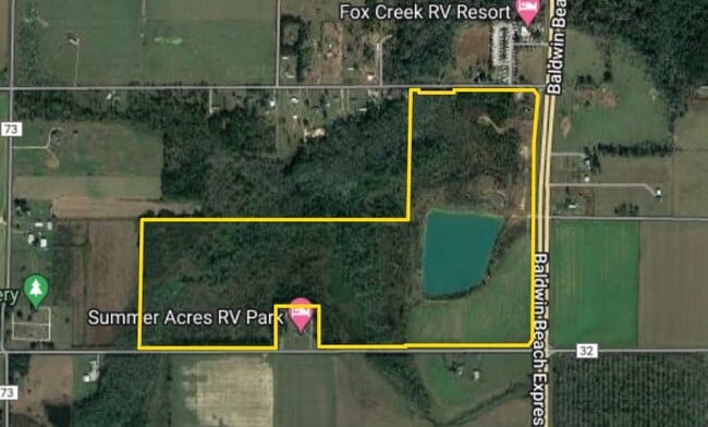
County Rd 32
Daphne-Fairhope-Foley, AL
Pineywoods
48-08-33-0-000-009.000
147 AC(C) E1/2 OF SE1/4 AND SE1/4 OF SW1/4 AND SW1/4 OF SE1/ 4 OF SEC 33 LESS AND EXCEPT PAR DESC AS BEG AT A PT 40' N & 2195
Timberlandforesttreesagricultural
Baldwin
A
Alabama
01003C0806M
147 AC
2024
Baldwin County
2024
Mobile
011000
DEMOGRAPHICS near County Rd 32
1 Mile
3 Mile
5 Mile
2024 Total Population
257
3,275
14,652
2029 Population
289
3,679
16,344
Pop Growth 2024-2029
+ 12.45%
+ 12.34%
+ 11.55%
Average Age
40
42
42
2024 Total Households
95
1,272
5,635
HH Growth 2024-2029
+ 11.58%
+ 11.71%
+ 10.70%
Median Household Inc
$53,889
$55,428
$54,477
Avg Household Size
2.60
2.50
2.40
2024 Avg HH Vehicles
2.00
2.00
2.00
Median Home Value
$212,500
$226,770
$223,256
Median Year Built
1994
1996
1995
Nearby Places
Map Layers
Map Styles
 Street
 Aerial
- Restaurants
- Banks
- Shops
- Fitness
- Groceries
PUBLIC TRANSPORTATION
AIRPORT
Mobile International
DRIVE
WALK
Distance
Mobile International
50 min
39.2 mi
Pensacola International
DRIVE
WALK
Distance
Pensacola International
59 min
40.3 mi
Freight Ports
Port of Mobile
DRIVE
WALK
Distance
Port of Mobile
45 min
35.8 mi
SALE & LEASE HISTORY
LISTING DATE
SALE/LEASE

Jul 23, 2024
For Sale
Nearby Properties
Address
Land Use
TOTAL SIZE
Lot Size
Zoning
Address
Land Use
TOTAL SIZE
Lot Size
Zoning
Address
Land Use
TOTAL SIZE
Lot Size
Zoning
28,590 SF
2.86 AC
Address
Land Use
TOTAL SIZE
Lot Size
Zoning
7,875 SF
6.50 AC
Address
Land Use
TOTAL SIZE
Lot Size
Zoning
3,404 SF
19 AC
Address
Land Use
TOTAL SIZE
Lot Size
Zoning
30,490 SF
4.51 AC
Address
Land Use
TOTAL SIZE
Lot Size
Zoning
8,080 SF
5 AC
Address
Land Use
TOTAL SIZE
Lot Size
Zoning
45,100 SF
15 AC
Address
Land Use
TOTAL SIZE
Lot Size
Zoning
1,400 SF
5.50 AC
Address
Land Use
TOTAL SIZE
Lot Size
Zoning
1,254 SF
1 AC
Address
Land Use
TOTAL SIZE
Lot Size
Zoning
5,688 SF
98 AC
Address
Land Use
TOTAL SIZE
Lot Size
Zoning
3,715 SF
Address
Land Use
TOTAL SIZE
Lot Size
Zoning
35,536 SF
5.20 AC
Address
Land Use
TOTAL SIZE
Lot Size
Zoning
36,639 SF
19 AC
Address
Land Use
TOTAL SIZE
Lot Size
Zoning
23,874 SF
8.50 AC
Address
Land Use
TOTAL SIZE
Lot Size
Zoning
10,818 SF
2.84 AC
Address
Land Use
TOTAL SIZE
Lot Size
Zoning
16,311 SF
1.45 AC
Address
Land Use
TOTAL SIZE
Lot Size
Zoning
19,024 SF
5.10 AC
Address
Land Use
TOTAL SIZE
Lot Size
Zoning
38,766 SF
3.20 AC
Address
Land Use
TOTAL SIZE
Lot Size
Zoning
9,118 SF
6.80 AC
Address
Land Use
TOTAL SIZE
Lot Size
Zoning
68,200 SF
15 AC
Address
Land Use
TOTAL SIZE
Lot Size
Zoning
11,178 SF
4 AC
Address
Land Use
TOTAL SIZE
Lot Size
Zoning
10,791 SF
3.38 AC
Address
Land Use
TOTAL SIZE
Lot Size
Zoning
31,319 SF
3.26 AC
Address
Land Use
TOTAL SIZE
Lot Size
Zoning
3,456 SF
7.60 AC
Address
Land Use
TOTAL SIZE
Lot Size
Zoning
11,487 SF
3 AC
Address
Land Use
TOTAL SIZE
Lot Size
Zoning
12,179 SF
6.30 AC
Address
Land Use
TOTAL SIZE
Lot Size
Zoning
20,350 SF
8.90 AC
Address
Land Use
TOTAL SIZE
Lot Size
Zoning
Address
Land Use
TOTAL SIZE
Lot Size
Zoning
28,990 SF
6.90 AC
Address
Land Use
TOTAL SIZE
Lot Size
Zoning
17,671 SF
23 AC
The World's #1 Commercial Real Estate Marketplace
Connect with us
© 2025 CoStar Group
The information above has been obtained from sources believed reliable. While we do not doubt its accuracy we have not verified it and make no guarantee, warranty or representation about it. It is your responsibility to independently confirm its accuracy and completeness. Any projections, opinions, assumptions, or estimates used are for example only and do not represent the current or future performance of the property. The value of this transaction to you depends on tax and other factors which should be evaluated by your tax, financial, and legal advisors. You and your advisors should conduct a careful, independent investigation of the property to determine to your satisfaction the suitability of the property for your needs.