Property Record
Crawford Rd, Denton, TX 76207

Save to a Folder
{{folder.Name}}
{{folder.ListingIds.length}} Properties
{{folder.ListingIds.length}} Property
Create a New Folder
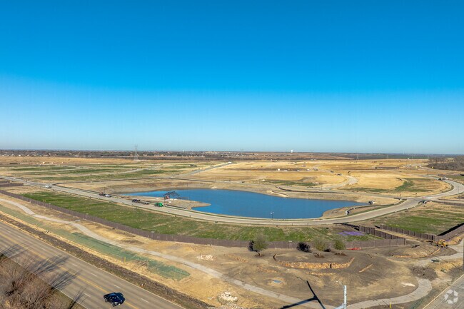
Property Detail
Crawford Rd
Dallas-Fort Worth-Arlington, TX
A1141A M. SCORLOCK, TR 1 & 2, 226.867 ACRES
R73314
DENTON
Vacantlandnec
Texas
A Areas with a 1% annual chance of flooding and a 26% chance of flooding over the life of a 30-year mortgage.
66
2024
226.87 AC
2025
Northwest Fort Worth
020405
Dallas/Ft Worth
NEARBY LISTINGS FOR SALE OR LEASE
DEMOGRAPHICS near Crawford Rd
1 mile
3 mile
5 mile
2025 Total Population
5,172
26,916
49,059
2030 Population
6,073
31,249
56,716
Pop Growth 2025-2030
+ 17.42%
+ 16.10%
+ 15.61%
Average Age
48
44
41
2025 Total Households
2,099
9,882
17,145
HH Growth 2025-2030
+ 16.87%
+ 16.07%
+ 15.75%
Median Household Inc
$128,750
$128,691
$133,341
Avg Household Size
2.50
2.70
2.90
2025 Avg HH Vehicles
2.00
2.00
2.00
Median Home Value
$553,907
$573,298
$591,700
Median Year Built
2011
2011
2010
Nearby Places
Map Layers
Map Styles
 Street
 Aerial
Layers
 Traffic
 Biking
Places
Listings with unknown addresses are not visible on the map
- Restaurants
- Banks
- Shops
- Fitness
- Groceries
PUBLIC TRANSPORTATION
AIRPORT
Dallas-Fort Worth International
Drive
Walk
Distance
Dallas-Fort Worth International
40 min
30.6 mi
Freight Ports
Port of Shreveport
Drive
Walk
Distance
Port of Shreveport
265 min
243.2 mi
Nearby Properties
Address
Land Use
TOTAL SIZE
Lot Size
Zoning
Address
Land Use
TOTAL SIZE
Lot Size
Zoning
140,103 SF
25.31 AC
Address
Land Use
TOTAL SIZE
Lot Size
Zoning
89,774 SF
12.84 AC
Address
Land Use
TOTAL SIZE
Lot Size
Zoning
60,861 SF
12.27 AC
Address
Land Use
TOTAL SIZE
Lot Size
Zoning
70,000 SF
12 AC
Address
Land Use
TOTAL SIZE
Lot Size
Zoning
89,150 SF
21.36 AC
Address
Land Use
TOTAL SIZE
Lot Size
Zoning
18,959 SF
10 AC
Address
Land Use
TOTAL SIZE
Lot Size
Zoning
78,750 SF
5.47 AC
Address
Land Use
TOTAL SIZE
Lot Size
Zoning
24.92 AC
Address
Land Use
TOTAL SIZE
Lot Size
Zoning
36,402 SF
4.53 AC
Address
Land Use
TOTAL SIZE
Lot Size
Zoning
17,500 SF
9.38 AC
Address
Land Use
TOTAL SIZE
Lot Size
Zoning
29.32 AC
Address
Land Use
TOTAL SIZE
Lot Size
Zoning
4,335 SF
67.74 AC
Address
Land Use
TOTAL SIZE
Lot Size
Zoning
61,500 SF
6.48 AC
Address
Land Use
TOTAL SIZE
Lot Size
Zoning
41,800 SF
5.16 AC
Address
Land Use
TOTAL SIZE
Lot Size
Zoning
6,201 SF
2.56 AC
Address
Land Use
TOTAL SIZE
Lot Size
Zoning
55,250 SF
10 AC
Address
Land Use
TOTAL SIZE
Lot Size
Zoning
11,274 SF
1.50 AC
Address
Land Use
TOTAL SIZE
Lot Size
Zoning
5,440 SF
12.67 AC
Address
Land Use
TOTAL SIZE
Lot Size
Zoning
31,200 SF
5.54 AC
Address
Land Use
TOTAL SIZE
Lot Size
Zoning
36,657 SF
17.45 AC
Address
Land Use
TOTAL SIZE
Lot Size
Zoning
12,134 SF
10.90 AC
Address
Land Use
TOTAL SIZE
Lot Size
Zoning
20.01 AC
Address
Land Use
TOTAL SIZE
Lot Size
Zoning
48,800 SF
5.66 AC
Address
Land Use
TOTAL SIZE
Lot Size
Zoning
59,000 SF
10 AC
Address
Land Use
TOTAL SIZE
Lot Size
Zoning
5.75 AC
Address
Land Use
TOTAL SIZE
Lot Size
Zoning
3,310 SF
1.18 AC
Address
Land Use
TOTAL SIZE
Lot Size
Zoning
9,788 SF
10.90 AC
Address
Land Use
TOTAL SIZE
Lot Size
Zoning
11,025 SF
2.32 AC
Address
Land Use
TOTAL SIZE
Lot Size
Zoning
10,738 SF
3 AC
The World's #1 Commercial Real Estate Marketplace
Connect with us
© 2026 CoStar Group
The information above has been obtained from sources believed reliable. While we do not doubt its accuracy we have not verified it and make no guarantee, warranty or representation about it. It is your responsibility to independently confirm its accuracy and completeness. Any projections, opinions, assumptions, or estimates used are for example only and do not represent the current or future performance of the property. The value of this transaction to you depends on tax and other factors which should be evaluated by your tax, financial, and legal advisors. You and your advisors should conduct a careful, independent investigation of the property to determine to your satisfaction the suitability of the property for your needs.