Property Record
Ayers St, Corpus Christi, TX 78417

This Property Is For Sale
Property Detail
Ayers St
Corpus Christi, TX
BOHEMIAN COLONY LANDS 3.449 ACS OUT OF SE COR LT 3 SEC 4
197815
NUECES
Commercialacreage
Texas
B-4
3
B and X Area of moderate flood hazard, usually the area between the limits of the 100-year and 500-year floods.
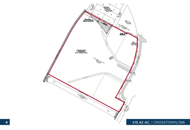
3.45 AC
0
Southwest
2025
Corpus Christi
001702
NEARBY LISTINGS FOR SALE OR LEASE
DEMOGRAPHICS near Ayers St
1 mile
3 mile
5 mile
2025 Total Population
8,810
82,846
176,747
2030 Population
8,621
81,321
174,799
Pop Growth 2025-2030
(2.15%)
(1.84%)
(1.10%)
Average Age
38
39
39
2025 Total Households
2,908
29,447
65,972
HH Growth 2025-2030
(2.30%)
(1.88%)
(1.16%)
Median Household Inc
$59,216
$53,751
$56,978
Avg Household Size
2.90
2.70
2.60
2025 Avg HH Vehicles
2.00
2.00
2.00
Median Home Value
$131,494
$138,366
$167,464
Median Year Built
1972
1964
1971
Nearby Places
Map Layers
Map Styles
 Street
 Aerial
Transit
 Traffic
 Biking
Places
Listings with unknown addresses are not visible on the map
- Restaurants
- Banks
- Shops
- Fitness
- Groceries
PUBLIC TRANSPORTATION
AIRPORT
Corpus Christi International
Drive
Walk
Distance
Corpus Christi International
14 min
7.8 mi
Freight Ports
Port of Corpus Christi
Drive
Walk
Distance
Port of Corpus Christi
9 min
6.3 mi
Nearby Properties
Address
Land Use
TOTAL SIZE
Lot Size
Zoning
Address
Land Use
TOTAL SIZE
Lot Size
Zoning
567,638 SF
18.37 AC
B4
Address
Land Use
TOTAL SIZE
Lot Size
Zoning
419,479 SF
32.65 AC
Address
Land Use
TOTAL SIZE
Lot Size
Zoning
1 SF
62.73 AC
III
Address
Land Use
TOTAL SIZE
Lot Size
Zoning
176,076 SF
19.84 AC
R1B
Address
Land Use
TOTAL SIZE
Lot Size
Zoning
251,402 SF
7.17 AC
Address
Land Use
TOTAL SIZE
Lot Size
Zoning
117,000 SF
19.20 AC
R1B
Address
Land Use
TOTAL SIZE
Lot Size
Zoning
278,919 SF
39.27 AC
R1B
Address
Land Use
TOTAL SIZE
Lot Size
Zoning
1 SF
40.02 AC
R1B
Address
Land Use
TOTAL SIZE
Lot Size
Zoning
74,247 SF
6.39 AC
Address
Land Use
TOTAL SIZE
Lot Size
Zoning
124,257 SF
7.63 AC
Address
Land Use
TOTAL SIZE
Lot Size
Zoning
65,301 SF
7.37 AC
B-4
Address
Land Use
TOTAL SIZE
Lot Size
Zoning
85,871 SF
18.68 AC
R1B
Address
Land Use
TOTAL SIZE
Lot Size
Zoning
89,537 SF
11.35 AC
R1B
Address
Land Use
TOTAL SIZE
Lot Size
Zoning
86,224 SF
33.89 AC
Address
Land Use
TOTAL SIZE
Lot Size
Zoning
83,835 SF
19.14 AC
Address
Land Use
TOTAL SIZE
Lot Size
Zoning
108,420 SF
20 AC
R1B
Address
Land Use
TOTAL SIZE
Lot Size
Zoning
74,261 SF
4.44 AC
R1B
Address
Land Use
TOTAL SIZE
Lot Size
Zoning
105.49 AC
R1B
Address
Land Use
TOTAL SIZE
Lot Size
Zoning
13,773 SF
28.82 AC
R1B
Address
Land Use
TOTAL SIZE
Lot Size
Zoning
114,121 SF
2.64 AC
B-4
Address
Land Use
TOTAL SIZE
Lot Size
Zoning
42,984 SF
5.20 AC
Address
Land Use
TOTAL SIZE
Lot Size
Zoning
186,106 SF
6.54 AC
B1
Address
Land Use
TOTAL SIZE
Lot Size
Zoning
140,058 SF
90.04 AC
I2
Address
Land Use
TOTAL SIZE
Lot Size
Zoning
95,658 SF
21.87 AC
I2
Address
Land Use
TOTAL SIZE
Lot Size
Zoning
60,934 SF
12.20 AC
R1B
Address
Land Use
TOTAL SIZE
Lot Size
Zoning
95,860 SF
10.80 AC
R1B
Address
Land Use
TOTAL SIZE
Lot Size
Zoning
25,998 SF
31.72 AC
R1B
Address
Land Use
TOTAL SIZE
Lot Size
Zoning
73,559 SF
11.05 AC
R1B
Address
Land Use
TOTAL SIZE
Lot Size
Zoning
28,410 SF
8.55 AC
Address
Land Use
TOTAL SIZE
Lot Size
Zoning
3,292 SF
352.15 AC
The World's #1 Commercial Real Estate Marketplace
Connect with us
© 2026 CoStar Group
The information above has been obtained from sources believed reliable. While we do not doubt its accuracy we have not verified it and make no guarantee, warranty or representation about it. It is your responsibility to independently confirm its accuracy and completeness. Any projections, opinions, assumptions, or estimates used are for example only and do not represent the current or future performance of the property. The value of this transaction to you depends on tax and other factors which should be evaluated by your tax, financial, and legal advisors. You and your advisors should conduct a careful, independent investigation of the property to determine to your satisfaction the suitability of the property for your needs.