Property Record
Dixieland Rd, Harlingen, TX

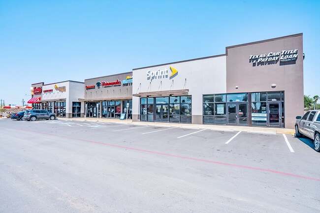


Current Lease Availabilities
Property Detail
Dixieland Rd
Brownsville-Harlingen, TX
LOT 3 REPLAT LTS 1-3 BLK 1 COSTA DEL SOL SUB & LTS 1-2 TARGET SUBD (2019 PLAT C1-3686 CCMR FILED 1/31/2018)
184031-0000-002000
CAMERON
Commercialnec
Texas
B and X Area of moderate flood hazard, usually the area between the limits of the 100-year and 500-year floods.
3
2024
1.54 AC
2025
Greater Harlingen
0120012018
Brownsville/Harlingen
14,400 SF
NEARBY LISTINGS FOR SALE OR LEASE
DEMOGRAPHICS near Dixieland Rd
1 mile
3 mile
5 mile
2024 Total Population
6,705
58,842
101,959
2029 Population
6,891
60,416
104,605
Pop Growth 2024-2029
+ 2.77%
+ 2.67%
+ 2.60%
Average Age
37
38
38
2024 Total Households
2,389
20,208
35,039
HH Growth 2024-2029
+ 2.97%
+ 2.88%
+ 2.72%
Median Household Inc
$52,457
$54,420
$57,277
Avg Household Size
2.70
2.80
2.80
2024 Avg HH Vehicles
2.00
2.00
2.00
Median Home Value
$109,951
$143,014
$160,090
Median Year Built
1985
1984
1988
Nearby Places
Map Layers
Map Styles
 Street
 Aerial
Transit
 Traffic
 Biking
Places
Listings with unknown addresses are not visible on the map
- Restaurants
- Banks
- Shops
- Fitness
- Groceries
PUBLIC TRANSPORTATION
AIRPORT
Valley International
Drive
Walk
Distance
Valley International
13 min
6.1 mi
Brownsville/South Padre Island International
Drive
Walk
Distance
Brownsville/South Padre Island International
38 min
28.4 mi
Freight Ports
Port of Brownsville
Drive
Walk
Distance
Port of Brownsville
31 min
26.0 mi
Nearby Properties
Address
Land Use
TOTAL SIZE
Lot Size
Zoning
Address
Land Use
TOTAL SIZE
Lot Size
Zoning
246,234 SF
16.40 AC
Address
Land Use
TOTAL SIZE
Lot Size
Zoning
293,886 SF
23.57 AC
Address
Land Use
TOTAL SIZE
Lot Size
Zoning
171,714 SF
16.03 AC
C
Address
Land Use
TOTAL SIZE
Lot Size
Zoning
74,848 SF
2.30 AC
Address
Land Use
TOTAL SIZE
Lot Size
Zoning
391,617 SF
23.20 AC
C
Address
Land Use
TOTAL SIZE
Lot Size
Zoning
41,182 SF
34.14 AC
M-R
Address
Land Use
TOTAL SIZE
Lot Size
Zoning
176,365 SF
14.65 AC
Address
Land Use
TOTAL SIZE
Lot Size
Zoning
135,258 SF
4.26 AC
C
Address
Land Use
TOTAL SIZE
Lot Size
Zoning
72,063 SF
2.29 AC
Address
Land Use
TOTAL SIZE
Lot Size
Zoning
152,724 SF
17.78 AC
Address
Land Use
TOTAL SIZE
Lot Size
Zoning
63,450 SF
2.88 AC
Address
Land Use
TOTAL SIZE
Lot Size
Zoning
13,924 SF
31.33 AC
C
Address
Land Use
TOTAL SIZE
Lot Size
Zoning
77,189 SF
3.28 AC
Address
Land Use
TOTAL SIZE
Lot Size
Zoning
177,812 SF
21.40 AC
C
Address
Land Use
TOTAL SIZE
Lot Size
Zoning
41,370 SF
3.40 AC
C
Address
Land Use
TOTAL SIZE
Lot Size
Zoning
63,381 SF
3.15 AC
Address
Land Use
TOTAL SIZE
Lot Size
Zoning
81,569 SF
36.61 AC
Address
Land Use
TOTAL SIZE
Lot Size
Zoning
91,630 SF
11.17 AC
Address
Land Use
TOTAL SIZE
Lot Size
Zoning
89,508 SF
9.90 AC
Address
Land Use
TOTAL SIZE
Lot Size
Zoning
47,539 SF
8.77 AC
C
Address
Land Use
TOTAL SIZE
Lot Size
Zoning
134,367 SF
14.42 AC
Address
Land Use
TOTAL SIZE
Lot Size
Zoning
206,973 SF
12.77 AC
Address
Land Use
TOTAL SIZE
Lot Size
Zoning
79,466 SF
6.23 AC
C
Address
Land Use
TOTAL SIZE
Lot Size
Zoning
68,826 SF
6.27 AC
Address
Land Use
TOTAL SIZE
Lot Size
Zoning
116,913 SF
8.44 AC
C
Address
Land Use
TOTAL SIZE
Lot Size
Zoning
90,376 SF
1.93 AC
Address
Land Use
TOTAL SIZE
Lot Size
Zoning
176,627 SF
12.45 AC
A-C
Address
Land Use
TOTAL SIZE
Lot Size
Zoning
77,077 SF
5.20 AC
Address
Land Use
TOTAL SIZE
Lot Size
Zoning
50,659 SF
6.43 AC
Address
Land Use
TOTAL SIZE
Lot Size
Zoning
145,232 SF
6.38 AC
The World's #1 Commercial Real Estate Marketplace
Connect with us
© 2026 CoStar Group
The information above has been obtained from sources believed reliable. While we do not doubt its accuracy we have not verified it and make no guarantee, warranty or representation about it. It is your responsibility to independently confirm its accuracy and completeness. Any projections, opinions, assumptions, or estimates used are for example only and do not represent the current or future performance of the property. The value of this transaction to you depends on tax and other factors which should be evaluated by your tax, financial, and legal advisors. You and your advisors should conduct a careful, independent investigation of the property to determine to your satisfaction the suitability of the property for your needs.