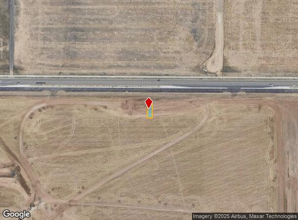
Property Record
21183 E 63Rd Dr, Aurora, CO 80019
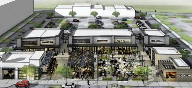

Current Lease Availabilities
NEARBY LISTINGS FOR SALE OR LEASE
Property Detail
21183 E 63Rd Dr
Denver
Painted Prairie
Denver-Aurora-Lakewood, CO
Adams
1821-11-1-13-032
Colorado
Townhouserowhouse
0.06 AC
1,874 SF
Northeast
DEMOGRAPHICS near 21183 E 63Rd Dr
1 Mile
3 Mile
5 Mile
2024 Total Population
1,463
40,945
77,054
2029 Population
1,522
42,042
78,722
Pop Growth 2024-2029
+ 4.03%
+ 2.68%
+ 2.16%
Average Age
35
34
34
2024 Total Households
516
12,703
23,483
HH Growth 2024-2029
+ 3.88%
+ 3.00%
+ 2.41%
Median Household Inc
$106,632
$91,204
$88,247
Avg Household Size
2.80
3.10
3.10
2024 Avg HH Vehicles
2.00
2.00
2.00
Median Home Value
$464,285
$399,713
$385,003
Median Year Built
2007
2006
2004
Nearby Places
Map Layers
Map Styles
 Street
 Aerial
- Restaurants
- Banks
- Shops
- Fitness
- Groceries
PUBLIC TRANSPORTATION
COMMUTER RAIL
61St & Pena Station Track 2 (Union Station to Denver Airport Station - Regional Transportation District)
DRIVE
WALK
Distance
61St & Pena Station Track 2 (Union Station to Denver Airport Station - Regional Transportation District)
7 min
3.0 mi
40Th Ave & Airport Blvd - Gateway Park Station Track 2 (Union Station to Denver Airport Station - Regional Transportation District)
DRIVE
WALK
Distance
40Th Ave & Airport Blvd - Gateway Park Station Track 2 (Union Station to Denver Airport Station - Regional Transportation District)
14 min
6.1 mi
AIRPORT
Denver International
DRIVE
WALK
Distance
Denver International
15 min
7.5 mi
Freight Ports
Tulsa Port Of Catoosa
DRIVE
WALK
Distance
Tulsa Port Of Catoosa
718 min
698.7 mi
Nearby Properties
Address
Land Use
TOTAL SIZE
Lot Size
Zoning
Address
Land Use
TOTAL SIZE
Lot Size
Zoning
1,996,111 SF
73.07 AC
Address
Land Use
TOTAL SIZE
Lot Size
Zoning
938,254 SF
74.01 AC
Address
Land Use
TOTAL SIZE
Lot Size
Zoning
489,080 SF
65.53 AC
Address
Land Use
TOTAL SIZE
Lot Size
Zoning
288,020 SF
49.76 AC
Address
Land Use
TOTAL SIZE
Lot Size
Zoning
670,320 SF
35.50 AC
Address
Land Use
TOTAL SIZE
Lot Size
Zoning
1,214,982 SF
149.04 AC
I-MX-8
Address
Land Use
TOTAL SIZE
Lot Size
Zoning
200,105 SF
34.54 AC
C-MU-20
Address
Land Use
TOTAL SIZE
Lot Size
Zoning
185,812 SF
20.93 AC
C-MU-20
Address
Land Use
TOTAL SIZE
Lot Size
Zoning
541,840 SF
27.24 AC
Address
Land Use
TOTAL SIZE
Lot Size
Zoning
353,350 SF
28.91 AC
Address
Land Use
TOTAL SIZE
Lot Size
Zoning
217,995 SF
12.31 AC
S-SU-D
Address
Land Use
TOTAL SIZE
Lot Size
Zoning
174,550 SF
4.29 AC
C-MX
Address
Land Use
TOTAL SIZE
Lot Size
Zoning
121,970 SF
12.12 AC
C-MU-20
Address
Land Use
TOTAL SIZE
Lot Size
Zoning
143,838 SF
8.17 AC
C-MU-30
Address
Land Use
TOTAL SIZE
Lot Size
Zoning
116,914 SF
13.43 AC
PUD
Address
Land Use
TOTAL SIZE
Lot Size
Zoning
294,266 SF
16.64 AC
C-MU-20
Address
Land Use
TOTAL SIZE
Lot Size
Zoning
289,972 SF
7.96 AC
C-MU-30
Address
Land Use
TOTAL SIZE
Lot Size
Zoning
111,156 SF
3.94 AC
C-MU-20
Address
Land Use
TOTAL SIZE
Lot Size
Zoning
343,923 SF
11.33 AC
C-MX
Address
Land Use
TOTAL SIZE
Lot Size
Zoning
437,144 SF
11.58 AC
Address
Land Use
TOTAL SIZE
Lot Size
Zoning
106,305 SF
12.04 AC
R-MU-20
Address
Land Use
TOTAL SIZE
Lot Size
Zoning
145,300 SF
2.70 AC
S-MX-8A
Address
Land Use
TOTAL SIZE
Lot Size
Zoning
107,276 SF
3.43 AC
C-MU-20
Address
Land Use
TOTAL SIZE
Lot Size
Zoning
205,800 SF
13.80 AC
Address
Land Use
TOTAL SIZE
Lot Size
Zoning
201,250 SF
14.37 AC
Address
Land Use
TOTAL SIZE
Lot Size
Zoning
5,853 SF
55.30 AC
Address
Land Use
TOTAL SIZE
Lot Size
Zoning
144,003 SF
9.32 AC
Address
Land Use
TOTAL SIZE
Lot Size
Zoning
203,840 SF
16.47 AC
Address
Land Use
TOTAL SIZE
Lot Size
Zoning
213,495 SF
9.74 AC
C-MU-30
Address
Land Use
TOTAL SIZE
Lot Size
Zoning
110,192 SF
2.95 AC
C-MU-30
The World's #1 Commercial Real Estate Marketplace
Connect with us
© 2025 CoStar Group
The information above has been obtained from sources believed reliable. While we do not doubt its accuracy we have not verified it and make no guarantee, warranty or representation about it. It is your responsibility to independently confirm its accuracy and completeness. Any projections, opinions, assumptions, or estimates used are for example only and do not represent the current or future performance of the property. The value of this transaction to you depends on tax and other factors which should be evaluated by your tax, financial, and legal advisors. You and your advisors should conduct a careful, independent investigation of the property to determine to your satisfaction the suitability of the property for your needs.