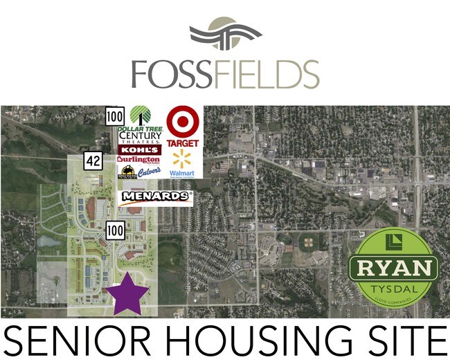
Property Record
1600 N Powder House Rd, Sioux Falls, SD 57110


Property Detail
1600 N Powder House Rd
Sioux Falls, SD-MN
Gateway Addn
10289
W12 SW14 (EX LOTS H2, H3 & H4 & GOLDEN GATEWAY ADDN) & VACATED ROW BY RESOLUTION 80-21 7-101-48 SIOUX FALLS CITY UNPLATTED
Commercialacreage
Minnehaha
X
South Dakota
46099C0459D
23.68 AC
2024
Sioux Falls
2024
Other Market Areas
000407
NEARBY LISTINGS FOR SALE OR LEASE
DEMOGRAPHICS near 1600 N Powder House Rd
1 mile
3 mile
5 mile
2024 Total Population
2,744
40,765
108,904
2029 Population
3,037
44,571
119,153
Pop Growth 2024-2029
+ 10.68%
+ 9.34%
+ 9.41%
Average Age
37
37
38
2024 Total Households
942
15,317
43,137
HH Growth 2024-2029
+ 11.04%
+ 9.63%
+ 9.96%
Median Household Inc
$102,917
$76,838
$74,059
Avg Household Size
2.90
2.60
2.40
2024 Avg HH Vehicles
2.00
2.00
2.00
Median Home Value
$352,325
$265,427
$262,379
Median Year Built
2006
1993
1987
Nearby Places
Map Layers
Map Styles
 Street
 Aerial
Transit
 Traffic
 Biking
Places
Listings with unknown addresses are not visible on the map
- Restaurants
- Banks
- Shops
- Fitness
- Groceries
PUBLIC TRANSPORTATION
AIRPORT
Joe Foss Field
Drive
Walk
Distance
Joe Foss Field
29 min
9.3 mi
Freight Ports
Port Milwaukee
Drive
Walk
Distance
Port Milwaukee
543 min
500.5 mi
SALE & LEASE HISTORY
LISTING DATE
SALE/LEASE

Sep 28, 2016
For Sale
May 30, 2017
For Sale
Nearby Properties
Address
Land Use
TOTAL SIZE
Lot Size
Zoning
Address
Land Use
TOTAL SIZE
Lot Size
Zoning
15.39 AC
Address
Land Use
TOTAL SIZE
Lot Size
Zoning
4,136 SF
18.95 AC
Address
Land Use
TOTAL SIZE
Lot Size
Zoning
3,306 SF
17.41 AC
Address
Land Use
TOTAL SIZE
Lot Size
Zoning
11,800 SF
11.78 AC
Address
Land Use
TOTAL SIZE
Lot Size
Zoning
41.01 AC
FP;FP
Address
Land Use
TOTAL SIZE
Lot Size
Zoning
17,117 SF
6.51 AC
PD;PLANNED
Address
Land Use
TOTAL SIZE
Lot Size
Zoning
50,160 SF
24.88 AC
Address
Land Use
TOTAL SIZE
Lot Size
Zoning
87,328 SF
6.92 AC
Address
Land Use
TOTAL SIZE
Lot Size
Zoning
5.85 AC
Address
Land Use
TOTAL SIZE
Lot Size
Zoning
212,260 SF
20.37 AC
Address
Land Use
TOTAL SIZE
Lot Size
Zoning
219,120 SF
18.65 AC
Address
Land Use
TOTAL SIZE
Lot Size
Zoning
83,394 SF
4.46 AC
Address
Land Use
TOTAL SIZE
Lot Size
Zoning
1,806 SF
170.92 AC
FP;FP
Address
Land Use
TOTAL SIZE
Lot Size
Zoning
8,060 SF
9.66 AC
I2;GENERAL
Address
Land Use
TOTAL SIZE
Lot Size
Zoning
134,519 SF
12 AC
Address
Land Use
TOTAL SIZE
Lot Size
Zoning
144,152 SF
12.89 AC
Address
Land Use
TOTAL SIZE
Lot Size
Zoning
1,860 SF
86.79 AC
Address
Land Use
TOTAL SIZE
Lot Size
Zoning
1,760 SF
168 AC
RA;APARTME
Address
Land Use
TOTAL SIZE
Lot Size
Zoning
212,500 SF
12 AC
Address
Land Use
TOTAL SIZE
Lot Size
Zoning
47,617 SF
7.74 AC
Address
Land Use
TOTAL SIZE
Lot Size
Zoning
94,124 SF
6.77 AC
Address
Land Use
TOTAL SIZE
Lot Size
Zoning
6,564 SF
15.96 AC
Address
Land Use
TOTAL SIZE
Lot Size
Zoning
26,359 SF
12.36 AC
Address
Land Use
TOTAL SIZE
Lot Size
Zoning
120,000 SF
8.99 AC
Address
Land Use
TOTAL SIZE
Lot Size
Zoning
7,306 SF
12 AC
Address
Land Use
TOTAL SIZE
Lot Size
Zoning
39.68 AC
Address
Land Use
TOTAL SIZE
Lot Size
Zoning
60,680 SF
6.29 AC
Address
Land Use
TOTAL SIZE
Lot Size
Zoning
37,016 SF
5.29 AC
Address
Land Use
TOTAL SIZE
Lot Size
Zoning
3,152 SF
6.73 AC
Address
Land Use
TOTAL SIZE
Lot Size
Zoning
33,552 SF
4.51 AC
The World's #1 Commercial Real Estate Marketplace
Connect with us
© 2026 CoStar Group
The information above has been obtained from sources believed reliable. While we do not doubt its accuracy we have not verified it and make no guarantee, warranty or representation about it. It is your responsibility to independently confirm its accuracy and completeness. Any projections, opinions, assumptions, or estimates used are for example only and do not represent the current or future performance of the property. The value of this transaction to you depends on tax and other factors which should be evaluated by your tax, financial, and legal advisors. You and your advisors should conduct a careful, independent investigation of the property to determine to your satisfaction the suitability of the property for your needs.